TopoQuest Logo
Do you find TopoQuest useful?
Help keep TopoQuest running and adding new maps/features by donating!
Bitcoin:  19c7KJd3qBynnjoSw5npx9KScwjBe4ifkT
Litecoin:  LXs6TkuXGGXo1vDsWCkWVdjQX94eUKd6ui
Home View Maps Find Maps Find Places Resources & Links


De Witt SW, Arkansas Topographic Map

USGS Map Title: De Witt SW, AR
USGS Map MRC: 34091C4
DRG (GeoTIFF) Download: o34091c4.tif


Neighboring USGS Topographic Map Quads:


  Stuttgart South, AR  
34091D5
 

  Almyra, AR  
34091D4
 

  De Witt NE, AR  
34091D3
 

  Lodge Corner, AR  
34091C5
 

  De Witt SW, AR  
34091C4
 

  De Witt, AR  
34091C3
 

  Reydell, AR  
34091B5
 

  One Horse Store, AR  
34091B4
 

  Tichnor, AR  
34091B3


Map MRC Location:

N35°
W92°
N35°
W91°
H8 H7 H6 H5 H4 H3 H2 H1
G8 G7 G6 G5 G4 G3 G2 G1
F8 F7 F6 F5 F4 F3 F2 F1
E8 E7 E6 E5 E4 E3 E2 E1
D8 D7 D6 D5 D4 D3 D2 D1
C8 C7 C6 C5 C4 C3 C2 C1
B8 B7 B6 B5 B4 B3 B2 B1
A8 A7 A6 A5 A4 A3 A2 A1
N34°
W92°
N34°
W91°

De Witt SW, AR USGS 1:24K Topographic Map Preview:
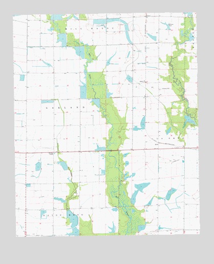
De Witt SW, AR USGS Topographic Map
Click on map above to begin viewing in our Map Viewer.

This topographic map contains these locations and features:
Feature Name Type Latitude Longitude GNIS ID View Map
Arkansas Noname 280 DamDamN34.2668°W91.4101°80825View Map
BurksPopulated PlaceN34.3018°W91.4023°57473View Map
Ditch Number 1CanalN34.2773°W91.3890°62256View Map
Ditch Number 2CanalN34.2587°W91.3904°62259View Map
Eldridge CornerPopulated PlaceN34.2973°W91.4737°57710View Map
Fullers ReservoirReservoirN34.3486°W91.4346°62207View Map
Girerd PondReservoirN34.3084°W91.3953°80820View Map
Girerd Pond DamDamN34.3101°W91.3935°80819View Map
Hall LakeReservoirN34.3139°W91.3816°80824View Map
Hall Lake DamDamN34.3151°W91.3801°80823View Map
Hillman PondReservoirN34.3676°W91.3951°74894View Map
Hillman Pond DamDamN34.3651°W91.3935°80818View Map
Hillman Reservoir DamDamN34.3734°W91.3785°80821View Map
Hillman Reservoir Number Two DamDamN34.3718°W91.4735°80826View Map
KittlersPopulated PlaceN34.3729°W91.4098°57079View Map
Lateral Number 10CanalN34.2951°W91.4926°62263View Map
Lateral Number 11CanalN34.3001°W91.4871°62264View Map
Lateral Number 12CanalN34.2701°W91.4798°62265View Map
Lateral Number 13CanalN34.2868°W91.4557°62266View Map
Lateral Number 5CanalN34.3279°W91.4998°63874View Map
Lateral Number 6CanalN34.3501°W91.4807°62261View Map
Lateral Number 9CanalN34.2995°W91.4593°62262View Map
Main DitchCanalN34.3265°W91.4918°62239View Map
Monica (historical)Populated PlaceN34.2987°W91.3821°62245View Map
New Providence School (historical)SchoolN34.2720°W91.4746°62253View Map
OlenaPopulated PlaceN34.3362°W91.4104°53039View Map
Sollars ReservoirReservoirN34.2520°W91.4601°81301View Map
Sollars Reservoir DamDamN34.2518°W91.4568°81300View Map
Thomas ReservoirReservoirN34.2774°W91.4142°81299View Map
Thomas Reservoir DamDamN34.2751°W91.4151°81298View Map
Thomas ReservoirsReservoirN34.2713°W91.4195°62316View Map

Note: Coordinates in the location and feature list above are referenced to NAD83 datum.


Copyright (C) 2008-2025 Ryan Niemi / Sunset Dynamics ... All Rights Reserved