TopoQuest Logo
Do you find TopoQuest useful?
Help keep TopoQuest running and adding new maps/features by donating!
Bitcoin:  19c7KJd3qBynnjoSw5npx9KScwjBe4ifkT
Litecoin:  LXs6TkuXGGXo1vDsWCkWVdjQX94eUKd6ui
Home View Maps Find Maps Find Places Resources & Links


Dead Canyon, Washington Topographic Map

USGS Map Title: Dead Canyon, WA
USGS Map MRC: 45121H2
DRG (GeoTIFF) Download: o45121h2.tif


Neighboring USGS Topographic Map Quads:


  Glenwood, WA  
46121A3
 

  Outlet Falls, WA  
46121A2
 

  Twin Buttes, WA  
46121A1
 

  Camas Prairie, WA  
45121H3
 

  Dead Canyon, WA  
45121H2
 

  Grayback Mountain, WA  
45121H1
 

  Appleton, WA  
45121G3
 

  Klickitat, WA  
45121G2
 

  Wahkiacus, WA  
45121G1


Map MRC Location:

N46°
W122°
N46°
W121°
H8 H7 H6 H5 H4 H3 H2 H1
G8 G7 G6 G5 G4 G3 G2 G1
F8 F7 F6 F5 F4 F3 F2 F1
E8 E7 E6 E5 E4 E3 E2 E1
D8 D7 D6 D5 D4 D3 D2 D1
C8 C7 C6 C5 C4 C3 C2 C1
B8 B7 B6 B5 B4 B3 B2 B1
A8 A7 A6 A5 A4 A3 A2 A1
N45°
W122°
N45°
W121°

Dead Canyon, WA USGS 1:24K Topographic Map Preview:
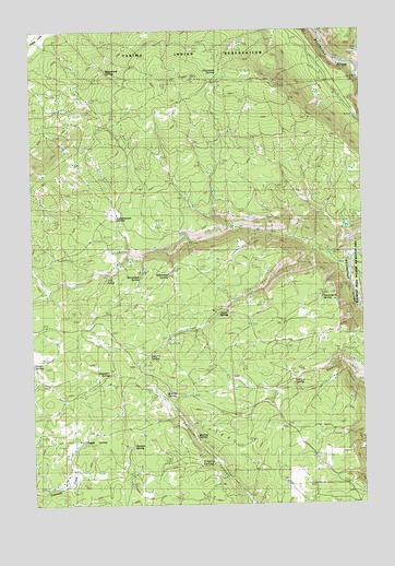
Dead Canyon, WA USGS Topographic Map
Click on map above to begin viewing in our Map Viewer.

This topographic map contains these locations and features:
Feature Name Type Latitude Longitude GNIS ID View Map
Boulder SpringSpringN45.9551°W121.1473°1503492View Map
Camp Five SpringSpringN45.9079°W121.1437°1510268View Map
Camp Six SpringSpringN45.9146°W121.2076°1510267View Map
Cottonwood SpringSpringN45.9857°W121.1820°1504178View Map
Dead CanyonValleyN45.9423°W121.1415°1518530View Map
Fill PondLakeN45.9347°W121.2230°1510511View Map
Gates SpringSpringN45.9368°W121.1815°1505096View Map
Gregory SpringSpringN45.8848°W121.1879°1505295View Map
Harmon SpringSpringN45.8926°W121.2145°1505393View Map
Hathaway SpringSpringN45.9357°W121.1995°1505418View Map
Kuhnhausen SpringSpringN45.9512°W121.2184°1506029View Map
Ladies SpringSpringN45.9601°W121.1262°1506040View Map
Legall SpringLakeN45.8916°W121.2321°1506124View Map
Masondale SpringSpringN45.9351°W121.2092°1506504View Map
Murray SpringSpringN45.8960°W121.1912°1506904View Map
Myting SpringSpringN45.9043°W121.2001°1506918View Map
Paradise SpringSpringN45.9098°W121.2209°1507293View Map
Pennington SpringSpringN45.9296°W121.1406°1507367View Map
Rock SpringsSpringN45.9929°W121.1995°1507866View Map
Spoon SpringSpringN45.9260°W121.1765°1508610View Map
The PlateauPlainN45.8915°W121.1959°1527061View Map
Wellenbrock SpringSpringN45.9898°W121.2226°1509362View Map
Willis CanyonValleyN45.9415°W121.1451°1509542View Map

Note: Coordinates in the location and feature list above are referenced to NAD83 datum.


Copyright (C) 2008-2025 Ryan Niemi / Sunset Dynamics ... All Rights Reserved