TopoQuest Logo
Do you find TopoQuest useful?
Help keep TopoQuest running and adding new maps/features by donating!
Bitcoin:  19c7KJd3qBynnjoSw5npx9KScwjBe4ifkT
Litecoin:  LXs6TkuXGGXo1vDsWCkWVdjQX94eUKd6ui
Home View Maps Find Maps Find Places Resources & Links


Camas Prairie, Washington Topographic Map

USGS Map Title: Camas Prairie, WA
USGS Map MRC: 45121H3
DRG (GeoTIFF) Download: o45121h3.tif


Neighboring USGS Topographic Map Quads:


  King Mountain, WA  
46121A4
 

  Glenwood, WA  
46121A3
 

  Outlet Falls, WA  
46121A2
 

  Quigley Butte, WA  
45121H4
 

  Camas Prairie, WA  
45121H3
 

  Dead Canyon, WA  
45121H2
 

  Husum, WA  
45121G4
 

  Appleton, WA  
45121G3
 

  Klickitat, WA  
45121G2


Map MRC Location:

N46°
W122°
N46°
W121°
H8 H7 H6 H5 H4 H3 H2 H1
G8 G7 G6 G5 G4 G3 G2 G1
F8 F7 F6 F5 F4 F3 F2 F1
E8 E7 E6 E5 E4 E3 E2 E1
D8 D7 D6 D5 D4 D3 D2 D1
C8 C7 C6 C5 C4 C3 C2 C1
B8 B7 B6 B5 B4 B3 B2 B1
A8 A7 A6 A5 A4 A3 A2 A1
N45°
W122°
N45°
W121°

Camas Prairie, WA USGS 1:24K Topographic Map Preview:
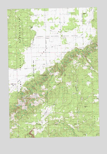
Camas Prairie, WA USGS Topographic Map
Click on map above to begin viewing in our Map Viewer.

This topographic map contains these locations and features:
Feature Name Type Latitude Longitude GNIS ID View Map
Bird CreekStreamN45.9829°W121.2629°1516573View Map
Camas PrairieFlatN45.9651°W121.3234°1517237View Map
Castle SpringSpringN45.9146°W121.2551°1517478View Map
Chapman CreekStreamN45.9426°W121.3376°1529047View Map
Cold Springs DitchStreamN45.9829°W121.3409°1529046View Map
Conboy LakeLakeN45.9712°W121.2820°1529958View Map
Conboy Lake National Wildlife RefugeParkN45.9717°W121.3301°1528428View Map
Diamond Gap LookoutLocaleN45.9151°W121.3417°1529960View Map
Dunkard GraveyardCemeteryN45.8876°W121.2828°1529044View Map
Frasier CreekStreamN45.9951°W121.2573°1515700View Map
Holmes CreekStreamN45.9418°W121.3376°1533041View Map
Jebe SwaleStreamN45.9112°W121.2751°1521343View Map
Liberty BondLocaleN45.8768°W121.2695°1529043View Map
Log Corral SpringSpringN45.9040°W121.2723°1529045View Map
Medley CanyonValleyN45.9473°W121.3037°1522989View Map
Mount Adams CemeteryCemeteryN45.9940°W121.3351°1523416View Map
PanakanicLocaleN45.8971°W121.3220°1533647View Map
Panakanic PrairieFlatN45.8957°W121.3262°1528451View Map
Panakanic Water Works DamDamN45.8882°W121.3562°1532507View Map
Whitcomb CabinParkN45.9357°W121.3309°1529614View Map
Willard SpringSwampN45.9821°W121.3445°1528165View Map

Note: Coordinates in the location and feature list above are referenced to NAD83 datum.


Copyright (C) 2008-2024 Ryan Niemi / Sunset Dynamics ... All Rights Reserved