TopoQuest Logo
Do you find TopoQuest useful?
Help keep TopoQuest running and adding new maps/features by donating!
Bitcoin:  19c7KJd3qBynnjoSw5npx9KScwjBe4ifkT
Litecoin:  LXs6TkuXGGXo1vDsWCkWVdjQX94eUKd6ui
Home View Maps Find Maps Find Places Resources & Links


Glenwood, Washington Topographic Map

USGS Map Title: Glenwood, WA
USGS Map MRC: 46121A3
DRG (GeoTIFF) Download: o46121a3.tif


Neighboring USGS Topographic Map Quads:


  Mount Adams East, WA  
46121B4
 

  Jungle Butte, WA  
46121B3
 

  Signal Peak, WA  
46121B2
 

  King Mountain, WA  
46121A4
 

  Glenwood, WA  
46121A3
 

  Outlet Falls, WA  
46121A2
 

  Quigley Butte, WA  
45121H4
 

  Camas Prairie, WA  
45121H3
 

  Dead Canyon, WA  
45121H2


Map MRC Location:

N47°
W122°
N47°
W121°
H8 H7 H6 H5 H4 H3 H2 H1
G8 G7 G6 G5 G4 G3 G2 G1
F8 F7 F6 F5 F4 F3 F2 F1
E8 E7 E6 E5 E4 E3 E2 E1
D8 D7 D6 D5 D4 D3 D2 D1
C8 C7 C6 C5 C4 C3 C2 C1
B8 B7 B6 B5 B4 B3 B2 B1
A8 A7 A6 A5 A4 A3 A2 A1
N46°
W122°
N46°
W121°

Glenwood, WA USGS 1:24K Topographic Map Preview:
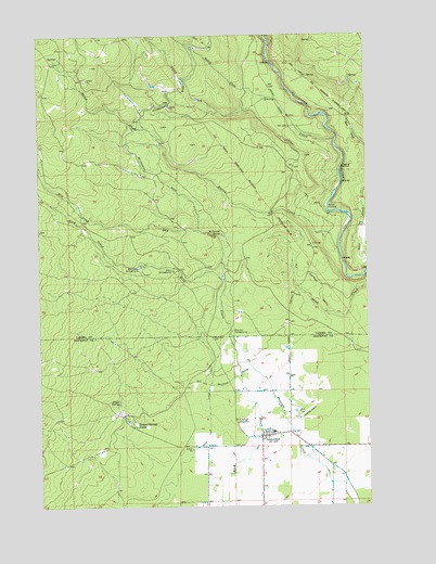
Glenwood, WA USGS Topographic Map
Click on map above to begin viewing in our Map Viewer.

This topographic map contains these locations and features:
Feature Name Type Latitude Longitude GNIS ID View Map
Bacon CreekStreamN46.0685°W121.2620°1516020View Map
Big Muddy CreekStreamN46.1248°W121.2895°1516534View Map
Bird Creek CampgroundLocaleN46.0637°W121.3376°1516576View Map
Blue Jay CampgroundLocaleN46.0462°W121.3034°1516685View Map
Dairy CreekStreamN46.0971°W121.2629°1518453View Map
Draper SpringsSpringN46.0273°W121.3456°1518917View Map
Draper Springs CampLocaleN46.0215°W121.3401°1518918View Map
Dry CreekStreamN46.0601°W121.3059°1518949View Map
Flying L Ranch Airport (historical)AirportN46.0085°W121.2748°1534142View Map
GlenwoodPopulated PlaceN46.0187°W121.2906°1520005View Map
Glenwood Census Designated PlaceCensusN46.0228°W121.2926°2585643View Map
Glenwood High and Elementary SchoolSchoolN46.0198°W121.2873°1530701View Map
Glenwood Post OfficePost OfficeN46.0183°W121.2922°2781573View Map
Klickitat County Fire Protection District 8BuildingN46.0196°W121.2888°2619782View Map
McCumber SpringSwampN46.0717°W121.3064°1522880View Map
North Fork Dairy CreekStreamN46.1082°W121.2887°1523767View Map
Parrott CrossingPopulated PlaceN46.0790°W121.2659°1524223View Map
Sage Flat DitchCanalN46.0235°W121.3117°1525341View Map
Stout CampgroundLocaleN46.0623°W121.3248°1526607View Map

Note: Coordinates in the location and feature list above are referenced to NAD83 datum.


Copyright (C) 2008-2025 Ryan Niemi / Sunset Dynamics ... All Rights Reserved