TopoQuest Logo
Do you find TopoQuest useful?
Help keep TopoQuest running and adding new maps/features by donating!
Bitcoin:  19c7KJd3qBynnjoSw5npx9KScwjBe4ifkT
Litecoin:  LXs6TkuXGGXo1vDsWCkWVdjQX94eUKd6ui
Home View Maps Find Maps Find Places Resources & Links


Deason, Tennessee Topographic Map

USGS Map Title: Deason, TN
USGS Map MRC: 35086E4
DRG (GeoTIFF) Download: o35086e4.tif


Neighboring USGS Topographic Map Quads:


  Rover, TN  
35086F5
 

  Fosterville, TN  
35086F4
 

  Webbs Jungle, TN  
35086F3
 

  Unionville, TN  
35086E5
 

  Deason, TN  
35086E4
 

  Wartrace, TN  
35086E3
 

  Bedford, TN  
35086D5
 

  Shelbyville, TN  
35086D4
 

  Normandy, TN  
35086D3


Map MRC Location:

N36°
W87°
N36°
W86°
H8 H7 H6 H5 H4 H3 H2 H1
G8 G7 G6 G5 G4 G3 G2 G1
F8 F7 F6 F5 F4 F3 F2 F1
E8 E7 E6 E5 E4 E3 E2 E1
D8 D7 D6 D5 D4 D3 D2 D1
C8 C7 C6 C5 C4 C3 C2 C1
B8 B7 B6 B5 B4 B3 B2 B1
A8 A7 A6 A5 A4 A3 A2 A1
N35°
W87°
N35°
W86°

Deason, TN USGS 1:24K Topographic Map Preview:
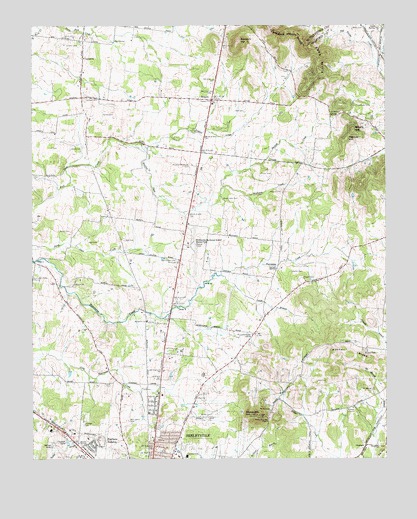
Deason, TN USGS Topographic Map
Click on map above to begin viewing in our Map Viewer.

This topographic map contains these locations and features:
Feature Name Type Latitude Longitude GNIS ID View Map
Arnold CemeteryCemeteryN35.5217°W86.4183°1319222View Map
Bedford CountyCivilN35.5138°W86.4589°1639723View Map
Bedford County EMSBuildingN35.5658°W86.4498°2697365View Map
Bedford County Farm (historical)LocaleN35.5176°W86.4125°1319232View Map
Bell CemeteryCemeteryN35.5628°W86.4675°1276916View Map
Bell CemeteryCemeteryN35.6001°W86.4250°1276917View Map
Benford CreekStreamN35.5906°W86.4647°1277003View Map
Big SpringSpringN35.6203°W86.4711°1277400View Map
Bigham CemeteryCemeteryN35.5870°W86.3989°1319243View Map
Blue Moon FarmsLocaleN35.6008°W86.4231°2662797View Map
Bomar Academy (historical)SchoolN35.5162°W86.3853°1319245View Map
Bomar Field-Shelbyville Municipal AirportAirportN35.5617°W86.4448°1301349View Map
Bridlewood FarmLocaleN35.5906°W86.4369°2662959View Map
Brown CemeteryCemeteryN35.5042°W86.4830°1278527View Map
Brown CemeteryCemeteryN35.5123°W86.4372°1278528View Map
Burns Chapel CemeteryCemeteryN35.5498°W86.4853°1319254View Map
Burns ChurchChurchN35.5506°W86.4850°1305552View Map
CaldwellPopulated PlaceN35.5037°W86.3822°1314785View Map
Caperton LakeReservoirN35.5049°W86.4877°1279628View Map
Carrick SpringSpringN35.5548°W86.4136°1279732View Map
Central SchoolSchoolN35.5012°W86.4453°1280179View Map
Claxton HillSummitN35.5920°W86.3889°1280623View Map
Commissioner District 2CivilN35.5909°W86.4779°2463895View Map
Commissioner District 8CivilN35.5038°W86.4602°2464657View Map
Cooper CemeteryCemeteryN35.5520°W86.4042°1281190View Map
Cooper CemeteryCemeteryN35.6192°W86.4836°1281192View Map
Coops Academy (historical)SchoolN35.5520°W86.3953°1319276View Map
Coops BranchStreamN35.5528°W86.4339°1281226View Map
Crossroads CemeteryCemeteryN35.5987°W86.3939°1319281View Map
Crossroads ChurchChurchN35.5987°W86.3942°1306200View Map
Damron CemeteryCemeteryN35.5317°W86.4561°1319286View Map
DeasonPopulated PlaceN35.6034°W86.4367°1282269View Map
Deason Church of ChristChurchN35.6056°W86.4355°1319293View Map
Dial CemeteryCemeteryN35.5965°W86.3933°1319294View Map
Eakin Elementary SchoolSchoolN35.5009°W86.4483°1319297View Map
Epps HillsSummitN35.6151°W86.3975°1283834View Map
Erwin Slave CemeteryCemeteryN35.5748°W86.4328°1283851View Map
Fairfield FarmLocaleN35.5422°W86.4147°2652560View Map
Fairlane EstatesPopulated PlaceN35.5040°W86.4789°1283980View Map
Hall CemeteryCemeteryN35.5623°W86.4803°1286562View Map
Harris Store (historical)LocaleN35.6070°W86.4819°1644988View Map
Hart Chapel CemeteryCemeteryN35.5576°W86.4492°1287044View Map
Harts Chapel (historical)ChurchN35.5578°W86.4492°1319339View Map
Harts Chapel School (historical)SchoolN35.5578°W86.4486°1319340View Map
Heritage Medical CenterHospitalN35.5637°W86.4488°2697355View Map
Hictons Big SpringSpringN35.5898°W86.4619°1644989View Map
Horse MountainSummitN35.5126°W86.4200°1288411View Map
Horse Mountain CemeteryCemeteryN35.5131°W86.4164°1319361View Map
Horse Mountain ChurchChurchN35.5117°W86.4161°1306588View Map
Houston Whitworth CemeteryCemeteryN35.5845°W86.4444°1288516View Map
Hurricane Creek ChurchChurchN35.5520°W86.5000°1288819View Map
Hurricane Grove CemeteryCemeteryN35.5359°W86.4211°1319364View Map
Hurricane Grove ChurchChurchN35.5359°W86.4222°1306599View Map
Hutton CreekStreamN35.5948°W86.4442°1288878View Map
Jennings CemeteryCemeteryN35.5098°W86.4819°1289377View Map
Jones SpringSpringN35.6242°W86.3778°1289822View Map
McAdams CemeteryCemeteryN35.5367°W86.4411°1319404View Map
McCuistion CemeteryCemeteryN35.5112°W86.4661°1293219View Map
McDale School (historical)SchoolN35.5259°W86.4355°1319406View Map
Mingle HillSummitN35.5948°W86.3864°1294044View Map
Minkslide CreekStreamN35.5787°W86.4325°1294054View Map
Mount Moriah CemeteryCemeteryN35.5201°W86.3794°1294671View Map
Mount Moriah Church (historical)ChurchN35.5204°W86.3800°1319419View Map
Mount View ChurchChurchN35.5140°W86.4161°1306794View Map
Mountain View CemeteryCemeteryN35.5140°W86.4164°1319444View Map
Northside ChurchChurchN35.5573°W86.4486°1295970View Map
Ogilivie CemeteryCemeteryN35.5917°W86.4222°1319437View Map
Orr CemeteryCemeteryN35.5595°W86.4980°1319442View Map
Pannell RidgeRidgeN35.5298°W86.3855°1296716View Map
Parker CemeteryCemeteryN35.5537°W86.4080°1296806View Map
Parker CemeteryCemeteryN35.5820°W86.4194°1296807View Map
Philippi United Methodist ChurchChurchN35.5148°W86.3869°1310150View Map
Phillippi ChurchChurchN35.5145°W86.3867°1297324View Map
Phillips CemeteryCemeteryN35.5101°W86.4875°1319451View Map
Phillips CemeteryCemeteryN35.5306°W86.3825°1297340View Map
Philpott CemeteryCemeteryN35.5773°W86.4117°1297371View Map
Purvis CemeteryCemeteryN35.5656°W86.4867°1298711View Map
Rainwater CemeteryCemeteryN35.6017°W86.3847°1298855View Map
Ransom CemeteryCemeteryN35.6070°W86.4367°1319465View Map
Ransom HillSummitN35.6203°W86.4275°1298924View Map
Ranson ChurchChurchN35.6040°W86.4372°1298928View Map
Saddlecrest FarmsLocaleN35.5503°W86.4211°2652570View Map
Sand Creek FarmsLocaleN35.5778°W86.4489°2652567View Map
Shady Grove School (historical)SchoolN35.5837°W86.3964°1319478View Map
Shelbyville Fire Department Station 3BuildingN35.5628°W86.4452°2653856View Map
Smith CemeteryCemeteryN35.6220°W86.4847°1270607View Map
Springer CemeteryCemeteryN35.6042°W86.4811°1271136View Map
Steele CemeteryCemeteryN35.5895°W86.4864°1271302View Map
Steele CemeteryCemeteryN35.5995°W86.4750°1271303View Map
Stewart CemeteryCemeteryN35.5101°W86.4953°1319507View Map
Sulphur SpringSpringN35.5259°W86.4717°1311446View Map
Sulphur Springs School (historical)SchoolN35.5367°W86.4792°1319512View Map
Sutton CemeteryCemeteryN35.5640°W86.3858°1319514View Map
Swings LakeReservoirN35.5039°W86.4932°1271994View Map
Trinity Southern Methodist ChurchChurchN35.5051°W86.4569°1310158View Map
Tune CemeteryCemeteryN35.5442°W86.4628°1319535View Map
VannattaPopulated PlaceN35.6159°W86.4819°1314453View Map
Webb CemeteryCemeteryN35.6242°W86.3864°1274015View Map
Webb CemeteryCemeteryN35.6240°W86.4900°1319556View Map
Whiteside United Methodist ChurchChurchN35.5398°W86.4597°1304561View Map
WYCQ-FM (Shelbyville)TowerN35.5129°W86.4200°1640052View Map

Note: Coordinates in the location and feature list above are referenced to NAD83 datum.


Copyright (C) 2008-2025 Ryan Niemi / Sunset Dynamics ... All Rights Reserved