TopoQuest Logo
Do you find TopoQuest useful?
Help keep TopoQuest running and adding new maps/features by donating!
Bitcoin:  19c7KJd3qBynnjoSw5npx9KScwjBe4ifkT
Litecoin:  LXs6TkuXGGXo1vDsWCkWVdjQX94eUKd6ui
Home View Maps Find Maps Find Places Resources & Links


Deer Mountain, Montana Topographic Map

USGS Map Title: Deer Mountain, MT
USGS Map MRC: 46114A1
DRG (GeoTIFF) Download: o46114a1.tif


Neighboring USGS Topographic Map Quads:


  Hamilton South, MT  
46114B2
 

  Mountain House, MT  
46114B1
 

  Gird Point, MT  
46113B8
 

  Darby, MT  
46114A2
 

  Deer Mountain, MT  
46114A1
 

  Bald Top Mountain, MT  
46113A8
 

  Burnt Ridge, MT  
45114H2
 

  Robbins Gulch, MT  
45114H1
 

  French Basin, MT  
45113H8


Map MRC Location:

N47°
W115°
N47°
W114°
H8 H7 H6 H5 H4 H3 H2 H1
G8 G7 G6 G5 G4 G3 G2 G1
F8 F7 F6 F5 F4 F3 F2 F1
E8 E7 E6 E5 E4 E3 E2 E1
D8 D7 D6 D5 D4 D3 D2 D1
C8 C7 C6 C5 C4 C3 C2 C1
B8 B7 B6 B5 B4 B3 B2 B1
A8 A7 A6 A5 A4 A3 A2 A1
N46°
W115°
N46°
W114°

Deer Mountain, MT USGS 1:24K Topographic Map Preview:
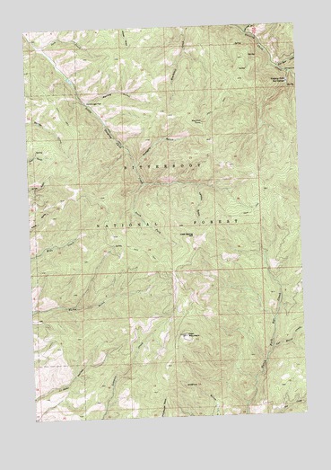
Deer Mountain, MT USGS Topographic Map
Click on map above to begin viewing in our Map Viewer.

This topographic map contains these locations and features:
Feature Name Type Latitude Longitude GNIS ID View Map
04N19W07DCD_01 SpringSpringN46.0969°W114.0051°813984View Map
04N19W07DCD_02 SpringSpringN46.0969°W114.0051°813983View Map
Blacktail PointSummitN46.0944°W114.0451°780078View Map
Bobcat SaddleGapN46.0455°W114.0598°2036649View Map
Cat House CreekStreamN46.0219°W114.0151°781046View Map
Cold Spring HillSummitN46.0580°W114.0498°791307View Map
Cold SpringsSpringN46.0566°W114.0529°794473View Map
Deer MountainSummitN46.0260°W114.0551°782265View Map
Hamburger FlatFlatN46.1010°W114.0981°784491View Map
Harlan PointSummitN46.0746°W114.1015°794472View Map
Jack CreekStreamN46.1191°W114.1168°785367View Map
Lairdon GulchValleyN46.0738°W114.0476°785892View Map
Last Log DrawValleyN46.1227°W114.0240°785977View Map
Ravalli CountyCivilN46.0817°W114.1208°1719582View Map
Rodgers GulchValleyN46.0813°W114.0762°789741View Map
Sleeping Child Hot SpringsSpringN46.1066°W114.0054°790648View Map
Sleeping Child Hot Springs (historical)LocaleN46.1066°W114.0054°1803061View Map
Sleeping Child School (historical)SchoolN46.1066°W114.0054°1803060View Map
South Fork Little Sleeping Child CreekStreamN46.0752°W114.0723°791003View Map
Spring GulchValleyN46.1013°W114.0981°791287View Map
Two Bear CreekStreamN46.1113°W114.0098°792542View Map

Note: Coordinates in the location and feature list above are referenced to NAD83 datum.


Copyright (C) 2008-2025 Ryan Niemi / Sunset Dynamics ... All Rights Reserved