TopoQuest Logo
Do you find TopoQuest useful?
Help keep TopoQuest running and adding new maps/features by donating!
Bitcoin:  19c7KJd3qBynnjoSw5npx9KScwjBe4ifkT
Litecoin:  LXs6TkuXGGXo1vDsWCkWVdjQX94eUKd6ui
Home View Maps Find Maps Find Places Resources & Links


Mountain House, Montana Topographic Map

USGS Map Title: Mountain House, MT
USGS Map MRC: 46114B1
DRG (GeoTIFF) Download: o46114b1.tif


Neighboring USGS Topographic Map Quads:


  Hamilton North, MT  
46114C2
 

  Corvallis, MT  
46114C1
 

  Willow Mountain, MT  
46113C8
 

  Hamilton South, MT  
46114B2
 

  Mountain House, MT  
46114B1
 

  Gird Point, MT  
46113B8
 

  Darby, MT  
46114A2
 

  Deer Mountain, MT  
46114A1
 

  Bald Top Mountain, MT  
46113A8


Map MRC Location:

N47°
W115°
N47°
W114°
H8 H7 H6 H5 H4 H3 H2 H1
G8 G7 G6 G5 G4 G3 G2 G1
F8 F7 F6 F5 F4 F3 F2 F1
E8 E7 E6 E5 E4 E3 E2 E1
D8 D7 D6 D5 D4 D3 D2 D1
C8 C7 C6 C5 C4 C3 C2 C1
B8 B7 B6 B5 B4 B3 B2 B1
A8 A7 A6 A5 A4 A3 A2 A1
N46°
W115°
N46°
W114°

Mountain House, MT USGS 1:24K Topographic Map Preview:
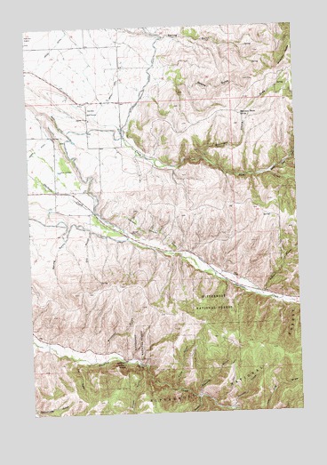
Mountain House, MT USGS Topographic Map
Click on map above to begin viewing in our Map Viewer.

This topographic map contains these locations and features:
Feature Name Type Latitude Longitude GNIS ID View Map
05N20W04ACD_01 WellWellN46.2188°W114.0987°814635View Map
05N20W10BAAC01 WellWellN46.2105°W114.0837°814603View Map
05N20W23BAC_01 WellWellN46.1805°W114.0648°814447View Map
05N20W23BBA_01 WellWellN46.1808°W114.0679°814451View Map
05N20W33BCCD01 WellWellN46.1469°W114.1109°814236View Map
Blacktail CreekStreamN46.1302°W114.0487°780062View Map
Brookins GulchValleyN46.1449°W114.0934°780427View Map
Dry GulchValleyN46.1833°W114.0976°782615View Map
Falls GulchValleyN46.1327°W114.0584°783298View Map
Hamilton DivisionCivilN46.2182°W114.0830°1940636View Map
Hamilton Golf CourseLocaleN46.2230°W114.0956°799320View Map
Moose GulchValleyN46.1408°W114.0762°787648View Map
Mountain HouseSummitN46.2383°W114.0048°787753View Map
Mountain House DrawValleyN46.2074°W114.0437°787754View Map
Mountain House SpringSpringN46.2214°W114.0260°787755View Map
Newton GulchValleyN46.1638°W114.0184°787976View Map
Quarry GulchValleyN46.2335°W114.0659°789711View Map
Saint Clair CreekStreamN46.2021°W114.0137°789928View Map
Sawdust GulchValleyN46.1308°W114.0484°790040View Map
Skalkaho Highline DitchCanalN46.1816°W114.0623°790578View Map
Spring GulchValleyN46.1816°W114.1090°791288View Map
SW NE Section 2 MineMineN46.1324°W114.0490°805089View Map
Tip GulchValleyN46.1421°W114.1048°792214View Map
Twomile CreekStreamN46.1263°W114.0356°792568View Map
Ward DitchCanalN46.2194°W114.1112°792814View Map

Note: Coordinates in the location and feature list above are referenced to NAD83 datum.


Copyright (C) 2008-2025 Ryan Niemi / Sunset Dynamics ... All Rights Reserved