TopoQuest Logo
Do you find TopoQuest useful?
Help keep TopoQuest running and adding new maps/features by donating!
Bitcoin:  19c7KJd3qBynnjoSw5npx9KScwjBe4ifkT
Litecoin:  LXs6TkuXGGXo1vDsWCkWVdjQX94eUKd6ui
Home View Maps Find Maps Find Places Resources & Links


Deerfield, South Dakota Topographic Map

USGS Map Title: Deerfield, SD
USGS Map MRC: 44103A7
DRG (GeoTIFF) Download: o44103a7.tif


Neighboring USGS Topographic Map Quads:


  Crooks Tower, SD  
44103B8
 

  Nahant, SD  
44103B7
 

  Minnesota Ridge, SD  
44103B6
 

  Crows Nest Peak, SD  
44103A8
 

  Deerfield, SD  
44103A7
 

  Rochford, SD  
44103A6
 

  Preacher Spring, SD  
43103H8
 

  Ditch Creek, SD  
43103H7
 

  Medicine Mountain, SD  
43103H6


Map MRC Location:

N45°
W104°
N45°
W103°
H8 H7 H6 H5 H4 H3 H2 H1
G8 G7 G6 G5 G4 G3 G2 G1
F8 F7 F6 F5 F4 F3 F2 F1
E8 E7 E6 E5 E4 E3 E2 E1
D8 D7 D6 D5 D4 D3 D2 D1
C8 C7 C6 C5 C4 C3 C2 C1
B8 B7 B6 B5 B4 B3 B2 B1
A8 A7 A6 A5 A4 A3 A2 A1
N44°
W104°
N44°
W103°

Deerfield, SD USGS 1:24K Topographic Map Preview:
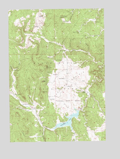
Deerfield, SD USGS Topographic Map
Click on map above to begin viewing in our Map Viewer.

This topographic map contains these locations and features:
Feature Name Type Latitude Longitude GNIS ID View Map
Alta (historical)LocaleN44.1089°W103.7533°1265562View Map
Black Hills National ForestForestN44.0076°W103.7953°1265823View Map
Black Tunnel MineMineN44.0858°W103.7810°1261289View Map
Castle RockPillarN44.0469°W103.8324°1261419View Map
Castle Rock SchoolSchoolN44.0311°W103.8424°1261420View Map
Copper Camp (historical)Populated PlaceN44.0916°W103.7991°1264599View Map
Cornelison RanchLocaleN44.0378°W103.8046°1261488View Map
Custer Trail CampgroundLocaleN44.0255°W103.7977°1263043View Map
Deer Head LodgeLocaleN44.0991°W103.7644°1261548View Map
Deer LodgeLocaleN44.0308°W103.8596°1261549View Map
DeerfieldPopulated PlaceN44.0172°W103.8341°1265181View Map
Deerfield DamDamN44.0291°W103.7858°1262874View Map
Deerfield LakeReservoirN44.0194°W103.7992°1261552View Map
Deerfield Lake Boat Ramp CampgroundLocaleN44.0216°W103.7816°1263054View Map
Deerfield Lake Recreation AreaParkN44.0200°W103.7952°1263081View Map
Deerfield SchoolSchoolN44.0297°W103.7999°1261553View Map
Divide Lode MineMineN44.0966°W103.7908°1261562View Map
Dutchman CampgroundLocaleN44.0244°W103.7827°1263076View Map
Dutchman CreekStreamN44.0291°W103.7810°1261606View Map
Erickson RanchLocaleN44.0591°W103.8024°1261647View Map
Flag MountainSummitN44.0707°W103.8268°1265641View Map
Gold RunStreamN44.0100°W103.7941°1261724View Map
Gold Run CampgroundLocaleN44.0028°W103.7921°1263082View Map
Golden West MineMineN44.0814°W103.7544°1265230View Map
Horsethief CreekStreamN44.0300°W103.8427°1261845View Map
Hughes DrawValleyN44.0434°W103.8685°1261850View Map
Hupp RanchLocaleN44.0400°W103.8230°1261856View Map
King of the West MineMineN44.0978°W103.7735°1261915View Map
Kinney RanchLocaleN44.0464°W103.7763°1261917View Map
Kinney SpringSpringN44.0319°W103.7667°1261918View Map
Lake Shore Picnic AreaLocaleN44.0133°W103.8133°1263077View Map
Lessering DrawValleyN44.1226°W103.7910°1261946View Map
Lessering RanchLocaleN44.1133°W103.7966°1261947View Map
Lind CampLocaleN44.0475°W103.7805°1261956View Map
Lyons DrawValleyN44.0678°W103.8692°1262008View Map
Lyons SpringSpringN44.0680°W103.8685°1262009View Map
Maitland DrawValleyN44.1213°W103.7947°1262014View Map
Maitland SpringSpringN44.1179°W103.8008°1262016View Map
Mercedes GulchValleyN44.0866°W103.7914°1262055View Map
Merry-Go-Round CampLocaleN44.1033°W103.7830°1262059View Map
Miller CampLocaleN44.0378°W103.7991°1262075View Map
Miller RanchLocaleN44.0353°W103.8516°1262077View Map
Miller RanchLocaleN44.0380°W103.7830°1262078View Map
Monheim RanchLocaleN44.1116°W103.7621°1262087View Map
Mountain City Picnic AreaLocaleN44.0144°W103.7994°1263079View Map
Musser SpringSpringN44.0655°W103.8262°1262105View Map
Nichols CreekStreamN44.0053°W103.8319°1262125View Map
Nichols Creek Gravel PitMineN44.0164°W103.8735°1263078View Map
Nipple ButteSummitN44.0569°W103.8315°1262129View Map
Oberg RanchLocaleN44.0519°W103.7999°1262161View Map
Pinedate (historical)LocaleN44.1055°W103.7671°1264580View Map
Prickett RanchLocaleN44.0450°W103.8688°1262242View Map
Reynolds PrairieFlatN44.0558°W103.7983°1262294View Map
Reynolds Prairie SchoolSchoolN44.0683°W103.7991°1262295View Map
Reynolds RanchLocaleN44.0764°W103.8069°1262296View Map
Reynolds RanchLocaleN44.0855°W103.8010°1262297View Map
Sawbuck DrawValleyN44.0835°W103.7710°1262363View Map
Shick RanchLocaleN44.0630°W103.8119°1262405View Map
Silver CreekStreamN44.0308°W103.8441°1262415View Map
South Fork Castle CreekStreamN44.0130°W103.8313°1262458View Map
Taylor SpringSpringN44.1084°W103.8364°1262556View Map
White Tail PeakSummitN44.1189°W103.8352°1262703View Map
White Tail Peak CampgroundLocaleN44.0133°W103.8066°1263080View Map
Yellow Bird MineMineN44.0997°W103.7746°1262749View Map

Note: Coordinates in the location and feature list above are referenced to NAD83 datum.


Copyright (C) 2008-2024 Ryan Niemi / Sunset Dynamics ... All Rights Reserved