TopoQuest Logo
Do you find TopoQuest useful?
Help keep TopoQuest running and adding new maps/features by donating!
Bitcoin:  19c7KJd3qBynnjoSw5npx9KScwjBe4ifkT
Litecoin:  LXs6TkuXGGXo1vDsWCkWVdjQX94eUKd6ui
Home View Maps Find Maps Find Places Resources & Links


Minnesota Ridge, South Dakota Topographic Map

USGS Map Title: Minnesota Ridge, SD
USGS Map MRC: 44103B6
DRG (GeoTIFF) Download: o44103b6.tif


Neighboring USGS Topographic Map Quads:


  Lead, SD  
44103C7
 

  Deadwood South, SD  
44103C6
 

  Deadman Mountain, SD  
44103C5
 

  Nahant, SD  
44103B7
 

  Minnesota Ridge, SD  
44103B6
 

  Nemo, SD  
44103B5
 

  Deerfield, SD  
44103A7
 

  Rochford, SD  
44103A6
 

  Silver City, SD  
44103A5


Map MRC Location:

N45°
W104°
N45°
W103°
H8 H7 H6 H5 H4 H3 H2 H1
G8 G7 G6 G5 G4 G3 G2 G1
F8 F7 F6 F5 F4 F3 F2 F1
E8 E7 E6 E5 E4 E3 E2 E1
D8 D7 D6 D5 D4 D3 D2 D1
C8 C7 C6 C5 C4 C3 C2 C1
B8 B7 B6 B5 B4 B3 B2 B1
A8 A7 A6 A5 A4 A3 A2 A1
N44°
W104°
N44°
W103°

Minnesota Ridge, SD USGS 1:24K Topographic Map Preview:
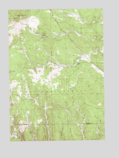
Minnesota Ridge, SD USGS Topographic Map
Click on map above to begin viewing in our Map Viewer.

This topographic map contains these locations and features:
Feature Name Type Latitude Longitude GNIS ID View Map
Albany (historical)LocaleN44.2000°W103.6908°1264659View Map
Black Hills Experimental ForestAreaN44.1619°W103.6355°1263099View Map
Boxelder SchoolSchoolN44.2244°W103.7069°1261335View Map
Buchholz (historical)LocaleN44.1453°W103.7205°1264671View Map
Camp Collins (historical)LocaleN44.1958°W103.7327°1264639View Map
Camp Paha SapaLocaleN44.2208°W103.6296°1261400View Map
Custer Crossing Picnic AreaLocaleN44.2217°W103.6708°1263037View Map
Custer Lookout TowerTowerN44.2444°W103.7352°1265747View Map
Custer PeakSummitN44.2442°W103.7352°1261521View Map
Diamond City (historical)Populated PlaceN44.1500°W103.6991°1263420View Map
Green Mountain (historical)SummitN44.1962°W103.7369°1264075View Map
Greens GulchValleyN44.1633°W103.7148°1261746View Map
Gregory (historical)Populated PlaceN44.1611°W103.7394°1264560View Map
Minnesota RidgeRidgeN44.1766°W103.7010°1262084View Map
Montana MineMineN44.1597°W103.7446°1262088View Map
Mountain Meadow CemeteryCemeteryN44.2039°W103.6557°1262099View Map
Mountain Meadows (historical)LocaleN44.2042°W103.6510°1264553View Map
Naoby (historical)LocaleN44.1986°W103.6519°1264551View Map
North Fork Rapid CreekStreamN44.1311°W103.7360°1262149View Map
Ochre City (historical)LocaleN44.1361°W103.6566°1264582View Map
Olsen (historical)LocaleN44.1583°W103.7380°1264546View Map
Roubaix LakeReservoirN44.1983°W103.6605°1262939View Map
Roubaix Lake CampgroundLocaleN44.1986°W103.6624°1263038View Map
Roubaix Lake DamDamN44.2000°W103.6588°1262866View Map
Solomon GulchValleyN44.1285°W103.7488°1262445View Map
South Fork Rapid CreekStreamN44.1311°W103.7360°1262464View Map

Note: Coordinates in the location and feature list above are referenced to NAD83 datum.


Copyright (C) 2008-2024 Ryan Niemi / Sunset Dynamics ... All Rights Reserved