TopoQuest Logo
Do you find TopoQuest useful?
Help keep TopoQuest running and adding new maps/features by donating!
Bitcoin:  19c7KJd3qBynnjoSw5npx9KScwjBe4ifkT
Litecoin:  LXs6TkuXGGXo1vDsWCkWVdjQX94eUKd6ui
Home View Maps Find Maps Find Places Resources & Links


Nahant, South Dakota Topographic Map

USGS Map Title: Nahant, SD
USGS Map MRC: 44103B7
DRG (GeoTIFF) Download: o44103b7.tif


Neighboring USGS Topographic Map Quads:


  Savoy, SD  
44103C8
 

  Lead, SD  
44103C7
 

  Deadwood South, SD  
44103C6
 

  Crooks Tower, SD  
44103B8
 

  Nahant, SD  
44103B7
 

  Minnesota Ridge, SD  
44103B6
 

  Crows Nest Peak, SD  
44103A8
 

  Deerfield, SD  
44103A7
 

  Rochford, SD  
44103A6


Map MRC Location:

N45°
W104°
N45°
W103°
H8 H7 H6 H5 H4 H3 H2 H1
G8 G7 G6 G5 G4 G3 G2 G1
F8 F7 F6 F5 F4 F3 F2 F1
E8 E7 E6 E5 E4 E3 E2 E1
D8 D7 D6 D5 D4 D3 D2 D1
C8 C7 C6 C5 C4 C3 C2 C1
B8 B7 B6 B5 B4 B3 B2 B1
A8 A7 A6 A5 A4 A3 A2 A1
N44°
W104°
N44°
W103°

Nahant, SD USGS 1:24K Topographic Map Preview:
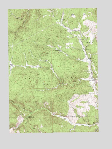
Nahant, SD USGS Topographic Map
Click on map above to begin viewing in our Map Viewer.

This topographic map contains these locations and features:
Feature Name Type Latitude Longitude GNIS ID View Map
Beaver SpringSpringN44.1445°W103.8611°1263048View Map
Beaver SpringSpringN44.1444°W103.8610°1261249View Map
Bee DrawValleyN44.1300°W103.8676°1261251View Map
Besant ParkFlatN44.1928°W103.8710°1265124View Map
Billings DrawValleyN44.1932°W103.8488°1261273View Map
Black Fox (historical)LocaleN44.1391°W103.8505°1264670View Map
Black Fox CampgroundLocaleN44.1455°W103.8435°1263053View Map
Black Fox SpringSpringN44.1647°W103.8612°1261282View Map
Black Fox Summer HomesLocaleN44.1453°W103.8494°1263049View Map
Buck SpringSpringN44.1564°W103.8387°1261358View Map
Bull Dog RanchLocaleN44.2086°W103.7694°1261367View Map
Bulldog (historical)LocaleN44.2003°W103.7569°1265564View Map
Buskala CreekStreamN44.1983°W103.7627°1261378View Map
Buskala RanchLocaleN44.2078°W103.8021°1261379View Map
Cave DrawValleyN44.1402°W103.8503°1261423View Map
Cave Draw Summer HomesLocaleN44.1394°W103.8510°1263052View Map
DumontPopulated PlaceN44.2386°W103.7988°1261600View Map
Dumont SchoolSchoolN44.2428°W103.7869°1261601View Map
Dump DrawValleyN44.1337°W103.7525°1261602View Map
Elkhorn I (historical)LocaleN44.1569°W103.7616°1264567View Map
Florence (historical)Populated PlaceN44.1358°W103.7802°1264596View Map
French RanchLocaleN44.1839°W103.7521°1261700View Map
Graveyard SpringSpringN44.2400°W103.8569°1261739View Map
Gudat GulchValleyN44.2091°W103.7688°1261757View Map
Gudat RanchLocaleN44.2155°W103.7602°1261758View Map
Hallorans DrawValleyN44.1903°W103.8144°1261763View Map
Harvey RanchLocaleN44.1980°W103.8230°1261777View Map
Harvey SpringSpringN44.2039°W103.8211°1261778View Map
Harvey SpringSpringN44.2134°W103.8722°1261779View Map
Hausle RanchLocaleN44.1328°W103.7574°1261784View Map
Hollens DrawValleyN44.2452°W103.8699°1261825View Map
Hop CreekStreamN44.1319°W103.7671°1261833View Map
Irey SpringSpringN44.2152°W103.8075°1261867View Map
Juso RanchLocaleN44.2439°W103.7691°1261904View Map
Long DrawValleyN44.1326°W103.7825°1261989View Map
Long DrawValleyN44.2457°W103.8478°1261990View Map
McKay Summer HomesLocaleN44.1516°W103.8371°1263051View Map
Melcher RanchLocaleN44.1708°W103.7580°1262054View Map
NahantPopulated PlaceN44.1767°W103.7555°1265672View Map
Nahant SchoolSchoolN44.1989°W103.7619°1262107View Map
North Rapid Stage Station (historical)LocaleN44.1755°W103.7560°1264549View Map
Peterson RanchLocaleN44.1325°W103.7658°1262195View Map
Rhoads ForkStreamN44.1453°W103.8438°1262298View Map
Rickgauer SpringSpringN44.1566°W103.8541°1926894View Map
Sasse RanchLocaleN44.1328°W103.7833°1262362View Map
Seep SpringSpringN44.1319°W103.8283°1263050View Map
Swede GulchValleyN44.1780°W103.7572°1262545View Map
Telegraph GulchValleyN44.1319°W103.7636°1262557View Map
Texana (historical)LocaleN44.1666°W103.8158°1264532View Map
Tillson CreekStreamN44.1778°W103.7563°1262589View Map
Unorganized Territory of South LawrenceCivilN44.2499°W103.7743°1267576View Map
Ward - Carr CemeteryCemeteryN44.2411°W103.8610°1262657View Map

Note: Coordinates in the location and feature list above are referenced to NAD83 datum.


Copyright (C) 2008-2024 Ryan Niemi / Sunset Dynamics ... All Rights Reserved