TopoQuest Logo
Do you find TopoQuest useful?
Help keep TopoQuest running and adding new maps/features by donating!
Bitcoin:  19c7KJd3qBynnjoSw5npx9KScwjBe4ifkT
Litecoin:  LXs6TkuXGGXo1vDsWCkWVdjQX94eUKd6ui
Home View Maps Find Maps Find Places Resources & Links


Deerhorn Creek, Oregon Topographic Map

USGS Map Title: Deerhorn Creek, OR
USGS Map MRC: 45119A1
DRG (GeoTIFF) Download: o45119a1.tif


Neighboring USGS Topographic Map Quads:


  Matlock Prairie, OR  
45119B2
 

  Sugarbowl Creek, OR  
45119B1
 

  Ukiah, OR  
45118B8
 

  Thompson Flat, OR  
45119A2
 

  Deerhorn Creek, OR  
45119A1
 

  Bridge Creek, OR  
45118A8
 

  Ritter, OR  
44119H2
 

  Meadow Brook Summit, OR  
44119H1
 

  Dale, OR  
44118H8


Map MRC Location:

N46°
W120°
N46°
W119°
H8 H7 H6 H5 H4 H3 H2 H1
G8 G7 G6 G5 G4 G3 G2 G1
F8 F7 F6 F5 F4 F3 F2 F1
E8 E7 E6 E5 E4 E3 E2 E1
D8 D7 D6 D5 D4 D3 D2 D1
C8 C7 C6 C5 C4 C3 C2 C1
B8 B7 B6 B5 B4 B3 B2 B1
A8 A7 A6 A5 A4 A3 A2 A1
N45°
W120°
N45°
W119°

Deerhorn Creek, OR USGS 1:24K Topographic Map Preview:
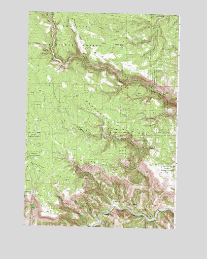
Deerhorn Creek, OR USGS Topographic Map
Click on map above to begin viewing in our Map Viewer.

This topographic map contains these locations and features:
Feature Name Type Latitude Longitude GNIS ID View Map
Bone CanyonValleyN45.0043°W119.0228°1138412View Map
Box SpringSpringN45.0179°W119.0857°1153712View Map
Buckaroo FlatFlatN45.0324°W119.1061°1138836View Map
Buckhorn RanchLocaleN45.0471°W119.0194°1138861View Map
Deerhorn CreekStreamN45.0049°W119.0186°1140867View Map
Deerhorn RidgeRidgeN45.0610°W119.0517°1140869View Map
Dry Fivemile CreekStreamN45.0990°W119.0833°1141325View Map
Gulliford CrossingLocaleN45.0932°W119.0955°1143147View Map
Hunter CreekStreamN45.0004°W119.0675°1143930View Map
Jericho CreekStreamN45.0121°W119.0514°1144256View Map
Middle Fork Wilkins CreekStreamN45.1201°W119.0186°1146167View Map
Silver CreekStreamN45.1007°W119.1047°1149490View Map
South Fork Wilkins CreekStreamN45.1238°W119.0103°1150045View Map
Stinking Water PondLakeN45.1060°W119.0464°1150440View Map
Taylor CreekStreamN45.1249°W119.1067°1150916View Map

Note: Coordinates in the location and feature list above are referenced to NAD83 datum.


Copyright (C) 2008-2025 Ryan Niemi / Sunset Dynamics ... All Rights Reserved