TopoQuest Logo
Do you find TopoQuest useful?
Help keep TopoQuest running and adding new maps/features by donating!
Bitcoin:  19c7KJd3qBynnjoSw5npx9KScwjBe4ifkT
Litecoin:  LXs6TkuXGGXo1vDsWCkWVdjQX94eUKd6ui
Home View Maps Find Maps Find Places Resources & Links


Pixley, California Topographic Map

USGS Map Title: Pixley, CA
USGS Map MRC: 35119H3
DRG (GeoTIFF) Download: o35119h3.tif


Neighboring USGS Topographic Map Quads:


  Taylor Weir, CA  
36119A4
 

  Tipton, CA  
36119A3
 

  Woodville, CA  
36119A2
 

  Alpaugh, CA  
35119H4
 

  Pixley, CA  
35119H3
 

  Sausalito School, CA  
35119H2
 

  Allensworth, CA  
35119G4
 

  Delano West, CA  
35119G3
 

  Delano East, CA  
35119G2


Map MRC Location:

N36°
W120°
N36°
W119°
H8 H7 H6 H5 H4 H3 H2 H1
G8 G7 G6 G5 G4 G3 G2 G1
F8 F7 F6 F5 F4 F3 F2 F1
E8 E7 E6 E5 E4 E3 E2 E1
D8 D7 D6 D5 D4 D3 D2 D1
C8 C7 C6 C5 C4 C3 C2 C1
B8 B7 B6 B5 B4 B3 B2 B1
A8 A7 A6 A5 A4 A3 A2 A1
N35°
W120°
N35°
W119°

Pixley, CA USGS 1:24K Topographic Map Preview:
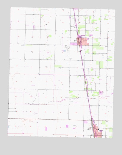
Pixley, CA USGS Topographic Map
Click on map above to begin viewing in our Map Viewer.

This topographic map contains these locations and features:
Feature Name Type Latitude Longitude GNIS ID View Map
EarlimartPopulated PlaceN35.8841°W119.2723°1652700View Map
Earlimart Branch Tulare County LibraryBuildingN35.8861°W119.2696°1835751View Map
Earlimart Census Designated PlaceCensusN35.8824°W119.2715°2408701View Map
Earlimart Elementary SchoolSchoolN35.8838°W119.2673°1835752View Map
Earlimart Middle SchoolSchoolN35.8880°W119.2709°1835753View Map
Earlimart Post OfficePost OfficeN35.8865°W119.2678°1835754View Map
Four J Farms DairyLocaleN35.9894°W119.3053°2681556View Map
PixleyPopulated PlaceN35.9686°W119.2918°1652777View Map
Pixley Airport (historical)AirportN35.9602°W119.3090°1653822View Map
Pixley Branch Tulare County LibraryBuildingN35.9736°W119.2904°1835768View Map
Pixley Census Designated PlaceCensusN35.9769°W119.2889°2409079View Map
Pixley DivisionCivilN35.9645°W119.2922°1935253View Map
Pixley Elementary SchoolSchoolN35.9730°W119.2801°247593View Map
Pixley Post OfficePost OfficeN35.9682°W119.2929°1835769View Map
Riverview DairyLocaleN35.9458°W119.3628°2702303View Map
South Creek DairyLocaleN35.9031°W119.3172°2702312View Map
Teviston Census Designated PlaceCensusN35.9289°W119.2783°2585460View Map
Tulare County Fire Department Battalion 2 Earlimart Fire Station 28BuildingN35.8850°W119.2689°2624419View Map
Tulare County Fire Department Battalion 2 Pixley Fire Station 27BuildingN35.9724°W119.2914°2624420View Map
Tulare County Sheriff's Office - Pixley Patrol SubstationBuildingN35.9721°W119.2910°2755833View Map
Veterans BuildingBuildingN35.8861°W119.2698°1835789View Map

Note: Coordinates in the location and feature list above are referenced to NAD83 datum.


Copyright (C) 2008-2025 Ryan Niemi / Sunset Dynamics ... All Rights Reserved