TopoQuest Logo
Do you find TopoQuest useful?
Help keep TopoQuest running and adding new maps/features by donating!
Bitcoin:  19c7KJd3qBynnjoSw5npx9KScwjBe4ifkT
Litecoin:  LXs6TkuXGGXo1vDsWCkWVdjQX94eUKd6ui
Home View Maps Find Maps Find Places Resources & Links


Delta, Wisconsin Topographic Map

USGS Map Title: Delta, WI
USGS Map MRC: 46091D3
DRG (GeoTIFF) Download: o46091d3.tif


Neighboring USGS Topographic Map Quads:


  Iron Lake, WI  
46091E4
 

  Hart Lake, WI  
46091E3
 

  Ino, WI  
46091E2
 

  Drummond NW, WI  
46091D4
 

  Delta, WI  
46091D3
 

  Grandview NW, WI  
46091D2
 

  Upper Eau Claire Lake, WI  
46091C4
 

  Drummond, WI  
46091C3
 

  Diamond Lake, WI  
46091C2


Map MRC Location:

N47°
W92°
N47°
W91°
H8 H7 H6 H5 H4 H3 H2 H1
G8 G7 G6 G5 G4 G3 G2 G1
F8 F7 F6 F5 F4 F3 F2 F1
E8 E7 E6 E5 E4 E3 E2 E1
D8 D7 D6 D5 D4 D3 D2 D1
C8 C7 C6 C5 C4 C3 C2 C1
B8 B7 B6 B5 B4 B3 B2 B1
A8 A7 A6 A5 A4 A3 A2 A1
N46°
W92°
N46°
W91°

Delta, WI USGS 1:24K Topographic Map Preview:
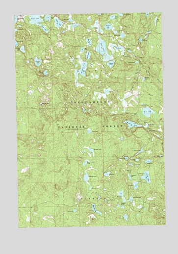
Delta, WI USGS Topographic Map
Click on map above to begin viewing in our Map Viewer.

This topographic map contains these locations and features:
Feature Name Type Latitude Longitude GNIS ID View Map
Anderson LakeLakeN46.4037°W91.3171°1578656View Map
Bass LakeLakeN46.4415°W91.2634°1578706View Map
Basswood LakeLakeN46.4663°W91.3189°1578708View Map
Bear LakeLakeN46.4914°W91.3038°1578720View Map
Bear PondLakeN46.4121°W91.3178°1578725View Map
Beaver LakeLakeN46.4185°W91.2702°1578740View Map
Bell LakeLakeN46.4788°W91.3180°1578750View Map
Bellevue LakeLakeN46.4344°W91.2768°1578753View Map
Bog LakeLakeN46.4961°W91.3272°1578826View Map
Bradox LakeLakeN46.4156°W91.2532°1580931View Map
Broadax LakeLakeN46.4156°W91.2532°1577350View Map
Bufo LakeLakeN46.4045°W91.2990°1578879View Map
Canthook LakeLakeN46.4709°W91.3559°1578947View Map
Carson PondLakeN46.4706°W91.2722°1578952View Map
Chelonia LakeLakeN46.4068°W91.2780°1578982View Map
Clay LakeLakeN46.3986°W91.2751°1579014View Map
DeltaPopulated PlaceN46.4727°W91.2702°1579114View Map
Delta Civilian Conservation Corps Camp (historical)LocaleN46.4449°W91.2657°1834343View Map
Delta Lookout TowerTowerN46.4322°W91.3238°1581204View Map
Dry Well LakeLakeN46.3898°W91.3005°1579147View Map
Eagle LakeLakeN46.4988°W91.3572°1579163View Map
East Fork White RiverStreamN46.4911°W91.3454°1579183View Map
Everett LakeLakeN46.4701°W91.2937°1579222View Map
Flakefjord LakeLakeN46.4035°W91.2801°1579253View Map
Flynn LakeLakeN46.4917°W91.3498°1579265View Map
Frog LakeLakeN46.4437°W91.3178°1579298View Map
Getsey LakeLakeN46.4977°W91.2917°1579322View Map
Happles LakeLakeN46.4799°W91.3687°1579387View Map
Hay LakeLakeN46.4791°W91.2880°1579411View Map
Heart LakeLakeN46.4867°W91.2835°1579422View Map
Hildur LakeLakeN46.4950°W91.3377°1579448View Map
Hollibar LakeLakeN46.4609°W91.2663°1579469View Map
Inch LakeLakeN46.4981°W91.3465°1579504View Map
Lake BullheadLakeN46.4837°W91.2681°1578892View Map
Lake DeltaLakeN46.4785°W91.3003°1579115View Map
Lake TwoLakeN46.4539°W91.2980°1580685View Map
Lee LakeLakeN46.3973°W91.3134°1579641View Map
Lemon LakeLakeN46.4774°W91.2778°1579642View Map
Lund LakeLakeN46.4126°W91.2636°1579789View Map
Muck LakeLakeN46.4134°W91.2736°1579937View Map
Mud Flat LakeLakeN46.4886°W91.2894°1579942View Map
Mud LakeLakeN46.4336°W91.2643°1579962View Map
Murrays 2WP1034 DamDamN46.4916°W91.3452°1791862View Map
Muskellunge LakeLakeN46.4979°W91.3749°1579978View Map
Mystery LakeLakeN46.4990°W91.2848°1579985View Map
Namagosh LakeLakeN46.4499°W91.2835°1577255View Map
Nelson LakeLakeN46.3800°W91.2839°1579998View Map
Perch LakeLakeN46.4034°W91.2657°1580114View Map
Perch Lake CampgroundLocaleN46.3886°W91.2694°1580932View Map
Phantom LakeLakeN46.4920°W91.2954°1580130View Map
Physa LakeLakeN46.4146°W91.2823°1580132View Map
Pike Lake Chain of Lakes 13ReservoirN46.4916°W91.3452°1791863View Map
Planorbis LakeLakeN46.4109°W91.2794°1580171View Map
Pond LakeLakeN46.3845°W91.3271°1580183View Map
Rainbow LakeLakeN46.4198°W91.3124°1580220View Map
Rainbow Lake WildernessReserveN46.4162°W91.3038°1580930View Map
Reynard LakeLakeN46.3929°W91.2868°1580246View Map
South Fork White RiverStreamN46.4683°W91.2685°1580461View Map
Spirit LakeLakeN46.4754°W91.3130°1580479View Map
Square LakeLakeN46.4477°W91.3542°1580515View Map
Steelhead LakeLakeN46.4658°W91.3495°1580529View Map
Stratton PondsLakeN46.3859°W91.2864°1580541View Map
Swede LakeLakeN46.4833°W91.3122°1580569View Map
Teacup LakeLakeN46.4304°W91.2629°1580588View Map
Three LakeLakeN46.4519°W91.3002°1580929View Map
Tower LakeLakeN46.4306°W91.3135°1580632View Map
Town of DeltaCivilN46.4593°W91.3020°1583073View Map
Wabigon LakeLakeN46.3837°W91.3086°1580717View Map
West Fork White RiverStreamN46.4630°W91.2744°1580755View Map
West LakeLakeN46.4733°W91.3262°1580758View Map
Wishbone LakeLakeN46.3906°W91.2791°1580813View Map
Wolf LakeLakeN46.4951°W91.2550°1580820View Map

Note: Coordinates in the location and feature list above are referenced to NAD83 datum.


Copyright (C) 2008-2025 Ryan Niemi / Sunset Dynamics ... All Rights Reserved