TopoQuest Logo
Do you find TopoQuest useful?
Help keep TopoQuest running and adding new maps/features by donating!
Bitcoin:  19c7KJd3qBynnjoSw5npx9KScwjBe4ifkT
Litecoin:  LXs6TkuXGGXo1vDsWCkWVdjQX94eUKd6ui
Home View Maps Find Maps Find Places Resources & Links


Hart Lake, Wisconsin Topographic Map

USGS Map Title: Hart Lake, WI
USGS Map MRC: 46091E3
DRG (GeoTIFF) Download: o46091e3.tif


Neighboring USGS Topographic Map Quads:


  Blaine Creek, WI  
46091F4
 

  Iron Lake NE, WI  
46091F3
 

  Moquah NW, WI  
46091F2
 

  Iron Lake, WI  
46091E4
 

  Hart Lake, WI  
46091E3
 

  Ino, WI  
46091E2
 

  Drummond NW, WI  
46091D4
 

  Delta, WI  
46091D3
 

  Grandview NW, WI  
46091D2


Map MRC Location:

N47°
W92°
N47°
W91°
H8 H7 H6 H5 H4 H3 H2 H1
G8 G7 G6 G5 G4 G3 G2 G1
F8 F7 F6 F5 F4 F3 F2 F1
E8 E7 E6 E5 E4 E3 E2 E1
D8 D7 D6 D5 D4 D3 D2 D1
C8 C7 C6 C5 C4 C3 C2 C1
B8 B7 B6 B5 B4 B3 B2 B1
A8 A7 A6 A5 A4 A3 A2 A1
N46°
W92°
N46°
W91°

Hart Lake, WI USGS 1:24K Topographic Map Preview:
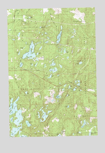
Hart Lake, WI USGS Topographic Map
Click on map above to begin viewing in our Map Viewer.

This topographic map contains these locations and features:
Feature Name Type Latitude Longitude GNIS ID View Map
Angus LakeLakeN46.5705°W91.3568°1578657View Map
Bailey LakeLakeN46.6164°W91.3435°1578684View Map
Bladder LakeLakeN46.5964°W91.3021°1578810View Map
Buck LakeLakeN46.5396°W91.2922°1578874View Map
Buskey BayLakeN46.5279°W91.3749°1578901View Map
Camp One LakeLakeN46.5007°W91.2615°1578934View Map
Crooked LakeLakeN46.5201°W91.3249°1579065View Map
Duck LakeLakeN46.5211°W91.3332°1579157View Map
Finger LakeLakeN46.5114°W91.2689°1579240View Map
Five Island LakeLakeN46.5128°W91.3486°1579249View Map
Hart LakeLakeN46.5185°W91.3619°1579398View Map
Hicks LakeLakeN46.5702°W91.3412°1579442View Map
Hobbs LakeLakeN46.5819°W91.3594°1579462View Map
Honey LakeLakeN46.5478°W91.2890°1579476View Map
Iron River Lookout TowerTowerN46.5763°W91.3238°1581239View Map
Island LakeLakeN46.5385°W91.3048°1579519View Map
Johnson LakeLakeN46.5809°W91.3332°1579545View Map
Lake MillicentLakeN46.5288°W91.3678°1579880View Map
Lake NokomisLakeN46.5287°W91.2912°1580017View Map
Lester LakeLakeN46.5006°W91.3039°1579647View Map
Long LakeLakeN46.5820°W91.3437°1579742View Map
Loon LakeLakeN46.5705°W91.3115°1579755View Map
McCarry LakeLakeN46.5174°W91.3719°1579833View Map
Mirror LakeLakeN46.5826°W91.2943°1579891View Map
Patsy LakeLakeN46.5443°W91.2727°1580095View Map
Pike LakeLakeN46.5364°W91.3711°1580142View Map
Pine LakeLakeN46.5431°W91.3503°1580160View Map
Sawdust LakeLakeN46.5710°W91.2724°1580347View Map
Silver Sack LakeLakeN46.6066°W91.3283°1580413View Map
Steckbaur LakeLakeN46.5868°W91.3523°1580528View Map
Toothpick LakeLakeN46.5040°W91.3009°1580620View Map
TopsidePopulated PlaceN46.5591°W91.3227°1580621View Map
Topside LakeLakeN46.5645°W91.3109°1580622View Map
Town of Iron RiverCivilN46.5467°W91.3670°1583434View Map
Tub LakeLakeN46.5032°W91.2754°1580657View Map
Twin Bear LakeLakeN46.5058°W91.3673°1580670View Map
Twin LakesLakeN46.5533°W91.2756°1580677View Map
Valley View CemeteryCemeteryN46.6225°W91.3614°1580649View Map
Wanoka LakeLakeN46.5452°W91.2819°1580724View Map
Wanoka Lake Recreation SiteLocaleN46.5433°W91.2832°1581003View Map
Wentzel LakeLakeN46.5584°W91.3160°1580740View Map

Note: Coordinates in the location and feature list above are referenced to NAD83 datum.


Copyright (C) 2008-2025 Ryan Niemi / Sunset Dynamics ... All Rights Reserved