TopoQuest Logo
Do you find TopoQuest useful?
Help keep TopoQuest running and adding new maps/features by donating!
Bitcoin:  19c7KJd3qBynnjoSw5npx9KScwjBe4ifkT
Litecoin:  LXs6TkuXGGXo1vDsWCkWVdjQX94eUKd6ui
Home View Maps Find Maps Find Places Resources & Links


Iron Lake, Wisconsin Topographic Map

USGS Map Title: Iron Lake, WI
USGS Map MRC: 46091E4
DRG (GeoTIFF) Download: o46091e4.tif


Neighboring USGS Topographic Map Quads:


  Oulu, WI  
46091F5
 

  Blaine Creek, WI  
46091F4
 

  Iron Lake NE, WI  
46091F3
 

  Brule, WI  
46091E5
 

  Iron Lake, WI  
46091E4
 

  Hart Lake, WI  
46091E3
 

  Island Lake, WI  
46091D5
 

  Drummond NW, WI  
46091D4
 

  Delta, WI  
46091D3


Map MRC Location:

N47°
W92°
N47°
W91°
H8 H7 H6 H5 H4 H3 H2 H1
G8 G7 G6 G5 G4 G3 G2 G1
F8 F7 F6 F5 F4 F3 F2 F1
E8 E7 E6 E5 E4 E3 E2 E1
D8 D7 D6 D5 D4 D3 D2 D1
C8 C7 C6 C5 C4 C3 C2 C1
B8 B7 B6 B5 B4 B3 B2 B1
A8 A7 A6 A5 A4 A3 A2 A1
N46°
W92°
N46°
W91°

Iron Lake, WI USGS 1:24K Topographic Map Preview:
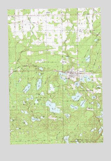
Iron Lake, WI USGS Topographic Map
Click on map above to begin viewing in our Map Viewer.

This topographic map contains these locations and features:
Feature Name Type Latitude Longitude GNIS ID View Map
Ahmeek LakeLakeN46.5228°W91.4663°1560712View Map
Bass LakeLakeN46.5117°W91.3785°1561277View Map
Bayfield County AirportAirportN46.5778°W91.4552°1582022View Map
Bismarck LakeLakeN46.5335°W91.4135°1561832View Map
Camp Eleven LakeLakeN46.5226°W91.4978°1562604View Map
Camp Two LakeLakeN46.5009°W91.4103°1578943View Map
Cat LakeLakeN46.5204°W91.3781°1562801View Map
Crystal LakeLakeN46.5518°W91.4758°1563593View Map
Dahl CreekStreamN46.5769°W91.4869°1577427View Map
Deep LakeLakeN46.5553°W91.4598°1563815View Map
Erick LakeLakeN46.5147°W91.4901°1565322View Map
Fire LakeLakeN46.5778°W91.3934°1564955View Map
Half Moon LakeLakeN46.5615°W91.3978°1565973View Map
Hall CreekStreamN46.5547°W91.4285°1577426View Map
Hostrawser LakeLakeN46.5465°W91.4556°1566755View Map
Iron LakeLakeN46.5337°W91.4422°1566969View Map
Iron RiverPopulated PlaceN46.5644°W91.4082°1566972View Map
Iron River Ambulance ServiceBuildingN46.5643°W91.4028°2698256View Map
Iron River Census Designated PlaceCensusN46.5671°W91.4070°2586509View Map
Iron River City CemeteryCemeteryN46.5674°W91.3986°1563094View Map
Iron River Elementary SchoolSchoolN46.5610°W91.4131°2713241View Map
Iron River Fire DepartmentBuildingN46.5643°W91.4030°2696772View Map
Iron River Flowage 8.37ReservoirN46.5666°W91.4235°1791723View Map
Iron River Light and Power Company WP182 DamDamN46.5666°W91.4235°1791722View Map
Iron River Police DepartmentBuildingN46.5633°W91.4028°2759637View Map
Iron River Post OfficePost OfficeN46.5640°W91.4110°2768072View Map
Jackman LakeLakeN46.5950°W91.3824°1567059View Map
Jesse LakeLakeN46.5244°W91.4565°1567173View Map
Jones LakeLakeN46.5424°W91.4719°1567269View Map
Lake RuthLakeN46.5036°W91.4241°1580303View Map
Lost LakeLakeN46.5348°W91.3808°1568678View Map
Mill Pond LakeLakeN46.5602°W91.4281°1834252View Map
Minor LakeLakeN46.5077°W91.4051°2440034View Map
Moon LakeLakeN46.5546°W91.4090°1569694View Map
Mud LakeLakeN46.5512°W91.4427°1569985View Map
Mullenhoff LakeLakeN46.5366°W91.4018°1570023View Map
MuskegPopulated PlaceN46.5705°W91.4907°1577740View Map
Nestle LakeLakeN46.5077°W91.3755°1579999View Map
Oula Pioneer Memorial ParkParkN46.6211°W91.4460°1834257View Map
Oulu ChurchChurchN46.6055°W91.4474°1570927View Map
Oulu SchoolSchoolN46.6186°W91.4952°1570929View Map
Perch LakeLakeN46.5422°W91.3867°1571215View Map
Peterson LakeLakeN46.5521°W91.3793°1580128View Map
Richardson LakeLakeN46.5393°W91.4638°1572283View Map
Roger LakeLakeN46.5258°W91.4225°1572536View Map
Russell LakeLakeN46.5385°W91.4805°1572750View Map
Simpson LakeLakeN46.5647°W91.4589°1574187View Map
Spider LakeLakeN46.5428°W91.4099°1574546View Map
Spring LakeLakeN46.5696°W91.4567°1574682View Map
Town of HughesCivilN46.5252°W91.4902°1583419View Map
Tripp TownhallBuildingN46.6191°W91.3938°1834271View Map
Wright LakeLakeN46.5200°W91.4786°1577053View Map

Note: Coordinates in the location and feature list above are referenced to NAD83 datum.


Copyright (C) 2008-2025 Ryan Niemi / Sunset Dynamics ... All Rights Reserved