TopoQuest Logo
Do you find TopoQuest useful?
Help keep TopoQuest running and adding new maps/features by donating!
Bitcoin:  19c7KJd3qBynnjoSw5npx9KScwjBe4ifkT
Litecoin:  LXs6TkuXGGXo1vDsWCkWVdjQX94eUKd6ui
Home View Maps Find Maps Find Places Resources & Links


The Cockscomb, Oregon Topographic Map

USGS Map Title: The Cockscomb, OR
USGS Map MRC: 44118H7
DRG (GeoTIFF) Download: o44118h7.tif


Neighboring USGS Topographic Map Quads:


  Bridge Creek, OR  
45118A8
 

  Ukiah SE, OR  
45118A7
 

  Pearson Ridge, OR  
45118A6
 

  Dale, OR  
44118H8
 

  The Cockscomb, OR  
44118H7
 

  Kelsay Butte, OR  
44118H6
 

  Wildcat Point, OR  
44118G8
 

  Sharp Ridge, OR  
44118G7
 

  Desolation Butte, OR  
44118G6


Map MRC Location:

N45°
W119°
N45°
W118°
H8 H7 H6 H5 H4 H3 H2 H1
G8 G7 G6 G5 G4 G3 G2 G1
F8 F7 F6 F5 F4 F3 F2 F1
E8 E7 E6 E5 E4 E3 E2 E1
D8 D7 D6 D5 D4 D3 D2 D1
C8 C7 C6 C5 C4 C3 C2 C1
B8 B7 B6 B5 B4 B3 B2 B1
A8 A7 A6 A5 A4 A3 A2 A1
N44°
W119°
N44°
W118°

The Cockscomb, OR USGS 1:24K Topographic Map Preview:
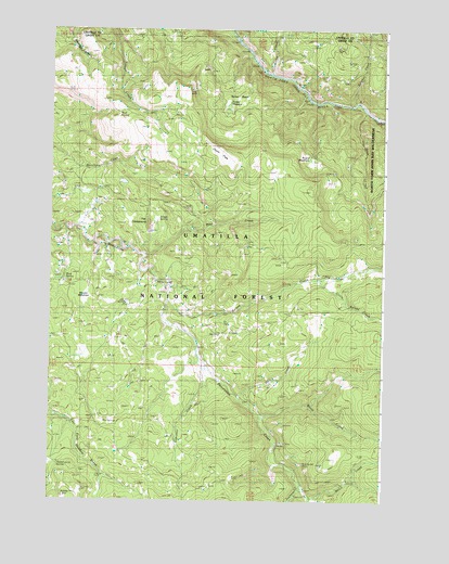
The Cockscomb, OR USGS Topographic Map
Click on map above to begin viewing in our Map Viewer.

This topographic map contains these locations and features:
Feature Name Type Latitude Longitude GNIS ID View Map
Big SpringsSpringN44.8952°W118.8508°1138082View Map
Blue Bucket MineMineN44.8835°W118.7794°1138285View Map
Bruin CreekStreamN44.8974°W118.7961°1138696View Map
Camp CreekStreamN44.9888°W118.7933°1139232View Map
Hunters SpringSpringN44.8841°W118.8717°1143949View Map
Junkens CreekStreamN44.8788°W118.7805°1144467View Map
Kelsay CreekStreamN44.9277°W118.8305°1144535View Map
Little Kelsay CreekStreamN44.9343°W118.7686°1145191View Map
Lower End Camp (historical)LocaleN44.8752°W118.7758°1145619View Map
Mote SpringSpringN44.9338°W118.8697°1146514View Map
Mud SpringSpringN44.9771°W118.8502°1146603View Map
Onion FlatsFlatN44.9652°W118.8072°1147235View Map
Otter CreekStreamN44.9779°W118.7580°1147290View Map
Park CreekStreamN44.9029°W118.8039°1147431View Map
Peep CreekStreamN44.9396°W118.8386°1147561View Map
Peep Creek Camp (historical)LocaleN44.9588°W118.7955°1147562View Map
Peep Creek Trail (historical)TrailN44.9524°W118.7744°1147563View Map
Round MeadowsFlatN44.9648°W118.7785°1148778View Map
Snapp SpringSpringN44.9494°W118.8347°1149794View Map
Spring CreekStreamN44.9157°W118.8191°1150159View Map
Starveout CreekStreamN44.9090°W118.8169°1150359View Map
Sulphur CreekStreamN44.9804°W118.7622°1150581View Map
The CockscombSummitN44.9485°W118.8369°1151004View Map
Trough Creek Trail (historical)TrailN44.9696°W118.8325°1151426View Map
Turner BasinBasinN44.9807°W118.8094°1151527View Map
Turner MeadowFlatN44.9807°W118.8094°1133782View Map
Wassen MeadowsFlatN44.9293°W118.8618°1151929View Map
Welch CreekStreamN44.8760°W118.7775°1151998View Map
Welch Creek Recreation SiteLocaleN44.8813°W118.7633°1151999View Map

Note: Coordinates in the location and feature list above are referenced to NAD83 datum.


Copyright (C) 2008-2024 Ryan Niemi / Sunset Dynamics ... All Rights Reserved