TopoQuest Logo
Do you find TopoQuest useful?
Help keep TopoQuest running and adding new maps/features by donating!
Bitcoin:  19c7KJd3qBynnjoSw5npx9KScwjBe4ifkT
Litecoin:  LXs6TkuXGGXo1vDsWCkWVdjQX94eUKd6ui
Home View Maps Find Maps Find Places Resources & Links


Devils Rock, California Topographic Map

USGS Map Title: Devils Rock, CA
USGS Map MRC: 40122G1
DRG (GeoTIFF) Download: o40122g1.tif


Neighboring USGS Topographic Map Quads:


  Bollibokka Mountain, CA  
40122H2
 

  Goose Gap, CA  
40122H1
 

  Roaring Creek, CA  
40121H8
 

  Minnesota Mountain, CA  
40122G2
 

  Devils Rock, CA  
40122G1
 

  Montgomery Creek, CA  
40121G8
 

  Bella Vista, CA  
40122F2
 

  Oak Run, CA  
40122F1
 

  Whitmore, CA  
40121F8


Map MRC Location:

N41°
W123°
N41°
W122°
H8 H7 H6 H5 H4 H3 H2 H1
G8 G7 G6 G5 G4 G3 G2 G1
F8 F7 F6 F5 F4 F3 F2 F1
E8 E7 E6 E5 E4 E3 E2 E1
D8 D7 D6 D5 D4 D3 D2 D1
C8 C7 C6 C5 C4 C3 C2 C1
B8 B7 B6 B5 B4 B3 B2 B1
A8 A7 A6 A5 A4 A3 A2 A1
N40°
W123°
N40°
W122°

Devils Rock, CA USGS 1:24K Topographic Map Preview:
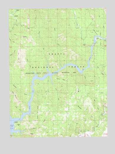
Devils Rock, CA USGS Topographic Map
Click on map above to begin viewing in our Map Viewer.

This topographic map contains these locations and features:
Feature Name Type Latitude Longitude GNIS ID View Map
Alder SpringSpringN40.8707°W122.0983°256170View Map
Arbuckle CampLocaleN40.7632°W122.1208°276656View Map
Arbuckle FlatFlatN40.7613°W122.1150°256304View Map
Arbuckle Flat CampgroundLocaleN40.7649°W122.1206°1661767View Map
Bars CreekStreamN40.8540°W122.1239°256561View Map
Bear CanyonValleyN40.8168°W122.0225°256629View Map
Bear GulchValleyN40.7729°W122.0072°256664View Map
Brock CreekStreamN40.8099°W122.0919°257467View Map
Browns CanyonValleyN40.7738°W122.1083°257505View Map
Cedar CreekStreamN40.7538°W122.0306°258122View Map
Chirpchatler CampLocaleN40.8596°W122.1181°276649View Map
Chirpchatter MountainSummitN40.8646°W122.1244°1656301View Map
Constant Flow GulchValleyN40.8471°W122.0133°258653View Map
Cow CanyonValleyN40.8465°W122.0069°258797View Map
Croxford RidgeRidgeN40.8046°W122.0544°276653View Map
Devils RockPillarN40.8474°W122.1083°259329View Map
Fenders FlatFlatN40.8429°W122.0153°260078View Map
Flat CreekStreamN40.8113°W122.0725°260191View Map
Gray RocksSummitN40.8240°W122.1133°260833View Map
Low Pass CreekStreamN40.8579°W122.1200°262998View Map
McCandless GulchValleyN40.7635°W122.0125°263304View Map
Mineral SchoolSchoolN40.7543°W122.0181°263671View Map
Potem CreekStreamN40.8368°W122.0206°264997View Map
Potem FallsFallsN40.8388°W122.0283°264998View Map
Ripgut CreekStreamN40.8168°W122.0583°265429View Map
Roberts CanyonValleyN40.8113°W122.0325°265455View Map
Sage Hen HillSummitN40.7982°W122.0367°1656271View Map
Shasta CountyCivilN40.7638°W122.0405°1682610View Map
Squaw Creek Fire Control StationLocaleN40.8721°W122.1161°267623View Map
Stein CreekStreamN40.8090°W122.0731°267718View Map
Stein Creek CampLocaleN40.8074°W122.0783°276648View Map
SugarloafSummitN40.7527°W122.0961°267860View Map
Sugarpine CanyonValleyN40.7563°W122.1219°267879View Map
Susanville CanyonValleyN40.7924°W122.0983°267991View Map

Note: Coordinates in the location and feature list above are referenced to NAD83 datum.


Copyright (C) 2008-2025 Ryan Niemi / Sunset Dynamics ... All Rights Reserved