TopoQuest Logo
Do you find TopoQuest useful?
Help keep TopoQuest running and adding new maps/features by donating!
Bitcoin:  19c7KJd3qBynnjoSw5npx9KScwjBe4ifkT
Litecoin:  LXs6TkuXGGXo1vDsWCkWVdjQX94eUKd6ui
Home View Maps Find Maps Find Places Resources & Links


Minnesota Mountain, California Topographic Map

USGS Map Title: Minnesota Mountain, CA
USGS Map MRC: 40122G2
DRG (GeoTIFF) Download: o40122g2.tif


Neighboring USGS Topographic Map Quads:


  Hanland Peak, CA  
40122H3
 

  Bollibokka Mountain, CA  
40122H2
 

  Goose Gap, CA  
40122H1
 

  O'Brien, CA  
40122G3
 

  Minnesota Mountain, CA  
40122G2
 

  Devils Rock, CA  
40122G1
 

  Project City, CA  
40122F3
 

  Bella Vista, CA  
40122F2
 

  Oak Run, CA  
40122F1


Map MRC Location:

N41°
W123°
N41°
W122°
H8 H7 H6 H5 H4 H3 H2 H1
G8 G7 G6 G5 G4 G3 G2 G1
F8 F7 F6 F5 F4 F3 F2 F1
E8 E7 E6 E5 E4 E3 E2 E1
D8 D7 D6 D5 D4 D3 D2 D1
C8 C7 C6 C5 C4 C3 C2 C1
B8 B7 B6 B5 B4 B3 B2 B1
A8 A7 A6 A5 A4 A3 A2 A1
N40°
W123°
N40°
W122°

Minnesota Mountain, CA USGS 1:24K Topographic Map Preview:
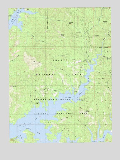
Minnesota Mountain, CA USGS Topographic Map
Click on map above to begin viewing in our Map Viewer.

This topographic map contains these locations and features:
Feature Name Type Latitude Longitude GNIS ID View Map
Arbuckle CreekStreamN40.7707°W122.1261°266385View Map
Baxters GulchValleyN40.7813°W122.2197°266419View Map
Brock MountainSummitN40.8049°W122.1317°266485View Map
Brushy CanyonValleyN40.7507°W122.1953°266489View Map
Bully HillSummitN40.7996°W122.2086°266513View Map
Bully HillPopulated PlaceN40.7977°W122.1931°1659702View Map
Campbell CreekStreamN40.8607°W122.2433°266527View Map
Chain Gang GulchValleyN40.8071°W122.1525°266549View Map
Dark CanyonValleyN40.8310°W122.1444°266621View Map
Dead Horse CreekStreamN40.7538°W122.1433°266625View Map
Dekkas CreekStreamN40.8721°W122.2328°266634View Map
Dekkas Creek SaddleGapN40.8593°W122.1797°266635View Map
Dekkas Rock CampgroundLocaleN40.8738°W122.2364°276979View Map
Didallas CreekStreamN40.8207°W122.1522°266644View Map
Dinner GulchValleyN40.8485°W122.1289°266645View Map
First CreekStreamN40.7913°W122.1869°266708View Map
Flume CanyonValleyN40.7888°W122.1783°266716View Map
Fort CreekStreamN40.7615°W122.2078°266719View Map
Fowler GulchValleyN40.8224°W122.1506°266722View Map
Frenchman GulchValleyN40.7813°W122.1922°266732View Map
Green MountainSummitN40.7790°W122.1578°266774View Map
Hoover GulchValleyN40.8163°W122.1608°266815View Map
Horse CreekStreamN40.7827°W122.2119°266822View Map
Horse MountainSummitN40.8024°W122.2461°266824View Map
Killanger PeakSummitN40.7854°W122.2169°266881View Map
Lick CanyonValleyN40.7988°W122.1586°266907View Map
Madison CanyonValleyN40.8302°W122.1389°266958View Map
Madison GulchValleyN40.8157°W122.1500°266959View Map
McClure GulchValleyN40.7727°W122.1989°266987View Map
Minnesota MountainSummitN40.8490°W122.1869°267019View Map
Monday FlatFlatN40.7954°W122.1700°267022View Map
Murphy CanyonValleyN40.7540°W122.1689°267049View Map
Museum CanyonValleyN40.7904°W122.1669°267051View Map
Reno CanyonValleyN40.7513°W122.1794°267176View Map
Reynolds CreekStreamN40.7513°W122.1497°267177View Map
Salt CreekStreamN40.8479°W122.1314°267204View Map
Second CreekStreamN40.7935°W122.1733°267220View Map
Silverthorn Bay Boat Launching RampLocaleN40.7554°W122.2403°276981View Map
Silverthorn Bay ResortLocaleN40.7552°W122.2422°276980View Map
Squaw CreekStreamN40.7763°W122.2094°267621View Map
Squaw Creek ArmBayN40.7935°W122.1672°267622View Map
Town CreekStreamN40.7910°W122.1917°268366View Map
Town MountainSummitN40.8232°W122.2106°268367View Map
West Fork Didallas CreekStreamN40.8260°W122.1572°268897View Map
Winnibulli CreekStreamN40.8588°W122.1419°269246View Map
Winnibulli MountainSummitN40.8485°W122.1456°269247View Map
Winston GulchValleyN40.8152°W122.1558°238047View Map
Winthrop (historical)Populated PlaceN40.7935°W122.1919°1682535View Map
Ydaloom (historical)Populated PlaceN40.7788°W122.2208°1682536View Map
Zinc CreekStreamN40.7827°W122.2122°269397View Map

Note: Coordinates in the location and feature list above are referenced to NAD83 datum.


Copyright (C) 2008-2024 Ryan Niemi / Sunset Dynamics ... All Rights Reserved