TopoQuest Logo
Do you find TopoQuest useful?
Help keep TopoQuest running and adding new maps/features by donating!
Bitcoin:  19c7KJd3qBynnjoSw5npx9KScwjBe4ifkT
Litecoin:  LXs6TkuXGGXo1vDsWCkWVdjQX94eUKd6ui
Home View Maps Find Maps Find Places Resources & Links


Montgomery Creek, California Topographic Map

USGS Map Title: Montgomery Creek, CA
USGS Map MRC: 40121G8
DRG (GeoTIFF) Download: o40121g8.tif


Neighboring USGS Topographic Map Quads:


  Goose Gap, CA  
40122H1
 

  Roaring Creek, CA  
40121H8
 

  Chalk Mountain, CA  
40121H7
 

  Devils Rock, CA  
40122G1
 

  Montgomery Creek, CA  
40121G8
 

  Hatchet Mountain Pass, CA  
40121G7
 

  Oak Run, CA  
40122F1
 

  Whitmore, CA  
40121F8
 

  Miller Mountain, CA  
40121F7


Map MRC Location:

N41°
W122°
N41°
W121°
H8 H7 H6 H5 H4 H3 H2 H1
G8 G7 G6 G5 G4 G3 G2 G1
F8 F7 F6 F5 F4 F3 F2 F1
E8 E7 E6 E5 E4 E3 E2 E1
D8 D7 D6 D5 D4 D3 D2 D1
C8 C7 C6 C5 C4 C3 C2 C1
B8 B7 B6 B5 B4 B3 B2 B1
A8 A7 A6 A5 A4 A3 A2 A1
N40°
W122°
N40°
W121°

Montgomery Creek, CA USGS 1:24K Topographic Map Preview:
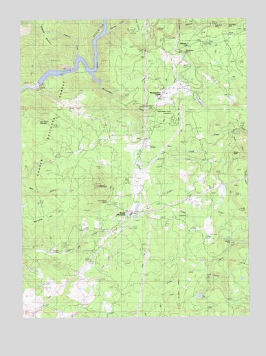
Montgomery Creek, CA USGS Topographic Map
Click on map above to begin viewing in our Map Viewer.

This topographic map contains these locations and features:
Feature Name Type Latitude Longitude GNIS ID View Map
Brush PatchAreaN40.8352°W121.9708°257535View Map
By Gonney SpringSpringN40.8611°W121.9096°257790View Map
Carroll Sand and Gravel PitMineN40.8467°W121.9264°2675419View Map
Cedar Creek Elementary SchoolSchoolN40.7913°W121.9414°258124View Map
Dunn CreekStreamN40.8257°W121.9311°1661798View Map
Frank Storey SpringSpringN40.7985°W121.9541°1661800View Map
Halcumb CemeteryCemeteryN40.8213°W121.9319°261012View Map
Hatchet CreekStreamN40.8688°W121.9547°261150View Map
HillcrestPopulated PlaceN40.8638°W121.9086°261354View Map
Hillcrest Forest Fire StationLocaleN40.8674°W121.8847°261355View Map
Hogback CreekStreamN40.8588°W121.9686°261404View Map
Kenyon School (historical)SchoolN40.7582°W121.9825°1682381View Map
Lick CreekStreamN40.8424°W121.9506°1661819View Map
Lion Slide FallsFallsN40.8724°W121.8931°1661820View Map
Lion Wash FallsFallsN40.8715°W121.8858°1661821View Map
Little Round MountainSummitN40.8315°W121.9931°262707View Map
Manzanita HillSummitN40.7929°W121.9847°1659051View Map
Mill CreekStreamN40.7513°W121.9344°263610View Map
Minnow CreekStreamN40.8196°W121.9356°263688View Map
Montgomery CreekPopulated PlaceN40.8415°W121.9236°263769View Map
Montgomery CreekStreamN40.8532°W121.9622°263770View Map
Montgomery Creek Census Designated PlaceCensusN40.8414°W121.9215°2408863View Map
Montgomery Creek Elementary SchoolSchoolN40.8434°W121.9204°1682383View Map
Montgomery Creek FallsFallsN40.8379°W121.9283°1661830View Map
Montgomery Creek Post OfficePost OfficeN40.8413°W121.9246°1661831View Map
Montgomery Creek RancheriaCivilN40.8342°W121.9157°263771View Map
Montgomery Creek Volunteer Fire Company Station 71BuildingN40.8084°W121.9404°2621929View Map
Montgomery Creek Volunteer Fire Company Station 71 SubstationBuildingN40.8646°W121.9088°2621931View Map
Moody SpringSpringN40.8524°W121.8969°263785View Map
Mountain SchoolLocaleN40.7943°W121.8972°263906View Map
North Fork Little Cow CreekStreamN40.7693°W121.9000°264178View Map
North Fork Montgomery CreekStreamN40.8274°W121.8839°264189View Map
Pit 7 ReservoirReservoirN40.8538°W121.9732°276757View Map
Pit Number 7 97-122 DamDamN40.8480°W121.9905°1663678View Map
Round MountainPopulated PlaceN40.7940°W121.9419°1659552View Map
Round MountainSummitN40.8052°W121.9581°265611View Map
Round Mountain Census Designated PlaceCensusN40.8005°W121.9375°2409216View Map
Round Mountain Post OfficePost OfficeN40.8032°W121.9404°2760049View Map
South Fork Montgomery CreekStreamN40.8274°W121.8839°267482View Map
Tolladay PeakSummitN40.7810°W121.8856°268323View Map
Willow CreekStreamN40.8360°W121.9389°269144View Map
Windy PointCapeN40.8171°W121.8842°269235View Map

Note: Coordinates in the location and feature list above are referenced to NAD83 datum.


Copyright (C) 2008-2025 Ryan Niemi / Sunset Dynamics ... All Rights Reserved