TopoQuest Logo
Do you find TopoQuest useful?
Help keep TopoQuest running and adding new maps/features by donating!
Bitcoin:  19c7KJd3qBynnjoSw5npx9KScwjBe4ifkT
Litecoin:  LXs6TkuXGGXo1vDsWCkWVdjQX94eUKd6ui
Home View Maps Find Maps Find Places Resources & Links


Dexter East, New Mexico Topographic Map

USGS Map Title: Dexter East, NM
USGS Map MRC: 33104B3
DRG (GeoTIFF) Download: o33104b3.tif


Neighboring USGS Topographic Map Quads:


  South Spring, NM  
33104C4
 

  Bottomless Lakes, NM  
33104C3
 

  Wade Ranch, NM  
33104C2
 

  Dexter West, NM  
33104B4
 

  Dexter East, NM  
33104B3
 

  Bar C Bar Ranch, NM  
33104B2
 

  Hagerman SW, NM  
33104A4
 

  Hagerman, NM  
33104A3
 

  Derrick Draw, NM  
33104A2


Map MRC Location:

N34°
W105°
N34°
W104°
H8 H7 H6 H5 H4 H3 H2 H1
G8 G7 G6 G5 G4 G3 G2 G1
F8 F7 F6 F5 F4 F3 F2 F1
E8 E7 E6 E5 E4 E3 E2 E1
D8 D7 D6 D5 D4 D3 D2 D1
C8 C7 C6 C5 C4 C3 C2 C1
B8 B7 B6 B5 B4 B3 B2 B1
A8 A7 A6 A5 A4 A3 A2 A1
N33°
W105°
N33°
W104°

Dexter East, NM USGS 1:24K Topographic Map Preview:
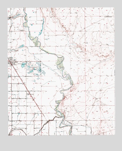
Dexter East, NM USGS Topographic Map
Click on map above to begin viewing in our Map Viewer.

This topographic map contains these locations and features:
Feature Name Type Latitude Longitude GNIS ID View Map
Calumet RanchLocaleN33.2409°W104.2584°887094View Map
Church of ChristChurchN33.1954°W104.3741°929239View Map
DexterPopulated PlaceN33.1973°W104.3730°888359View Map
Dexter Elementary SchoolSchoolN33.1973°W104.3730°914691View Map
Dexter Federal Fish HatcheryLocaleN33.1907°W104.3444°928913View Map
Dexter Fire and Rescue Station 1BuildingN33.1964°W104.3693°2657747View Map
Dexter High SchoolSchoolN33.1973°W104.3730°914693View Map
Dexter Junior High SchoolSchoolN33.1973°W104.3730°914692View Map
Dexter Post OfficePost OfficeN33.1952°W104.3716°937951View Map
Dexter Public LibraryBuildingN33.1973°W104.3730°929999View Map
Dexter Sewage Disposal PlantLocaleN33.2079°W104.3669°928914View Map
Durand ReservoirReservoirN33.2286°W104.3537°888587View Map
Eastside Church of ChristChurchN33.1973°W104.3730°920274View Map
First Baptist ChurchChurchN33.1973°W104.3730°934084View Map
First Methodist ChurchChurchN33.1779°W104.3741°930512View Map
First Methodist ChurchChurchN33.1954°W104.3719°929240View Map
First Presbyterian ChurchChurchN33.1946°W104.3711°929238View Map
GreenfieldPopulated PlaceN33.1654°W104.3491°898786View Map
Greenfield Post Office (historical)Post OfficeN33.1654°W104.3491°938078View Map
Lake VanPopulated PlaceN33.1934°W104.3572°932956View Map
Lake VanLakeN33.1942°W104.3569°898361View Map
Lake Van Rod ClubLocaleN33.1948°W104.3597°890894View Map
Midway Baptist ChurchChurchN33.1973°W104.3730°934085View Map
Pecos River BridgeBridgeN33.1973°W104.3730°935835View Map
Primera Iglesia BautistaChurchN33.1973°W104.3730°920999View Map
Rio FelixStreamN33.1429°W104.3097°923770View Map
Town of DexterCivilN33.1952°W104.3689°2412426View Map
Westside Church of ChristChurchN33.1973°W104.3730°920263View Map
Zuber Hollow Reservoir DamDamN33.2101°W104.3639°924029View Map

Note: Coordinates in the location and feature list above are referenced to NAD83 datum.


Copyright (C) 2008-2025 Ryan Niemi / Sunset Dynamics ... All Rights Reserved