TopoQuest Logo
Do you find TopoQuest useful?
Help keep TopoQuest running and adding new maps/features by donating!
Bitcoin:  19c7KJd3qBynnjoSw5npx9KScwjBe4ifkT
Litecoin:  LXs6TkuXGGXo1vDsWCkWVdjQX94eUKd6ui
Home View Maps Find Maps Find Places Resources & Links


Dexter West, New Mexico Topographic Map

USGS Map Title: Dexter West, NM
USGS Map MRC: 33104B4
DRG (GeoTIFF) Download: o33104b4.tif


Neighboring USGS Topographic Map Quads:


  Roswell South, NM  
33104C5
 

  South Spring, NM  
33104C4
 

  Bottomless Lakes, NM  
33104C3
 

  Peters Lake, NM  
33104B5
 

  Dexter West, NM  
33104B4
 

  Dexter East, NM  
33104B3
 

  Hackberry Ranch, NM  
33104A5
 

  Hagerman SW, NM  
33104A4
 

  Hagerman, NM  
33104A3


Map MRC Location:

N34°
W105°
N34°
W104°
H8 H7 H6 H5 H4 H3 H2 H1
G8 G7 G6 G5 G4 G3 G2 G1
F8 F7 F6 F5 F4 F3 F2 F1
E8 E7 E6 E5 E4 E3 E2 E1
D8 D7 D6 D5 D4 D3 D2 D1
C8 C7 C6 C5 C4 C3 C2 C1
B8 B7 B6 B5 B4 B3 B2 B1
A8 A7 A6 A5 A4 A3 A2 A1
N33°
W105°
N33°
W104°

Dexter West, NM USGS 1:24K Topographic Map Preview:
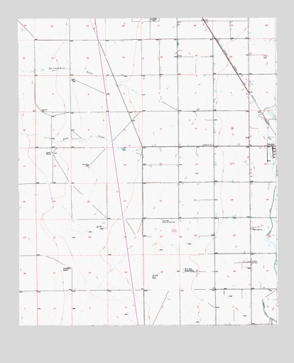
Dexter West, NM USGS Topographic Map
Click on map above to begin viewing in our Map Viewer.

This topographic map contains these locations and features:
Feature Name Type Latitude Longitude GNIS ID View Map
Bogles Cotton GinLocaleN33.1640°W104.3875°886572View Map
Dexter DivisionCivilN33.1767°W104.4011°1937521View Map
Dexter Fire and Rescue Station 2BuildingN33.1940°W104.3772°2657922View Map
Goodin WellWellN33.2248°W104.4727°889505View Map
Greenfield Artesian Recorder WellWellN33.1682°W104.4305°889602View Map
Jenkins AirportAirportN33.2401°W104.4740°2444049View Map
Kerr Brothers South RanchLocaleN33.1479°W104.4202°890673View Map
Kerr Well Number 1LocaleN33.1648°W104.4605°897948View Map
Kerr Well Number 2LocaleN33.1443°W104.4355°897949View Map
Lowe RanchLocaleN33.1954°W104.4841°891413View Map
Moore WellWellN33.1904°W104.4658°892216View Map
Ra-1423-S Water WellWellN33.1929°W104.4397°922877View Map
Thirteenmile DrawValleyN33.2195°W104.4336°923703View Map
Twin Wells Stock PensLocaleN33.1509°W104.3880°929078View Map
Vinyard WellWellN33.2123°W104.4891°896159View Map
Williams RanchLocaleN33.1490°W104.4764°896632View Map
Zubi DrawValleyN33.1940°W104.4400°896851View Map

Note: Coordinates in the location and feature list above are referenced to NAD83 datum.


Copyright (C) 2008-2025 Ryan Niemi / Sunset Dynamics ... All Rights Reserved