TopoQuest Logo
Do you find TopoQuest useful?
Help keep TopoQuest running and adding new maps/features by donating!
Bitcoin:  19c7KJd3qBynnjoSw5npx9KScwjBe4ifkT
Litecoin:  LXs6TkuXGGXo1vDsWCkWVdjQX94eUKd6ui
Home View Maps Find Maps Find Places Resources & Links


South Spring, New Mexico Topographic Map

USGS Map Title: South Spring, NM
USGS Map MRC: 33104C4
DRG (GeoTIFF) Download: o33104c4.tif


Neighboring USGS Topographic Map Quads:


  Roswell North, NM  
33104D5
 

  Bitter Lake, NM  
33104D4
 

  Comanche Spring, NM  
33104D3
 

  Roswell South, NM  
33104C5
 

  South Spring, NM  
33104C4
 

  Bottomless Lakes, NM  
33104C3
 

  Peters Lake, NM  
33104B5
 

  Dexter West, NM  
33104B4
 

  Dexter East, NM  
33104B3


Map MRC Location:

N34°
W105°
N34°
W104°
H8 H7 H6 H5 H4 H3 H2 H1
G8 G7 G6 G5 G4 G3 G2 G1
F8 F7 F6 F5 F4 F3 F2 F1
E8 E7 E6 E5 E4 E3 E2 E1
D8 D7 D6 D5 D4 D3 D2 D1
C8 C7 C6 C5 C4 C3 C2 C1
B8 B7 B6 B5 B4 B3 B2 B1
A8 A7 A6 A5 A4 A3 A2 A1
N33°
W105°
N33°
W104°

South Spring, NM USGS 1:24K Topographic Map Preview:
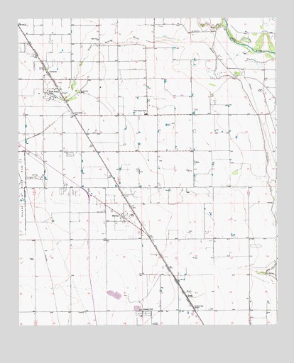
South Spring, NM USGS Topographic Map
Click on map above to begin viewing in our Map Viewer.

This topographic map contains these locations and features:
Feature Name Type Latitude Longitude GNIS ID View Map
05159 Water WellWellN33.2843°W104.3752°928436View Map
06071 Water WellWellN33.2740°W104.3752°925006View Map
10189 Water WellWellN33.2912°W104.3752°928439View Map
Benedict AirparkAirportN33.2555°W104.4421°2444035View Map
Chaves CountyCivilN33.3633°W104.4669°1702364View Map
ChisumPopulated PlaceN33.2620°W104.4189°898531View Map
Chisum Post Office (historical)Post OfficeN33.2620°W104.4189°938143View Map
Christ Light MinistryChurchN33.3532°W104.4855°920414View Map
East Grand Plain ElementarySchoolN33.3359°W104.4386°901745View Map
East Grand PlainsPopulated PlaceN33.3357°W104.4375°899618View Map
East Grand Plains Volunteer Fire Department Main StationBuildingN33.3347°W104.4426°2657920View Map
East Grand Plains Volunteer Fire Department Station 2BuildingN33.3121°W104.4157°2658215View Map
FairbanksPopulated PlaceN33.3532°W104.4855°899631View Map
Hagerman CanalCanalN33.3112°W104.3789°889716View Map
MidwayPopulated PlaceN33.2948°W104.4505°923629View Map
Midway Census Designated PlaceCensusN33.2958°W104.4518°2629119View Map
Midway Fire and Emergency Medical ServicesBuildingN33.2855°W104.4495°2658182View Map
Midway Post Office (historical)Post OfficeN33.2948°W104.4505°938191View Map
Oasis RanchLocaleN33.3454°W104.3816°892803View Map
Orchard ParkLocaleN33.2559°W104.4405°923638View Map
Orchard Park StationLocaleN33.2562°W104.4147°892928View Map
Ra-7809 Water WellWellN33.2540°W104.4200°922879View Map
Rio HondoStreamN33.3709°W104.3991°910242View Map
Shady Grove ChurchChurchN33.3665°W104.4611°894741View Map
South SpringPopulated PlaceN33.3357°W104.4727°898601View Map
South Spring AcresPopulated PlaceN33.3445°W104.4855°899922View Map
South Spring RanchLocaleN33.3457°W104.4702°895127View Map
South Spring RiverStreamN33.3673°W104.4164°923694View Map
Southspring Post Office (historical)Post OfficeN33.3357°W104.4727°937757View Map

Note: Coordinates in the location and feature list above are referenced to NAD83 datum.


Copyright (C) 2008-2025 Ryan Niemi / Sunset Dynamics ... All Rights Reserved