TopoQuest Logo
Do you find TopoQuest useful?
Help keep TopoQuest running and adding new maps/features by donating!
Bitcoin:  19c7KJd3qBynnjoSw5npx9KScwjBe4ifkT
Litecoin:  LXs6TkuXGGXo1vDsWCkWVdjQX94eUKd6ui
Home View Maps Find Maps Find Places Resources & Links


Diamond Mountain, California Topographic Map

USGS Map Title: Diamond Mountain, CA
USGS Map MRC: 40120C6
DRG (GeoTIFF) Download: o40120c6.tif


Neighboring USGS Topographic Map Quads:


  Roop Mountain, CA  
40120D7
 

  Susanville, CA  
40120D6
 

  Johnstonville, CA  
40120D5
 

  Fredonyer Pass, CA  
40120C7
 

  Diamond Mountain, CA  
40120C6
 

  Janesville, CA  
40120C5
 

  Moonlight Peak, CA  
40120B7
 

  Kettle Rock, CA  
40120B6
 

  Antelope Lake, CA  
40120B5


Map MRC Location:

N41°
W121°
N41°
W120°
H8 H7 H6 H5 H4 H3 H2 H1
G8 G7 G6 G5 G4 G3 G2 G1
F8 F7 F6 F5 F4 F3 F2 F1
E8 E7 E6 E5 E4 E3 E2 E1
D8 D7 D6 D5 D4 D3 D2 D1
C8 C7 C6 C5 C4 C3 C2 C1
B8 B7 B6 B5 B4 B3 B2 B1
A8 A7 A6 A5 A4 A3 A2 A1
N40°
W121°
N40°
W120°

Diamond Mountain, CA USGS 1:24K Topographic Map Preview:
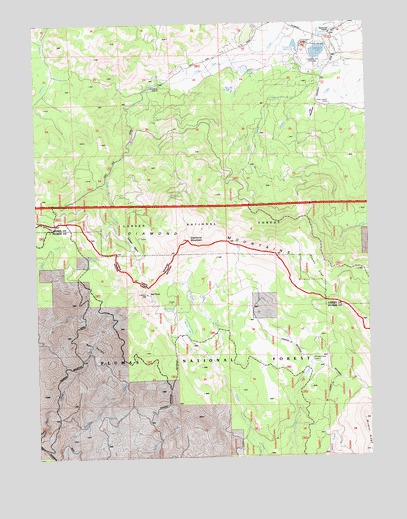
Diamond Mountain, CA USGS Topographic Map
Click on map above to begin viewing in our Map Viewer.

This topographic map contains these locations and features:
Feature Name Type Latitude Longitude GNIS ID View Map
Aspen FlatFlatN40.3038°W120.6449°256353View Map
Bear ValleyBasinN40.2829°W120.7302°256715View Map
Diamond MountainSummitN40.3127°W120.6930°259347View Map
Emerson 255 DamDamN40.3666°W120.6461°1663807View Map
Emerson DitchCanalN40.3502°W120.6641°259897View Map
Emerson LakeLakeN40.3664°W120.6439°259899View Map
Emerson Lake Golf ClubLocaleN40.3630°W120.6452°1654246View Map
Emerson SpringSpringN40.3714°W120.6435°259901View Map
Gilman BasinBasinN40.3118°W120.7141°260567View Map
Gold Run PitMineN40.3703°W120.6722°2677634View Map
Hills CreekStreamN40.3668°W120.6613°261357View Map
Lost MeadowsFlatN40.3493°W120.6458°262960View Map
Nagel ReservoirReservoirN40.3618°W120.6709°263999View Map
Peter Lassen GraveLocaleN40.3516°W120.6394°264665View Map
Red RockSummitN40.2971°W120.7091°265319View Map
Red Rock SpringSpringN40.2929°W120.6988°231386View Map
Richmond Elementary SchoolSchoolN40.3718°W120.6391°265413View Map
Ridenoure ReservoirReservoirN40.3685°W120.6522°265414View Map
Snoring SpringSpringN40.3085°W120.7313°267303View Map
The Beaver PondsLakeN40.2863°W120.6939°268174View Map
Wheeler Sheep CampgroundLocaleN40.2768°W120.6469°274896View Map

Note: Coordinates in the location and feature list above are referenced to NAD83 datum.


Copyright (C) 2008-2024 Ryan Niemi / Sunset Dynamics ... All Rights Reserved