TopoQuest Logo
Do you find TopoQuest useful?
Help keep TopoQuest running and adding new maps/features by donating!
Bitcoin:  19c7KJd3qBynnjoSw5npx9KScwjBe4ifkT
Litecoin:  LXs6TkuXGGXo1vDsWCkWVdjQX94eUKd6ui
Home View Maps Find Maps Find Places Resources & Links


Kettle Rock, California Topographic Map

USGS Map Title: Kettle Rock, CA
USGS Map MRC: 40120B6
DRG (GeoTIFF) Download: o40120b6.tif


Neighboring USGS Topographic Map Quads:


  Fredonyer Pass, CA  
40120C7
 

  Diamond Mountain, CA  
40120C6
 

  Janesville, CA  
40120C5
 

  Moonlight Peak, CA  
40120B7
 

  Kettle Rock, CA  
40120B6
 

  Antelope Lake, CA  
40120B5
 

  Taylorsville, CA  
40120A7
 

  Genesee Valley, CA  
40120A6
 

  Babcock Peak, CA  
40120A5


Map MRC Location:

N41°
W121°
N41°
W120°
H8 H7 H6 H5 H4 H3 H2 H1
G8 G7 G6 G5 G4 G3 G2 G1
F8 F7 F6 F5 F4 F3 F2 F1
E8 E7 E6 E5 E4 E3 E2 E1
D8 D7 D6 D5 D4 D3 D2 D1
C8 C7 C6 C5 C4 C3 C2 C1
B8 B7 B6 B5 B4 B3 B2 B1
A8 A7 A6 A5 A4 A3 A2 A1
N40°
W121°
N40°
W120°

Kettle Rock, CA USGS 1:24K Topographic Map Preview:
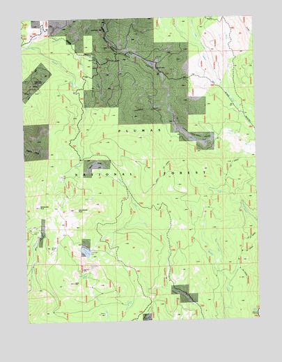
Kettle Rock, CA USGS Topographic Map
Click on map above to begin viewing in our Map Viewer.

This topographic map contains these locations and features:
Feature Name Type Latitude Longitude GNIS ID View Map
Babcock CrossingCrossingN40.1268°W120.6269°1657972View Map
Browns CabinLocaleN40.2288°W120.6794°219898View Map
Cool SpringSpringN40.1321°W120.6949°221494View Map
Eisenheimer PeakSummitN40.1710°W120.7241°223014View Map
Engel Mine Upper CampLocaleN40.2238°W120.7425°223213View Map
Fant CreekStreamN40.2393°W120.7250°223390View Map
Fant Gathering Corral (historical)LocaleN40.2299°W120.7183°1666178View Map
Greenville DivisionCivilN40.1382°W120.7441°1935122View Map
Kettle RockSummitN40.1407°W120.7258°226549View Map
Kettle Rock LakeLakeN40.1537°W120.7189°226550View Map
Kettle Rock SpringSpringN40.1435°W120.7183°226551View Map
Lights Creek Guard Station (historical)LocaleN40.2396°W120.7480°1666183View Map
Lone Pine Mine Number 1MineN40.2010°W120.7255°1666184View Map
Lone RockPillarN40.2454°W120.7100°227512View Map
Lone Rock ValleyValleyN40.2160°W120.6736°254933View Map
Lonesome CanyonValleyN40.2141°W120.6747°227534View Map
Lucky S MineMineN40.1616°W120.7472°1655131View Map
Morton CreekStreamN40.2382°W120.7483°263854View Map
Mud LakeLakeN40.1763°W120.7150°229240View Map
Pierce CreekStreamN40.2382°W120.6544°264710View Map
Rattlesnake PeakSummitN40.1724°W120.7436°231268View Map
Sage CreekStreamN40.1482°W120.6488°232110View Map
Smith CreekStreamN40.2385°W120.7441°266322View Map
Tanners RockSummitN40.1554°W120.7377°1659957View Map
Taylor LakeLakeN40.1538°W120.7186°236048View Map
Taylor Lake 288 DamDamN40.1538°W120.7186°1663816View Map
Wilcox ValleyValleyN40.1882°W120.7072°237746View Map
Willow CreekStreamN40.2174°W120.6397°269152View Map

Note: Coordinates in the location and feature list above are referenced to NAD83 datum.


Copyright (C) 2008-2024 Ryan Niemi / Sunset Dynamics ... All Rights Reserved