TopoQuest Logo
Do you find TopoQuest useful?
Help keep TopoQuest running and adding new maps/features by donating!
Bitcoin:  19c7KJd3qBynnjoSw5npx9KScwjBe4ifkT
Litecoin:  LXs6TkuXGGXo1vDsWCkWVdjQX94eUKd6ui
Home View Maps Find Maps Find Places Resources & Links


Dickey Lake, Washington Topographic Map

USGS Map Title: Dickey Lake, WA
USGS Map MRC: 48124A5
DRG (GeoTIFF) Download: o48124a5.tif


Neighboring USGS Topographic Map Quads:


  Ozette, WA  
48124B6
 

  Umbrella Creek, WA  
48124B5
 

  Hoko Falls, WA  
48124B4
 

  Allens Bay, WA  
48124A6
 

  Dickey Lake, WA  
48124A5
 

  Gunderson Mountain, WA  
48124A4
 

  La Push, WA  
47124H6
 

  Quillayute Prairie, WA  
47124H5
 

  Forks, WA  
47124H4


Map MRC Location:

N49°
W125°
N49°
W124°
H8 H7 H6 H5 H4 H3 H2 H1
G8 G7 G6 G5 G4 G3 G2 G1
F8 F7 F6 F5 F4 F3 F2 F1
E8 E7 E6 E5 E4 E3 E2 E1
D8 D7 D6 D5 D4 D3 D2 D1
C8 C7 C6 C5 C4 C3 C2 C1
B8 B7 B6 B5 B4 B3 B2 B1
A8 A7 A6 A5 A4 A3 A2 A1
N48°
W125°
N48°
W124°

Dickey Lake, WA USGS 1:24K Topographic Map Preview:
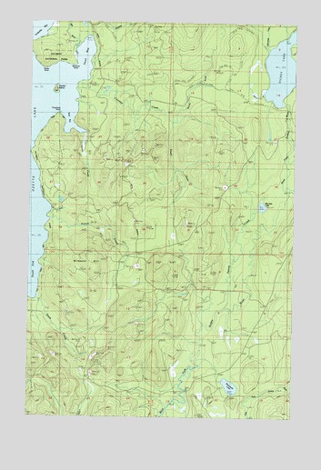
Dickey Lake, WA USGS Topographic Map
Click on map above to begin viewing in our Map Viewer.

This topographic map contains these locations and features:
Feature Name Type Latitude Longitude GNIS ID View Map
Barbour CreekStreamN48.1029°W124.5158°1503162View Map
Bensons PointCapeN48.1109°W124.6049°1503313View Map
Big Joes LakeLakeN48.0666°W124.5164°1503350View Map
Big RiverStreamN48.1162°W124.6055°1516538View Map
Birkestol HillSummitN48.0504°W124.5986°2787694View Map
Boot BayBayN48.0917°W124.6061°1503479View Map
Crooked CreekStreamN48.1037°W124.6052°1504281View Map
Dickey LakeLakeN48.1108°W124.5077°1518769View Map
Elk CreekStreamN48.0653°W124.6158°1504713View Map
Garden IslandIslandN48.1031°W124.6149°1505078View Map
Middle Fork Dickey RiverStreamN48.0840°W124.5030°1523066View Map
North Fork Crooked CreekStreamN48.0951°W124.5591°1507040View Map
Preachers PointCapeN48.0959°W124.6130°1507620View Map
Quinn CreekStreamN48.0895°W124.5999°1507682View Map
Rocky PointCapeN48.1103°W124.6197°1507885View Map
Sands CreekStreamN48.1151°W124.5013°1525424View Map
Siwash CreekStreamN48.0581°W124.6183°1508370View Map
South CreekStreamN48.0365°W124.6230°1508509View Map
South EndBayN48.0412°W124.6230°1508513View Map
South Fork Crooked CreekStreamN48.0934°W124.5602°1508519View Map
Squaw CreekStreamN48.0345°W124.5327°1511562View Map
Stampede CreekStreamN48.1217°W124.5038°1508684View Map
Swan BayBayN48.1173°W124.6002°1508856View Map
Umbrella BayBayN48.1237°W124.6205°1509164View Map
Wentworth LakeLakeN48.0097°W124.5306°1509378View Map

Note: Coordinates in the location and feature list above are referenced to NAD83 datum.


Copyright (C) 2008-2025 Ryan Niemi / Sunset Dynamics ... All Rights Reserved