TopoQuest Logo
Do you find TopoQuest useful?
Help keep TopoQuest running and adding new maps/features by donating!
Bitcoin:  19c7KJd3qBynnjoSw5npx9KScwjBe4ifkT
Litecoin:  LXs6TkuXGGXo1vDsWCkWVdjQX94eUKd6ui
Home View Maps Find Maps Find Places Resources & Links


Ozette, Washington Topographic Map

USGS Map Title: Ozette, WA
USGS Map MRC: 48124B6
DRG (GeoTIFF) Download: o48124b6.tif


Neighboring USGS Topographic Map Quads:


  Makah Bay, WA  
48124C6
 

  Neah Bay, WA  
48124C5
 

  Bodelteh Islands, WA  
48124B7
 

  Ozette, WA  
48124B6
 

  Umbrella Creek, WA  
48124B5


  Allens Bay, WA  
48124A6
 

  Dickey Lake, WA  
48124A5


Map MRC Location:

N49°
W125°
N49°
W124°
H8 H7 H6 H5 H4 H3 H2 H1
G8 G7 G6 G5 G4 G3 G2 G1
F8 F7 F6 F5 F4 F3 F2 F1
E8 E7 E6 E5 E4 E3 E2 E1
D8 D7 D6 D5 D4 D3 D2 D1
C8 C7 C6 C5 C4 C3 C2 C1
B8 B7 B6 B5 B4 B3 B2 B1
A8 A7 A6 A5 A4 A3 A2 A1
N48°
W125°
N48°
W124°

Ozette, WA USGS 1:24K Topographic Map Preview:
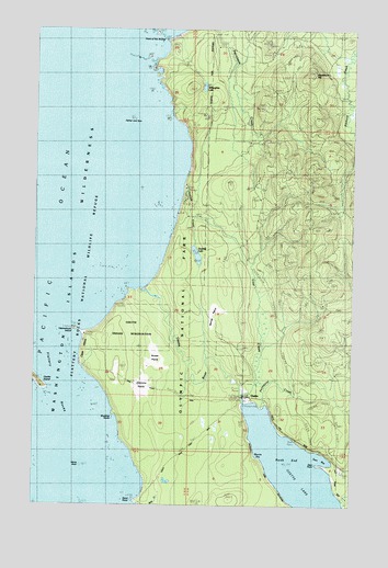
Ozette, WA USGS Topographic Map
Click on map above to begin viewing in our Map Viewer.

This topographic map contains these locations and features:
Feature Name Type Latitude Longitude GNIS ID View Map
Ahlstroms PrairieFlatN48.1576°W124.7075°1502953View Map
Blooms BayBayN48.1376°W124.6638°1503444View Map
Boca De AlavaAreaN48.1820°W124.7083°1514744View Map
Cape AlavaCapeN48.1659°W124.7325°1503792View Map
Coal CreekStreamN48.1542°W124.6700°1504037View Map
Deer BayBayN48.1362°W124.6363°1504404View Map
Deer PointCapeN48.1348°W124.6400°1504420View Map
Father and SonBarN48.2262°W124.7133°1504837View Map
Indian VillageLocaleN48.1640°W124.7322°1505737View Map
Mannys PrairieFlatN48.1748°W124.6819°1506450View Map
North EndBayN48.1365°W124.6522°1507030View Map
OzettePopulated PlaceN48.1548°W124.6672°1511209View Map
Ozette CampgroundLocaleN48.1470°W124.6500°1534065View Map
Ozette Indian Reservation (historical)CivilN48.1706°W124.7138°1509689View Map
Ozette IslandIslandN48.1570°W124.7497°1507244View Map
Ozette RiverStreamN48.1815°W124.7094°1507245View Map
Palmquist CreekStreamN48.1570°W124.6611°1507269View Map
Pilchuck CreekStreamN48.2456°W124.6272°1507421View Map
Point of ArchesCapeN48.2465°W124.7002°1509729View Map
Rooses PrairieFlatN48.1623°W124.7036°1507905View Map
Sand PointCapeN48.1256°W124.7111°1508095View Map
Seafield CreekStreamN48.2092°W124.6930°1509837View Map
Seafield LakeLakeN48.1906°W124.6878°1508182View Map
Tskawahyah IslandIslandN48.1706°W124.7352°1509094View Map
Umbrella CreekStreamN48.1251°W124.6288°1509165View Map
Washburn HillSummitN48.2382°W124.6429°1512778View Map
Wedding RocksPillarN48.1481°W124.7202°1509806View Map
White RockPillarN48.1348°W124.7322°1512802View Map
Willoughby LakeLakeN48.2348°W124.6854°1509544View Map

Note: Coordinates in the location and feature list above are referenced to NAD83 datum.


Copyright (C) 2008-2024 Ryan Niemi / Sunset Dynamics ... All Rights Reserved