TopoQuest Logo
Do you find TopoQuest useful?
Help keep TopoQuest running and adding new maps/features by donating!
Bitcoin:  19c7KJd3qBynnjoSw5npx9KScwjBe4ifkT
Litecoin:  LXs6TkuXGGXo1vDsWCkWVdjQX94eUKd6ui
Home View Maps Find Maps Find Places Resources & Links


Allens Bay, Washington Topographic Map

USGS Map Title: Allens Bay, WA
USGS Map MRC: 48124A6
DRG (GeoTIFF) Download: o48124a6.tif


Neighboring USGS Topographic Map Quads:


  Bodelteh Islands, WA  
48124B7
 

  Ozette, WA  
48124B6
 

  Umbrella Creek, WA  
48124B5


  Allens Bay, WA  
48124A6
 

  Dickey Lake, WA  
48124A5


  La Push, WA  
47124H6
 

  Quillayute Prairie, WA  
47124H5


Map MRC Location:

N49°
W125°
N49°
W124°
H8 H7 H6 H5 H4 H3 H2 H1
G8 G7 G6 G5 G4 G3 G2 G1
F8 F7 F6 F5 F4 F3 F2 F1
E8 E7 E6 E5 E4 E3 E2 E1
D8 D7 D6 D5 D4 D3 D2 D1
C8 C7 C6 C5 C4 C3 C2 C1
B8 B7 B6 B5 B4 B3 B2 B1
A8 A7 A6 A5 A4 A3 A2 A1
N48°
W125°
N48°
W124°

Allens Bay, WA USGS 1:24K Topographic Map Preview:
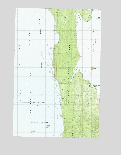
Allens Bay, WA USGS Topographic Map
Click on map above to begin viewing in our Map Viewer.

This topographic map contains these locations and features:
Feature Name Type Latitude Longitude GNIS ID View Map
Allens BayBayN48.0670°W124.6597°1503002View Map
Allens Bay TrailTrailN48.0470°W124.6736°1503003View Map
Allens SloughStreamN48.0615°W124.6641°1503004View Map
Baby IslandIslandN48.0501°W124.6297°1503093View Map
Birkestol PointCapeN48.0506°W124.6313°1503386View Map
Carroll IslandIslandN48.0051°W124.7249°1503822View Map
Cedar CreekStreamN48.0181°W124.6794°1503877View Map
Cemetery PointCliffN48.0790°W124.6561°1531625View Map
Eagle PointCapeN48.1237°W124.6413°1504617View Map
Ericksons Bay CampgroundLocaleN48.1215°W124.6619°1510146View Map
Ericsons BayBayN48.1142°W124.6575°1504766View Map
Foot RockPillarN48.0295°W124.7024°1512217View Map
Hand RockPillarN48.0303°W124.7186°1512265View Map
Jersted PointCapeN48.1170°W124.6280°1505807View Map
Kayostia BeachBeachN48.0384°W124.6833°1505917View Map
Norwegian MemorialParkN48.0373°W124.6816°1507116View Map
Old CemeteryCemeteryN48.0726°W124.6605°1507153View Map
Ozette LakeLakeN48.0947°W124.6372°1531490View Map
Shafers PointCapeN48.1131°W124.6472°1508242View Map
South Sand Point TrailTrailN48.1173°W124.6825°1508564View Map
Starbuck MineMineN48.0137°W124.6780°1509737View Map
Tivoli IslandIslandN48.0673°W124.6388°1509035View Map
Two Man RockPillarN48.0109°W124.7013°1512744View Map
Umbrella PointCapeN48.1240°W124.6288°1509166View Map
Wish CreekStreamN48.1234°W124.7055°1510147View Map
Yellow BanksBeachN48.0956°W124.6872°1531626View Map

Note: Coordinates in the location and feature list above are referenced to NAD83 datum.


Copyright (C) 2008-2025 Ryan Niemi / Sunset Dynamics ... All Rights Reserved