TopoQuest Logo
Do you find TopoQuest useful?
Help keep TopoQuest running and adding new maps/features by donating!
Bitcoin:  19c7KJd3qBynnjoSw5npx9KScwjBe4ifkT
Litecoin:  LXs6TkuXGGXo1vDsWCkWVdjQX94eUKd6ui
Home View Maps Find Maps Find Places Resources & Links


Dinero, Texas Topographic Map

USGS Map Title: Dinero, TX
USGS Map MRC: 28097B8
DRG (GeoTIFF) Download: o28097b8.tif


Neighboring USGS Topographic Map Quads:


  George West, TX  
28098C1
 

  Mulos Hills, TX  
28097C8
 

  Clareville, TX  
28097C7
 

  Crater Ridge, TX  
28098B1
 

  Dinero, TX  
28097B8
 

  Tynan, TX  
28097B7
 

  Midway, TX  
28098A1
 

  Sandia, TX  
28097A8
 

  Mathis, TX  
28097A7


Map MRC Location:

N29°
W98°
N29°
W97°
H8 H7 H6 H5 H4 H3 H2 H1
G8 G7 G6 G5 G4 G3 G2 G1
F8 F7 F6 F5 F4 F3 F2 F1
E8 E7 E6 E5 E4 E3 E2 E1
D8 D7 D6 D5 D4 D3 D2 D1
C8 C7 C6 C5 C4 C3 C2 C1
B8 B7 B6 B5 B4 B3 B2 B1
A8 A7 A6 A5 A4 A3 A2 A1
N28°
W98°
N28°
W97°

Dinero, TX USGS 1:24K Topographic Map Preview:
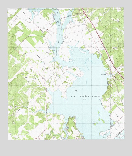
Dinero, TX USGS Topographic Map
Click on map above to begin viewing in our Map Viewer.

This topographic map contains these locations and features:
Feature Name Type Latitude Longitude GNIS ID View Map
Balania CemeteryCemeteryN28.1953°W97.9361°1329962View Map
Balania HillSummitN28.1924°W97.9569°1329963View Map
DineroPopulated PlaceN28.2264°W97.9617°1334369View Map
Hideaway HillPopulated PlaceN28.1870°W97.8936°1337696View Map
Hog HollowValleyN28.2463°W97.9739°1337897View Map
Lagarto CemeteryCemeteryN28.1470°W97.9375°1374432View Map
Lagarto CreekStreamN28.1470°W97.9367°1339449View Map
Lake Corpus ChristiReservoirN28.1364°W97.9091°1333388View Map
Lake Mathis Point ColoniaPopulated PlaceN28.1314°W97.8783°2011324View Map
Long HollowValleyN28.1708°W97.9568°1340468View Map
Los LomasPopulated PlaceN28.1378°W97.8881°1340612View Map
Mount LucasPopulated PlaceN28.1870°W97.9464°1378707View Map
Mustang HollowValleyN28.2046°W97.9013°1342318View Map
North Lakeshore Gardens ColoniaPopulated PlaceN28.1314°W97.8764°2011285View Map
Paisano CreekStreamN28.2494°W97.9739°1372190View Map
Peace Valley HarborPopulated PlaceN28.1300°W97.8972°1343713View Map
Ramirena CreekStreamN28.1525°W97.9567°1344727View Map
Rufe Williams HollowValleyN28.1865°W97.8888°1329139View Map
Swinney SwitchLocaleN28.2447°W97.9203°1348156View Map
Swinney Switch Volunteer Fire DepartmentBuildingN28.2436°W97.9193°2551187View Map
Twin Oaks RanchLocaleN28.2083°W97.9553°1348965View Map
Weathersby HollowValleyN28.2294°W97.9164°1349575View Map
Wright CemeteryCemeteryN28.2097°W97.9511°1350607View Map

Note: Coordinates in the location and feature list above are referenced to NAD83 datum.


Copyright (C) 2008-2025 Ryan Niemi / Sunset Dynamics ... All Rights Reserved