TopoQuest Logo
Do you find TopoQuest useful?
Help keep TopoQuest running and adding new maps/features by donating!
Bitcoin:  19c7KJd3qBynnjoSw5npx9KScwjBe4ifkT
Litecoin:  LXs6TkuXGGXo1vDsWCkWVdjQX94eUKd6ui
Home View Maps Find Maps Find Places Resources & Links


Dixie Union, Georgia Topographic Map

USGS Map Title: Dixie Union, GA
USGS Map MRC: 31082C4
DRG (GeoTIFF) Download: o31082c4.tif


Neighboring USGS Topographic Map Quads:


  Beach, GA  
31082D5
 

  Crawley, GA  
31082D4
 

  Mershon, GA  
31082D3
 

  Talmo, GA  
31082C5
 

  Dixie Union, GA  
31082C4
 

  Blackshear West, GA  
31082C3
 

  Pine Valley, GA  
31082B5
 

  Waycross West, GA  
31082B4
 

  Waycross East, GA  
31082B3


Map MRC Location:

N32°
W83°
N32°
W82°
H8 H7 H6 H5 H4 H3 H2 H1
G8 G7 G6 G5 G4 G3 G2 G1
F8 F7 F6 F5 F4 F3 F2 F1
E8 E7 E6 E5 E4 E3 E2 E1
D8 D7 D6 D5 D4 D3 D2 D1
C8 C7 C6 C5 C4 C3 C2 C1
B8 B7 B6 B5 B4 B3 B2 B1
A8 A7 A6 A5 A4 A3 A2 A1
N31°
W83°
N31°
W82°

Dixie Union, GA USGS 1:24K Topographic Map Preview:
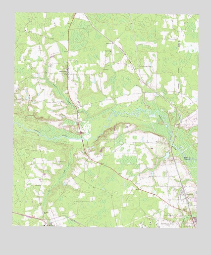
Dixie Union, GA USGS Topographic Map
Click on map above to begin viewing in our Map Viewer.

This topographic map contains these locations and features:
Feature Name Type Latitude Longitude GNIS ID View Map
Cox CreekStreamN31.2988°W82.4524°313074View Map
Dixie UnionPopulated PlaceN31.3394°W82.4632°313496View Map
Dixie Union ChurchChurchN31.3427°W82.4632°357664View Map
Dryden CreekStreamN31.3180°W82.4315°313689View Map
Ezekiel ChurchChurchN31.2763°W82.4165°314021View Map
HaywoodPopulated PlaceN31.3580°W82.4321°331940View Map
Haywood ChurchChurchN31.3530°W82.4337°315263View Map
JamestownPopulated PlaceN31.2705°W82.3832°332090View Map
Jamestown Baptist ChurchChurchN31.2663°W82.3854°357685View Map
Jamestown United Methodist ChurchChurchN31.2663°W82.3854°2502194View Map
Jordan ChurchChurchN31.3424°W82.4382°316267View Map
Pebble Hill ChurchChurchN31.3047°W82.4318°357703View Map
Pine View ChurchChurchN31.2741°W82.4810°320653View Map
Salem ChurchChurchN31.3599°W82.4740°357715View Map
Shriners Club LakeReservoirN31.2926°W82.3953°342129View Map
Shriners Club Lake DamDamN31.2935°W82.3932°342128View Map
WaltertownPopulated PlaceN31.2997°W82.4024°333360View Map
Ware County Fire Rescue Station 1 Industrial ParkBuildingN31.2553°W82.4055°2604954View Map
Ware County Fire Rescue Station 6 Dixie UnionBuildingN31.3439°W82.4626°2604824View Map
Ware County Fire Rescue Station 8 Peeble HillBuildingN31.2998°W82.4181°2604721View Map
Ware County Fire Rescue Station 9 WaresboroBuildingN31.2504°W82.4762°2604720View Map
Ware County JailBuildingN31.2565°W82.3907°357736View Map
Ware County Sheriff's OfficeBuildingN31.2564°W82.3905°2733671View Map
Ware State PrisonBuildingN31.2580°W82.3945°2735741View Map
Waresboro CemeteryCemeteryN31.2580°W82.4790°324849View Map

Note: Coordinates in the location and feature list above are referenced to NAD83 datum.


Copyright (C) 2008-2024 Ryan Niemi / Sunset Dynamics ... All Rights Reserved