TopoQuest Logo
Do you find TopoQuest useful?
Help keep TopoQuest running and adding new maps/features by donating!
Bitcoin:  19c7KJd3qBynnjoSw5npx9KScwjBe4ifkT
Litecoin:  LXs6TkuXGGXo1vDsWCkWVdjQX94eUKd6ui
Home View Maps Find Maps Find Places Resources & Links


Blackshear West, Georgia Topographic Map

USGS Map Title: Blackshear West, GA
USGS Map MRC: 31082C3
DRG (GeoTIFF) Download: o31082c3.tif


Neighboring USGS Topographic Map Quads:


  Crawley, GA  
31082D4
 

  Mershon, GA  
31082D3
 

  Patterson, GA  
31082D2
 

  Dixie Union, GA  
31082C4
 

  Blackshear West, GA  
31082C3
 

  Blackshear East, GA  
31082C2
 

  Waycross West, GA  
31082B4
 

  Waycross East, GA  
31082B3
 

  Hoboken West, GA  
31082B2


Map MRC Location:

N32°
W83°
N32°
W82°
H8 H7 H6 H5 H4 H3 H2 H1
G8 G7 G6 G5 G4 G3 G2 G1
F8 F7 F6 F5 F4 F3 F2 F1
E8 E7 E6 E5 E4 E3 E2 E1
D8 D7 D6 D5 D4 D3 D2 D1
C8 C7 C6 C5 C4 C3 C2 C1
B8 B7 B6 B5 B4 B3 B2 B1
A8 A7 A6 A5 A4 A3 A2 A1
N31°
W83°
N31°
W82°

Blackshear West, GA USGS 1:24K Topographic Map Preview:
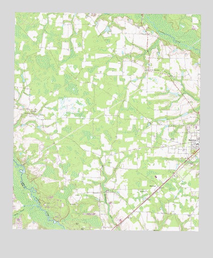
Blackshear West, GA USGS Topographic Map
Click on map above to begin viewing in our Map Viewer.

This topographic map contains these locations and features:
Feature Name Type Latitude Longitude GNIS ID View Map
Alabaha CemeteryCemeteryN31.3660°W82.2860°349036View Map
Alabaha Freewill Baptist ChurchChurchN31.3660°W82.2860°354270View Map
Alabaha School (historical)SchoolN31.3691°W82.3285°349037View Map
Baxley School (historical)SchoolN31.3158°W82.3607°349038View Map
Ben James CemeteryCemeteryN31.2647°W82.3318°349040View Map
Ben James ChurchChurchN31.2649°W82.3323°311074View Map
Bethel Temple Holiness ChurchChurchN31.3017°W82.2519°2502710View Map
Blackshear DivisionCivilN31.3050°W82.2659°1936112View Map
Deans Still (historical)LocaleN31.2613°W82.2929°349056View Map
Greater Saint James African Methodist Episcopal ChurchChurchN31.2990°W82.2509°2502715View Map
Hacklebarney ChurchChurchN31.2716°W82.3207°356132View Map
Hacklebarney Volunteer Fire DepartmentBuildingN31.2651°W82.2971°2604900View Map
HomesteadPopulated PlaceN31.2761°W82.2771°332016View Map
Homestead ChurchChurchN31.2733°W82.2854°315602View Map
Jordan LakeReservoirN31.3660°W82.3125°342054View Map
Jordan Lake DamDamN31.3669°W82.3115°342053View Map
Jot'Em Down StoreLocaleN31.3427°W82.2846°316286View Map
Kettle CreekStreamN31.2641°W82.3585°316399View Map
Marian Anderson LibraryBuildingN31.3005°W82.2521°1705312View Map
Martins Mobile Home ParkPopulated PlaceN31.2890°W82.2626°2502523View Map
Nunn CemeteryCemeteryN31.2888°W82.2537°319721View Map
Okefenokee Golf and Country ClubLocaleN31.2669°W82.3470°349081View Map
Pine Bloom School (historical)SchoolN31.3247°W82.2568°349090View Map
Piney Grove ChurchChurchN31.3027°W82.2693°320698View Map
Progress School (historical)SchoolN31.3455°W82.2901°349091View Map
Rehobeth CemeteryCemeteryN31.3163°W82.3646°349094View Map
Rehobeth ChurchChurchN31.3166°W82.3640°321497View Map
Southgate Baptist ChurchChurchN31.2592°W82.2553°2502717View Map
Sweat CemeteryCemeteryN31.3683°W82.2904°323806View Map
WACL-AM (Waycross)TowerN31.2619°W82.3237°352592View Map
Ward Memorial ChurchChurchN31.3119°W82.2502°2502719View Map
Ware Street Elementary SchoolSchoolN31.3008°W82.2510°349104View Map
Waters CemeteryCemeteryN31.2502°W82.2807°324909View Map
WKUB-FM (Blackshear)TowerN31.2638°W82.2915°352637View Map
YoumanPopulated PlaceN31.2599°W82.2543°349108View Map
Youman ChapelChurchN31.2597°W82.2548°325632View Map

Note: Coordinates in the location and feature list above are referenced to NAD83 datum.


Copyright (C) 2008-2024 Ryan Niemi / Sunset Dynamics ... All Rights Reserved