TopoQuest Logo
Do you find TopoQuest useful?
Help keep TopoQuest running and adding new maps/features by donating!
Bitcoin:  19c7KJd3qBynnjoSw5npx9KScwjBe4ifkT
Litecoin:  LXs6TkuXGGXo1vDsWCkWVdjQX94eUKd6ui
Home View Maps Find Maps Find Places Resources & Links


Doering, Wisconsin Topographic Map

USGS Map Title: Doering, WI
USGS Map MRC: 45089B4
DRG (GeoTIFF) Download: o45089b4.tif


Neighboring USGS Topographic Map Quads:


  Bloomville, WI  
45089C5
 

  Gleason, WI  
45089C4
 

  Bavaria, WI  
45089C3
 

  Pine Dells, WI  
45089B5
 

  Doering, WI  
45089B4
 

  Black Brook, WI  
45089B3
 

  Nutterville, WI  
45089A5
 

  Kalinke, WI  
45089A4
 

  Hogarty, WI  
45089A3


Map MRC Location:

N46°
W90°
N46°
W89°
H8 H7 H6 H5 H4 H3 H2 H1
G8 G7 G6 G5 G4 G3 G2 G1
F8 F7 F6 F5 F4 F3 F2 F1
E8 E7 E6 E5 E4 E3 E2 E1
D8 D7 D6 D5 D4 D3 D2 D1
C8 C7 C6 C5 C4 C3 C2 C1
B8 B7 B6 B5 B4 B3 B2 B1
A8 A7 A6 A5 A4 A3 A2 A1
N45°
W90°
N45°
W89°

Doering, WI USGS 1:24K Topographic Map Preview:
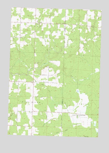
Doering, WI USGS Topographic Map
Click on map above to begin viewing in our Map Viewer.

This topographic map contains these locations and features:
Feature Name Type Latitude Longitude GNIS ID View Map
Ackley Lookout Tower (historical)TowerN45.1472°W89.3865°1840731View Map
Ackley State Wildlife AreasParkN45.1469°W89.4048°1560676View Map
DoeringPopulated PlaceN45.2352°W89.4582°1577575View Map
Doering School (historical)SchoolN45.2355°W89.4671°1838319View Map
East Branch Pratt CreekStreamN45.2394°W89.3823°1564297View Map
Forest View CemeteryCemeteryN45.2341°W89.3901°1565143View Map
Forest View Church (historical)ChurchN45.2447°W89.3960°1840768View Map
Forest View School (historical)SchoolN45.2330°W89.3893°1840769View Map
Gleason Flowage 2ReservoirN45.1361°W89.4096°1793228View Map
Little Oxbo CreekStreamN45.1841°W89.4748°1568345View Map
Lloyd CreekStreamN45.2214°W89.3868°1568474View Map
McCloud CreekStreamN45.2202°W89.4204°1569181View Map
Oxbo CreekStreamN45.1958°W89.4493°1570974View Map
Pratt CreekStreamN45.2227°W89.3898°1571907View Map
Prospect School (historical)SchoolN45.1319°W89.4668°1838377View Map
Saint Matthews Church (historical)ChurchN45.1766°W89.4671°1838391View Map
Skunk Creek D12.185 DamDamN45.1366°W89.4101°1793227View Map
Spring Brook School (historical)SchoolN45.1769°W89.4671°1838405View Map
Wildwood ChurchChurchN45.2355°W89.4257°1576747View Map

Note: Coordinates in the location and feature list above are referenced to NAD83 datum.


Copyright (C) 2008-2025 Ryan Niemi / Sunset Dynamics ... All Rights Reserved