TopoQuest Logo
Do you find TopoQuest useful?
Help keep TopoQuest running and adding new maps/features by donating!
Bitcoin:  19c7KJd3qBynnjoSw5npx9KScwjBe4ifkT
Litecoin:  LXs6TkuXGGXo1vDsWCkWVdjQX94eUKd6ui
Home View Maps Find Maps Find Places Resources & Links


Hogarty, Wisconsin Topographic Map

USGS Map Title: Hogarty, WI
USGS Map MRC: 45089A3
DRG (GeoTIFF) Download: o45089a3.tif


Neighboring USGS Topographic Map Quads:


  Doering, WI  
45089B4
 

  Black Brook, WI  
45089B3
 

  Antigo, WI  
45089B2
 

  Kalinke, WI  
45089A4
 

  Hogarty, WI  
45089A3
 

  Aniwa, WI  
45089A2
 

  Ringle, WI  
44089H4
 

  Hatley, WI  
44089H3
 

  Birnamwood, WI  
44089H2


Map MRC Location:

N46°
W90°
N46°
W89°
H8 H7 H6 H5 H4 H3 H2 H1
G8 G7 G6 G5 G4 G3 G2 G1
F8 F7 F6 F5 F4 F3 F2 F1
E8 E7 E6 E5 E4 E3 E2 E1
D8 D7 D6 D5 D4 D3 D2 D1
C8 C7 C6 C5 C4 C3 C2 C1
B8 B7 B6 B5 B4 B3 B2 B1
A8 A7 A6 A5 A4 A3 A2 A1
N45°
W90°
N45°
W89°

Hogarty, WI USGS 1:24K Topographic Map Preview:
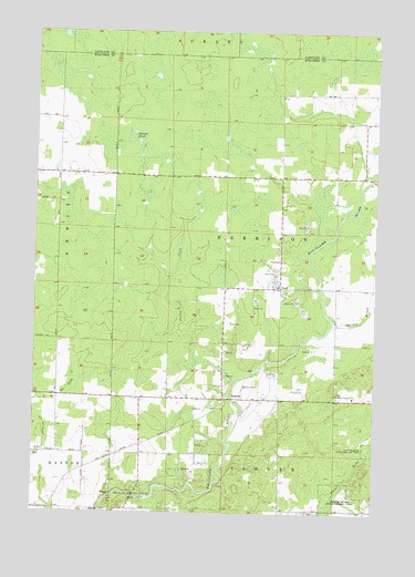
Hogarty, WI USGS Topographic Map
Click on map above to begin viewing in our Map Viewer.

This topographic map contains these locations and features:
Feature Name Type Latitude Longitude GNIS ID View Map
Aniwa Lookout TowerTowerN45.0311°W89.2643°1581164View Map
Bethany CemeteryCemeteryN45.0150°W89.3737°1844055View Map
Bethany ChurchChurchN45.0150°W89.3740°1561619View Map
Dells of the Eau Claire ParkParkN45.0055°W89.3379°1563887View Map
Dells of the Eau Claire River State Natural AreaParkN45.0036°W89.3429°1989935View Map
Fallows School (historical)SchoolN45.0655°W89.2854°1844110View Map
Harrison TownhallBuildingN45.0655°W89.2854°1844147View Map
HogartyPopulated PlaceN45.0297°W89.3057°1566521View Map
JohnsonPopulated PlaceN45.0114°W89.3559°1844167View Map
Nudell School (historical)SchoolN45.0211°W89.3232°1845218View Map
Plover River State Fishery AreaParkN45.0025°W89.2629°1571685View Map
Skulen CreekStreamN45.0344°W89.3023°1574242View Map
SnellPopulated PlaceN45.0586°W89.2851°1577826View Map
Spring BrookStreamN45.0505°W89.2662°1574599View Map
Steinke PondLakeN45.0988°W89.3393°1574851View Map
Town of HarrisonCivilN45.0741°W89.2850°1583357View Map

Note: Coordinates in the location and feature list above are referenced to NAD83 datum.


Copyright (C) 2008-2025 Ryan Niemi / Sunset Dynamics ... All Rights Reserved