TopoQuest Logo
Do you find TopoQuest useful?
Help keep TopoQuest running and adding new maps/features by donating!
Bitcoin:  19c7KJd3qBynnjoSw5npx9KScwjBe4ifkT
Litecoin:  LXs6TkuXGGXo1vDsWCkWVdjQX94eUKd6ui
Home View Maps Find Maps Find Places Resources & Links


Dollarhide Mountain, Idaho Topographic Map

USGS Map Title: Dollarhide Mountain, ID
USGS Map MRC: 43114E6
DRG (GeoTIFF) Download: o43114e6.tif


Neighboring USGS Topographic Map Quads:


  Paradise Peak, ID  
43114F7
 

  Baker Peak, ID  
43114F6
 

  Boyle Mountain, ID  
43114F5
 

  Sydney Butte, ID  
43114E7
 

  Dollarhide Mountain, ID  
43114E6
 

  Buttercup Mountain, ID  
43114E5
 

  Phillips Creek, ID  
43114D7
 

  Cannonball Mountain, ID  
43114D6
 

  Beaver Creek, ID  
43114D5


Map MRC Location:

N44°
W115°
N44°
W114°
H8 H7 H6 H5 H4 H3 H2 H1
G8 G7 G6 G5 G4 G3 G2 G1
F8 F7 F6 F5 F4 F3 F2 F1
E8 E7 E6 E5 E4 E3 E2 E1
D8 D7 D6 D5 D4 D3 D2 D1
C8 C7 C6 C5 C4 C3 C2 C1
B8 B7 B6 B5 B4 B3 B2 B1
A8 A7 A6 A5 A4 A3 A2 A1
N43°
W115°
N43°
W114°

Dollarhide Mountain, ID USGS 1:24K Topographic Map Preview:
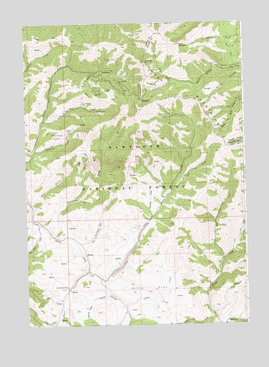
Dollarhide Mountain, ID USGS Topographic Map
Click on map above to begin viewing in our Map Viewer.

This topographic map contains these locations and features:
Feature Name Type Latitude Longitude GNIS ID View Map
Alma MineMineN43.5777°W114.7301°376561View Map
Basalt CreekStreamN43.5227°W114.7156°399545View Map
Bear GulchValleyN43.5502°W114.7467°377140View Map
Blackhorse CreekStreamN43.5366°W114.7342°399797View Map
Camas Cow CampLocaleN43.5007°W114.7365°378733View Map
Camp CreekStreamN43.5007°W114.7337°378780View Map
Carrie Leonard MineMineN43.6005°W114.6973°378953View Map
CarrietownPopulated PlaceN43.6049°W114.7003°396240View Map
Devils Dive CreekStreamN43.5030°W114.6437°380532View Map
Ditto FlatFlatN43.5152°W114.6801°380631View Map
Dollarhide MountainSummitN43.6091°W114.6817°397633View Map
Dollarhide SummitSummitN43.5938°W114.6834°397634View Map
Galore MineMineN43.5813°W114.7234°399881View Map
Gooding CorralsLocaleN43.5096°W114.7312°382431View Map
Gooding Cow CampLocaleN43.5157°W114.7278°382432View Map
Horn Silver MineMineN43.5916°W114.7181°383337View Map
King of the West CreekStreamN43.5849°W114.7398°399946View Map
King of the West MineMineN43.5885°W114.7106°384238View Map
Last Chance MineMineN43.6102°W114.7028°384458View Map
Liberal CreekStreamN43.5193°W114.7087°384595View Map
Moose Creek Ranger StationLocaleN43.5916°W114.7176°387185View Map
Packer GulchValleyN43.6010°W114.6662°388096View Map
Pine CreekStreamN43.5568°W114.6667°388481View Map
Red Rock CreekStreamN43.5424°W114.7426°389234View Map
Rives Placer (historical)AreaN43.5291°W114.7162°399544View Map
Rollins Placer (historical)AreaN43.5193°W114.7064°399546View Map
Sawmill CreekStreamN43.5441°W114.6787°389954View Map
Shaw MountainSummitN43.6160°W114.6614°390166View Map
Sheep CreekStreamN43.5088°W114.6942°390180View Map
Silver Star MineMineN43.5966°W114.7101°390459View Map
Stovepipe CreekStreamN43.5338°W114.7215°391514View Map
Tyrannis CreekStreamN43.5721°W114.7462°400147View Map
Tyrannis MineMineN43.5793°W114.7292°392584View Map
West Fork Willow CreekStreamN43.5263°W114.6387°393254View Map
White Rag GulchValleyN43.5121°W114.7051°393361View Map

Note: Coordinates in the location and feature list above are referenced to NAD83 datum.


Copyright (C) 2008-2024 Ryan Niemi / Sunset Dynamics ... All Rights Reserved