TopoQuest Logo
Do you find TopoQuest useful?
Help keep TopoQuest running and adding new maps/features by donating!
Bitcoin:  19c7KJd3qBynnjoSw5npx9KScwjBe4ifkT
Litecoin:  LXs6TkuXGGXo1vDsWCkWVdjQX94eUKd6ui
Home View Maps Find Maps Find Places Resources & Links


Sydney Butte, Idaho Topographic Map

USGS Map Title: Sydney Butte, ID
USGS Map MRC: 43114E7
DRG (GeoTIFF) Download: o43114e7.tif


Neighboring USGS Topographic Map Quads:


  Newman Peak, ID  
43114F8
 

  Paradise Peak, ID  
43114F7
 

  Baker Peak, ID  
43114F6
 

  Boardman Creek, ID  
43114E8
 

  Sydney Butte, ID  
43114E7
 

  Dollarhide Mountain, ID  
43114E6
 

  Smoky Dome, ID  
43114D8
 

  Phillips Creek, ID  
43114D7
 

  Cannonball Mountain, ID  
43114D6


Map MRC Location:

N44°
W115°
N44°
W114°
H8 H7 H6 H5 H4 H3 H2 H1
G8 G7 G6 G5 G4 G3 G2 G1
F8 F7 F6 F5 F4 F3 F2 F1
E8 E7 E6 E5 E4 E3 E2 E1
D8 D7 D6 D5 D4 D3 D2 D1
C8 C7 C6 C5 C4 C3 C2 C1
B8 B7 B6 B5 B4 B3 B2 B1
A8 A7 A6 A5 A4 A3 A2 A1
N43°
W115°
N43°
W114°

Sydney Butte, ID USGS 1:24K Topographic Map Preview:
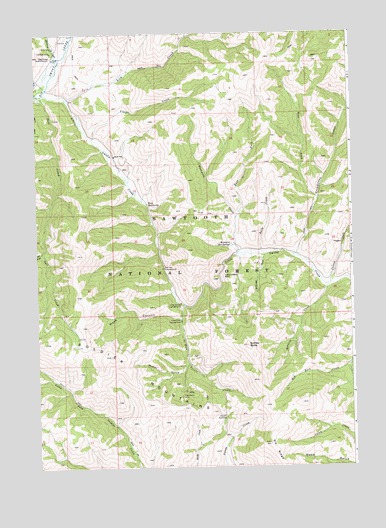
Sydney Butte, ID USGS Topographic Map
Click on map above to begin viewing in our Map Viewer.

This topographic map contains these locations and features:
Feature Name Type Latitude Longitude GNIS ID View Map
Belle CreekStreamN43.5618°W114.7865°377334View Map
Big Smoky Guard StationLocaleN43.6185°W114.8684°396118View Map
Big Smoky Work CenterBuildingN43.6208°W114.8678°2071293View Map
Carrie CreekStreamN43.5527°W114.7598°378952View Map
Carrie Creek CampgroundLocaleN43.5532°W114.7603°395518View Map
Couch SummitSummitN43.5149°W114.8015°397578View Map
East Fork Worswick CreekStreamN43.5721°W114.7962°381035View Map
Five Points CampgroundLocaleN43.5421°W114.8184°381798View Map
Five Points CreekStreamN43.5466°W114.8170°381799View Map
Five Points MineMineN43.5207°W114.8184°396492View Map
Grindstone CreekStreamN43.5610°W114.7726°382690View Map
Indian Head RockPopulated PlaceN43.5552°W114.8015°397810View Map
Lick CreekStreamN43.6063°W114.8626°384605View Map
Little Smoky CampgroundLocaleN43.5471°W114.8184°384956View Map
Little Smoky CreekStreamN43.6077°W114.8715°384957View Map
McHan GulchValleyN43.5291°W114.8167°386628View Map
Narrows CampgroundLocaleN43.5574°W114.8251°387475View Map
Paradise CreekStreamN43.6166°W114.8659°388178View Map
Placer CreekStreamN43.5949°W114.8523°388578View Map
Preis Hot SpringSpringN43.5760°W114.8312°388857View Map
Rosetta CreekStreamN43.5521°W114.7606°389613View Map
Salt CreekStreamN43.6074°W114.8726°389861View Map
Sydney ButteSummitN43.5349°W114.7920°398210View Map
Wash CanyonValleyN43.5435°W114.8187°392909View Map
West Fork Grindstone CreekStreamN43.5774°W114.7640°393112View Map
West Fork Salt CreekStreamN43.5621°W114.8731°393189View Map
Williams CreekStreamN43.5616°W114.7853°393457View Map
Worswick CreekStreamN43.5618°W114.7953°400179View Map
Worswick Hot SpringsSpringN43.5643°W114.7978°400180View Map

Note: Coordinates in the location and feature list above are referenced to NAD83 datum.


Copyright (C) 2008-2024 Ryan Niemi / Sunset Dynamics ... All Rights Reserved