TopoQuest Logo
Do you find TopoQuest useful?
Help keep TopoQuest running and adding new maps/features by donating!
Bitcoin:  19c7KJd3qBynnjoSw5npx9KScwjBe4ifkT
Litecoin:  LXs6TkuXGGXo1vDsWCkWVdjQX94eUKd6ui
Home View Maps Find Maps Find Places Resources & Links


Door Point, Louisiana Topographic Map

USGS Map Title: Door Point, LA
USGS Map MRC: 30089A2
DRG (GeoTIFF) Download: o30089a2.tif


Neighboring USGS Topographic Map Quads:


  Isle au Pitre, LA  
30089B2
 

  Cat Island, MS  
30089B1
 

  Three Mile Bay, LA  
30089A3
 

  Door Point, LA  
30089A2


  Oak Mound Bayou, LA  
29089H3
 

  Mitchell Island, LA  
29089H2


Map MRC Location:

N31°
W90°
N31°
W89°
H8 H7 H6 H5 H4 H3 H2 H1
G8 G7 G6 G5 G4 G3 G2 G1
F8 F7 F6 F5 F4 F3 F2 F1
E8 E7 E6 E5 E4 E3 E2 E1
D8 D7 D6 D5 D4 D3 D2 D1
C8 C7 C6 C5 C4 C3 C2 C1
B8 B7 B6 B5 B4 B3 B2 B1
A8 A7 A6 A5 A4 A3 A2 A1
N30°
W90°
N30°
W89°

Door Point, LA USGS 1:24K Topographic Map Preview:
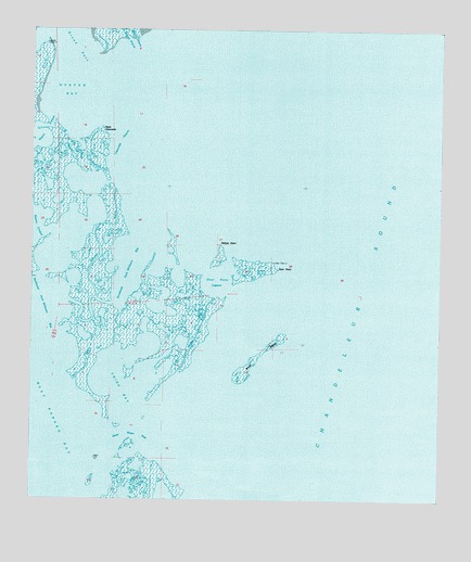
Door Point, LA USGS Topographic Map
Click on map above to begin viewing in our Map Viewer.

This topographic map contains these locations and features:
Feature Name Type Latitude Longitude GNIS ID View Map
Bayou PintouGutN30.1216°W89.2284°1629353View Map
Brush IslandIslandN30.0388°W89.1795°560283View Map
Chevrette BayouChannelN30.0946°W89.2231°560412View Map
Chino BayBayN30.0285°W89.2217°560424View Map
Deep Water PassChannelN30.0155°W89.2250°560612View Map
Door PointCapeN30.0619°W89.1711°560638View Map
Door Point BayouGutN30.0444°W89.1989°560639View Map
Door Point LagoonBayN30.0580°W89.1931°560640View Map
Door Point LightLocaleN30.0477°W89.1542°560641View Map
Grand Pass Oyster Bay LightLocaleN30.1244°W89.2367°560879View Map
Jack Williams BayouGutN30.0713°W89.2306°1627340View Map
Murder BayouGutN30.0613°W89.1761°1627736View Map
Oyster BayBayN30.1074°W89.2362°1627851View Map
Pelican PointCapeN30.0702°W89.1917°1627894View Map
Pfiefer KeysIslandN30.1152°W89.1711°1627910View Map
Point ChevretteCapeN30.1005°W89.2278°1627950View Map
Southeast Jack Williams BayBayN30.0605°W89.2203°1628265View Map
Sundown IslandIslandN30.1110°W89.2006°1628310View Map

Note: Coordinates in the location and feature list above are referenced to NAD83 datum.


Copyright (C) 2008-2025 Ryan Niemi / Sunset Dynamics ... All Rights Reserved