TopoQuest Logo
Do you find TopoQuest useful?
Help keep TopoQuest running and adding new maps/features by donating!
Bitcoin:  19c7KJd3qBynnjoSw5npx9KScwjBe4ifkT
Litecoin:  LXs6TkuXGGXo1vDsWCkWVdjQX94eUKd6ui
Home View Maps Find Maps Find Places Resources & Links


Three Mile Bay, Louisiana Topographic Map

USGS Map Title: Three Mile Bay, LA
USGS Map MRC: 30089A3
DRG (GeoTIFF) Download: o30089a3.tif


Neighboring USGS Topographic Map Quads:


  Saint Joe Pass, MS  
30089B4


  Isle au Pitre, LA  
30089B2
 

  Malheureux Point, LA  
30089A4
 

  Three Mile Bay, LA  
30089A3
 

  Door Point, LA  
30089A2
 

  Lake Eugenie, LA  
29089H4
 

  Oak Mound Bayou, LA  
29089H3
 

  Mitchell Island, LA  
29089H2


Map MRC Location:

N31°
W90°
N31°
W89°
H8 H7 H6 H5 H4 H3 H2 H1
G8 G7 G6 G5 G4 G3 G2 G1
F8 F7 F6 F5 F4 F3 F2 F1
E8 E7 E6 E5 E4 E3 E2 E1
D8 D7 D6 D5 D4 D3 D2 D1
C8 C7 C6 C5 C4 C3 C2 C1
B8 B7 B6 B5 B4 B3 B2 B1
A8 A7 A6 A5 A4 A3 A2 A1
N30°
W90°
N30°
W89°

Three Mile Bay, LA USGS 1:24K Topographic Map Preview:
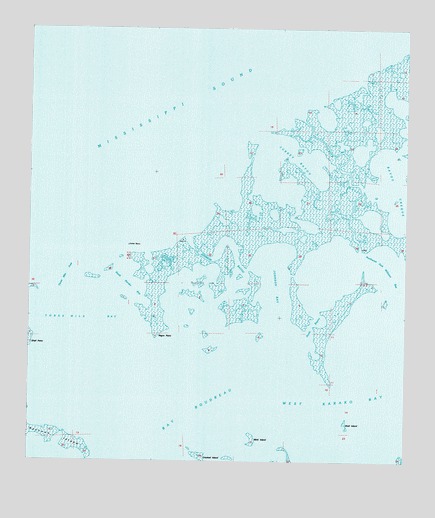
Three Mile Bay, LA USGS Topographic Map
Click on map above to begin viewing in our Map Viewer.

This topographic map contains these locations and features:
Feature Name Type Latitude Longitude GNIS ID View Map
Bayou CrequeGutN30.0846°W89.2531°559919View Map
Crooked IslandIslandN30.0019°W89.3167°560544View Map
Drum BayouGutN30.0869°W89.2703°560652View Map
Johnson BayBayN30.0508°W89.2928°1627366View Map
Johnson BayouGutN30.0624°W89.3103°1627367View Map
Little Raccoon IslandIslandN30.0210°W89.3459°1627535View Map
Mink IslandIslandN30.0071°W89.2998°1627671View Map
Negro PointCapeN30.0346°W89.3325°1627756View Map
North Karako BayBayN30.0513°W89.3414°1627790View Map
Northwest Jack Williams BayBayN30.0541°W89.2575°1627802View Map
Picnic BayouGutN30.0394°W89.2812°1627914View Map
Raccoon IslandIslandN30.0077°W89.3659°1628019View Map
Shell IslandIslandN30.0116°W89.2692°1628215View Map
Shell PointCapeN30.0338°W89.3739°1628221View Map
Three Mile BayBayN30.0416°W89.3612°1628359View Map
Three Mile PassChannelN30.0544°W89.3612°1628360View Map
Turkey BayouGutN30.0883°W89.2873°1628389View Map
West Karako BayBayN30.0169°W89.2542°1628475View Map

Note: Coordinates in the location and feature list above are referenced to NAD83 datum.


Copyright (C) 2008-2025 Ryan Niemi / Sunset Dynamics ... All Rights Reserved