TopoQuest Logo
Do you find TopoQuest useful?
Help keep TopoQuest running and adding new maps/features by donating!
Bitcoin:  19c7KJd3qBynnjoSw5npx9KScwjBe4ifkT
Litecoin:  LXs6TkuXGGXo1vDsWCkWVdjQX94eUKd6ui
Home View Maps Find Maps Find Places Resources & Links


Dorchester, Iowa Topographic Map

USGS Map Title: Dorchester, IA
USGS Map MRC: 43091D5
DRG (GeoTIFF) Download: o43091d5.tif


Neighboring USGS Topographic Map Quads:


  Spring Grove, MN  
43091E6
 

  Wilmington, MN  
43091E5
 

  Eitzen, MN  
43091E4
 

  Highlandville, IA  
43091D6
 

  Dorchester, IA  
43091D5
 

  Waukon NW, IA  
43091D4
 

  Freeport, IA  
43091C6
 

  Hanover, IA  
43091C5
 

  Waukon, IA  
43091C4


Map MRC Location:

N44°
W92°
N44°
W91°
H8 H7 H6 H5 H4 H3 H2 H1
G8 G7 G6 G5 G4 G3 G2 G1
F8 F7 F6 F5 F4 F3 F2 F1
E8 E7 E6 E5 E4 E3 E2 E1
D8 D7 D6 D5 D4 D3 D2 D1
C8 C7 C6 C5 C4 C3 C2 C1
B8 B7 B6 B5 B4 B3 B2 B1
A8 A7 A6 A5 A4 A3 A2 A1
N43°
W92°
N43°
W91°

Dorchester, IA USGS 1:24K Topographic Map Preview:
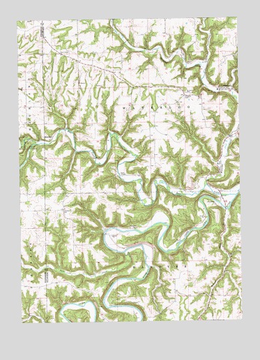
Dorchester, IA USGS Topographic Map
Click on map above to begin viewing in our Map Viewer.

This topographic map contains these locations and features:
Feature Name Type Latitude Longitude GNIS ID View Map
Bear CreekStreamN43.4266°W91.5026°454407View Map
Bear Creek Public AccessParkN43.4469°W91.6207°454422View Map
BergenLocaleN43.5000°W91.5654°466318View Map
Bergen Post Office (historical)Post OfficeN43.4994°W91.5668°1948825View Map
Camp TahigwaLocaleN43.4350°W91.5676°455133View Map
Camp Tahigwa Landing Site HeliportAirportN43.4389°W91.5674°466781View Map
DorchesterPopulated PlaceN43.4697°W91.5110°455958View Map
Dorchester Post OfficePost OfficeN43.4708°W91.5085°1948921View Map
Duck CreekStreamN43.4788°W91.5191°456043View Map
Iowa River CemeteryCemeteryN43.4211°W91.6010°457835View Map
Iverson Bottoms Wildlife Management AreaParkN43.4139°W91.5835°1948777View Map
Lonning's Landing Campground and Canoe SiteLocaleN43.4278°W91.5113°1948779View Map
Mineral CreekStreamN43.4214°W91.5063°459125View Map
New Galena Post Office (historical)Post OfficeN43.4319°W91.5274°1948824View Map
North Bear CreekStreamN43.4483°W91.6157°459552View Map
O'Hare Place CemeteryCemeteryN43.4083°W91.5585°1948922View Map
Paint CreekStreamN43.4033°W91.5665°459989View Map
Pete's CampgroundLocaleN43.4708°W91.5015°1948780View Map
Pine Creek Wildlife Management AreaParkN43.3986°W91.6113°1941282View Map
QuandahlPopulated PlaceN43.4500°W91.6065°460480View Map
Quandahl Post Office (historical)Post OfficeN43.4500°W91.6065°1948799View Map
Saint Johns CemeteryCemeteryN43.4689°W91.5304°461038View Map
Saint Marys CemeteryCemeteryN43.4672°W91.5307°461194View Map
Saint Marys ChurchChurchN43.4708°W91.5085°1948920View Map
South Bear CreekStreamN43.4486°W91.6157°461761View Map
Swenson Farm CemeteryCemeteryN43.4916°W91.6224°1941393View Map
Township of HanoverCivilN43.3851°W91.5511°467998View Map
Township of WaterlooCivilN43.4645°W91.5509°468950View Map
Waterloo CreekStreamN43.4303°W91.5204°462729View Map
Waterloo Creek Wildlife Management AreaParkN43.4889°W91.5460°1948778View Map
Waterloo Ridge CemeteryCemeteryN43.4852°W91.6002°1948945View Map
Waterloo Ridge ChurchChurchN43.4850°W91.6007°462731View Map
West Waterloo Ridge CemeteryCemeteryN43.4916°W91.6001°1948946View Map

Note: Coordinates in the location and feature list above are referenced to NAD83 datum.


Copyright (C) 2008-2025 Ryan Niemi / Sunset Dynamics ... All Rights Reserved