TopoQuest Logo
Do you find TopoQuest useful?
Help keep TopoQuest running and adding new maps/features by donating!
Bitcoin:  19c7KJd3qBynnjoSw5npx9KScwjBe4ifkT
Litecoin:  LXs6TkuXGGXo1vDsWCkWVdjQX94eUKd6ui
Home View Maps Find Maps Find Places Resources & Links


Waukon NW, Iowa Topographic Map

USGS Map Title: Waukon NW, IA
USGS Map MRC: 43091D4
DRG (GeoTIFF) Download: o43091d4.tif


Neighboring USGS Topographic Map Quads:


  Wilmington, MN  
43091E5
 

  Eitzen, MN  
43091E4
 

  Reno, MN  
43091E3
 

  Dorchester, IA  
43091D5
 

  Waukon NW, IA  
43091D4
 

  New Albin, IA  
43091D3
 

  Hanover, IA  
43091C5
 

  Waukon, IA  
43091C4
 

  Church, IA  
43091C3


Map MRC Location:

N44°
W92°
N44°
W91°
H8 H7 H6 H5 H4 H3 H2 H1
G8 G7 G6 G5 G4 G3 G2 G1
F8 F7 F6 F5 F4 F3 F2 F1
E8 E7 E6 E5 E4 E3 E2 E1
D8 D7 D6 D5 D4 D3 D2 D1
C8 C7 C6 C5 C4 C3 C2 C1
B8 B7 B6 B5 B4 B3 B2 B1
A8 A7 A6 A5 A4 A3 A2 A1
N43°
W92°
N43°
W91°

Waukon NW, IA USGS 1:24K Topographic Map Preview:
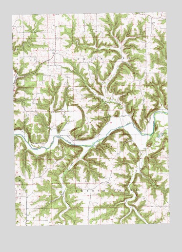
Waukon NW, IA USGS Topographic Map
Click on map above to begin viewing in our Map Viewer.

This topographic map contains these locations and features:
Feature Name Type Latitude Longitude GNIS ID View Map
Clear CreekStreamN43.4336°W91.4087°455453View Map
Clear Creek Post Office (historical)Post OfficeN43.4389°W91.4204°466420View Map
Clear Creek Wildlife Management AreaParkN43.4639°W91.4168°1948783View Map
English Bench CemeteryCemeteryN43.4264°W91.4536°1948926View Map
French CreekStreamN43.4269°W91.3887°456770View Map
French Creek Methodist CemeteryCemeteryN43.3998°W91.4258°1948971View Map
French Creek Post Office (historical)Post OfficeN43.4086°W91.4004°466421View Map
French Creek Wildlife Management AreaParkN43.3944°W91.4057°1948781View Map
Mount Hope CemeteryCemeteryN43.4387°W91.4234°1948973View Map
Mount Hope ChurchChurchN43.4380°W91.4232°459305View Map
Rex Post Office (historical)Post OfficeN43.4000°W91.4307°1948796View Map
Saint Johns ChurchChurchN43.4930°W91.3871°461067View Map
Silver CreekStreamN43.4214°W91.4374°461623View Map
Township of French CreekCivilN43.3850°W91.4302°467883View Map
Township of Union CityCivilN43.4643°W91.4301°468848View Map
Upper Iowa Canoe AccessLocaleN43.4283°W91.4626°1948782View Map
Upper Iowa River BridgeBridgeN43.4328°W91.4118°1948974View Map
Wheatland CemeteryCemeteryN43.4937°W91.3879°1948972View Map

Note: Coordinates in the location and feature list above are referenced to NAD83 datum.


Copyright (C) 2008-2024 Ryan Niemi / Sunset Dynamics ... All Rights Reserved