TopoQuest Logo
Do you find TopoQuest useful?
Help keep TopoQuest running and adding new maps/features by donating!
Bitcoin:  19c7KJd3qBynnjoSw5npx9KScwjBe4ifkT
Litecoin:  LXs6TkuXGGXo1vDsWCkWVdjQX94eUKd6ui
Home View Maps Find Maps Find Places Resources & Links


Dorset, Minnesota Topographic Map

USGS Map Title: Dorset, MN
USGS Map MRC: 46094H8
DRG (GeoTIFF) Download: o46094h8.tif


Neighboring USGS Topographic Map Quads:


  Park Rapids, MN  
46095H1
 

  Dorset, MN  
46094H8
 

  Nevis, MN  
46094H7
 

  Menahga, MN  
46095G1
 

  Huntersville, MN  
46094G8
 

  First Crow Wing Lake, MN  
46094G7


Map MRC Location:

N47°
W95°
N47°
W94°
H8 H7 H6 H5 H4 H3 H2 H1
G8 G7 G6 G5 G4 G3 G2 G1
F8 F7 F6 F5 F4 F3 F2 F1
E8 E7 E6 E5 E4 E3 E2 E1
D8 D7 D6 D5 D4 D3 D2 D1
C8 C7 C6 C5 C4 C3 C2 C1
B8 B7 B6 B5 B4 B3 B2 B1
A8 A7 A6 A5 A4 A3 A2 A1
N46°
W95°
N46°
W94°

Dorset, MN USGS 1:24K Topographic Map Preview:
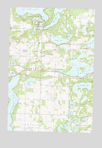
Dorset, MN USGS Topographic Map
Click on map above to begin viewing in our Map Viewer.

This topographic map contains these locations and features:
Feature Name Type Latitude Longitude GNIS ID View Map
Bear's Den Golf CourseLocaleN46.9181°W94.9847°2093934View Map
Beaver LakeLakeN46.9849°W94.9628°639835View Map
Bethel CemeteryCemeteryN46.8852°W94.9528°640022View Map
Boulder LakeLakeN46.9678°W94.9282°640399View Map
Clausens LakeLakeN46.9774°W94.8904°641259View Map
Crow Wing Number 5 Lake DamDamN46.9100°W94.8920°1776220View Map
Deer LakeLakeN46.9763°W94.9642°642726View Map
DorsetPopulated PlaceN46.9563°W94.9525°642900View Map
Dorset Lookout TowerTowerN46.9552°W94.9761°659822View Map
Dorset Post Office (historical)Post OfficeN46.9564°W94.9522°2093892View Map
Dorset Railroad Station (historical)LocaleN46.9564°W94.9522°2093891View Map
Evergreen Lodge Golf CourseLocaleN46.9931°W94.9931°2093935View Map
Fifth Crow Wing LakeLakeN46.9211°W94.8925°643623View Map
First English Lutheran ChurchChurchN46.9556°W94.9517°2093894View Map
Gartner DairyLocaleN46.9569°W94.9872°2674519View Map
Goat IslandIslandN46.9388°W94.8928°644193View Map
Hellkamp CreekStreamN46.9230°W94.9036°644854View Map
Henrietta CemeteryCemeteryN46.9225°W94.9533°644880View Map
Ida LakeLakeN46.9812°W94.9546°645330View Map
Lake Belle TaineLakeN46.9434°W94.8870°655321View Map
Little Sand LakeLakeN46.9913°W94.9322°646924View Map
Little Stony LakeLakeN46.8871°W94.9018°646938View Map
Long LakeLakeN46.8912°W94.9988°647120View Map
Long LakeLakeN46.9013°W94.9953°647121View Map
Loon LakeLakeN46.9883°W94.9603°647172View Map
Mud LakeLakeN46.9328°W94.9943°648324View Map
Park Rapids PitMineN46.9415°W94.9440°2729405View Map
Peysenske LakeLakeN46.9256°W94.9672°649341View Map
Pine ManorBuildingN46.9235°W94.9047°2697214View Map
Rockwell LakeLakeN46.9432°W94.9941°650210View Map
Round LakeLakeN46.9717°W94.9121°650350View Map
Sand RiverGutN46.9822°W94.9158°651169View Map
Shallow LakeLakeN46.9678°W94.8761°658227View Map
Shinker LakeLakeN46.9028°W94.9056°651989View Map
Stockade CampgroundLocaleN46.9292°W94.9944°2093906View Map
Sunday LakeLakeN46.8940°W94.9085°652808View Map
Township of HenriettaCivilN46.9356°W94.9727°664455View Map

Note: Coordinates in the location and feature list above are referenced to NAD83 datum.


Copyright (C) 2008-2025 Ryan Niemi / Sunset Dynamics ... All Rights Reserved