TopoQuest Logo
Do you find TopoQuest useful?
Help keep TopoQuest running and adding new maps/features by donating!
Bitcoin:  19c7KJd3qBynnjoSw5npx9KScwjBe4ifkT
Litecoin:  LXs6TkuXGGXo1vDsWCkWVdjQX94eUKd6ui
Home View Maps Find Maps Find Places Resources & Links


Double Springs, Mississippi Topographic Map

USGS Map Title: Double Springs, MS
USGS Map MRC: 33089D1
DRG (GeoTIFF) Download: o33089d1.tif


Neighboring USGS Topographic Map Quads:


  Sapa, MS  
33089E2
 

  Maben, MS  
33089E1
 

  Pheba, MS  
33088E8
 

  Reform, MS  
33089D2
 

  Double Springs, MS  
33089D1
 

  Longview, MS  
33088D8
 

  Ackerman, MS  
33089C2
 

  Sturgis, MS  
33089C1
 

  Bradley, MS  
33088C8


Map MRC Location:

N34°
W90°
N34°
W89°
H8 H7 H6 H5 H4 H3 H2 H1
G8 G7 G6 G5 G4 G3 G2 G1
F8 F7 F6 F5 F4 F3 F2 F1
E8 E7 E6 E5 E4 E3 E2 E1
D8 D7 D6 D5 D4 D3 D2 D1
C8 C7 C6 C5 C4 C3 C2 C1
B8 B7 B6 B5 B4 B3 B2 B1
A8 A7 A6 A5 A4 A3 A2 A1
N33°
W90°
N33°
W89°

Double Springs, MS USGS 1:24K Topographic Map Preview:
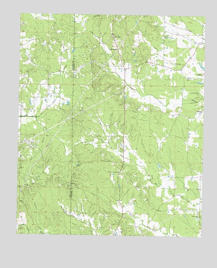
Double Springs, MS USGS Topographic Map
Click on map above to begin viewing in our Map Viewer.

This topographic map contains these locations and features:
Feature Name Type Latitude Longitude GNIS ID View Map
Bethlehem ChurchChurchN33.4460°W89.0014°667012View Map
Big Creek Methodist CemeteryCemeteryN33.4105°W89.0566°705748View Map
Big Creek Methodist ChurchChurchN33.4110°W89.0567°667109View Map
Busby School (historical)SchoolN33.4682°W89.1073°685837View Map
Butler Lake DamDamN33.4685°W89.0651°682112View Map
Bywy CreekStreamN33.4493°W89.1031°667897View Map
Dido (historical)LocaleN33.4098°W89.1081°685844View Map
Double SpringsPopulated PlaceN33.4815°W89.0609°669348View Map
Double Springs Baptist ChurchChurchN33.4876°W89.0634°669351View Map
Double Springs CemeteryCemeteryN33.4871°W89.0612°705755View Map
Double Springs Post Office (historical)Post OfficeN33.4035°W89.0756°712158View Map
Dudley BranchStreamN33.3762°W89.1076°685848View Map
Faith Pentecostal Church of GodChurchN33.4857°W89.0609°682929View Map
Furcher BranchStreamN33.4354°W89.1084°685890View Map
Glade BranchStreamN33.4415°W89.1134°670416View Map
High (historical)LocaleN33.4437°W89.0217°682947View Map
Kleban Lake DamDamN33.4151°W89.0301°682065View Map
LebanonLocaleN33.4565°W89.0667°682956View Map
Lost Lake DamDamN33.3851°W89.0117°682038View Map
Maben Lookout TowerTowerN33.4998°W89.0726°711270View Map
McMinn CemeteryCemeteryN33.4129°W89.1237°673407View Map
McMinn Lake DamDamN33.4068°W89.0384°682060View Map
Mount Olive CemeteryCemeteryN33.4176°W89.0670°674112View Map
Pleasant RidgePopulated PlaceN33.3862°W89.0020°682994View Map
Pleasant Ridge Baptist ChurchChurchN33.3865°W89.0023°676117View Map
Pleasant Ridge CemeteryCemeteryN33.3879°W89.0034°705767View Map
Self CreekPopulated PlaceN33.4654°W89.0112°683011View Map
Self Creek Bible Baptist ChurchChurchN33.4876°W89.0281°675252View Map
Self Creek CemeteryCemeteryN33.4648°W89.0123°705772View Map
Self Creek Christian AcademySchoolN33.4873°W89.0273°683012View Map
Self Creek Southern Baptist ChurchChurchN33.4648°W89.0120°677506View Map
Spring Hill CemeteryCemeteryN33.4015°W89.1176°707528View Map
Springhill ChurchChurchN33.4021°W89.1184°678183View Map
Steadman School (historical)SchoolN33.3779°W89.1084°685882View Map
Steelville (historical)LocaleN33.4115°W89.0556°705776View Map

Note: Coordinates in the location and feature list above are referenced to NAD83 datum.


Copyright (C) 2008-2025 Ryan Niemi / Sunset Dynamics ... All Rights Reserved