TopoQuest Logo
Do you find TopoQuest useful?
Help keep TopoQuest running and adding new maps/features by donating!
Bitcoin:  19c7KJd3qBynnjoSw5npx9KScwjBe4ifkT
Litecoin:  LXs6TkuXGGXo1vDsWCkWVdjQX94eUKd6ui
Home View Maps Find Maps Find Places Resources & Links


Reform, Mississippi Topographic Map

USGS Map Title: Reform, MS
USGS Map MRC: 33089D2
DRG (GeoTIFF) Download: o33089d2.tif


Neighboring USGS Topographic Map Quads:


  Eupora, MS  
33089E3
 

  Sapa, MS  
33089E2
 

  Maben, MS  
33089E1
 

  Tomnolen, MS  
33089D3
 

  Reform, MS  
33089D2
 

  Double Springs, MS  
33089D1
 

  Weir, MS  
33089C3
 

  Ackerman, MS  
33089C2
 

  Sturgis, MS  
33089C1


Map MRC Location:

N34°
W90°
N34°
W89°
H8 H7 H6 H5 H4 H3 H2 H1
G8 G7 G6 G5 G4 G3 G2 G1
F8 F7 F6 F5 F4 F3 F2 F1
E8 E7 E6 E5 E4 E3 E2 E1
D8 D7 D6 D5 D4 D3 D2 D1
C8 C7 C6 C5 C4 C3 C2 C1
B8 B7 B6 B5 B4 B3 B2 B1
A8 A7 A6 A5 A4 A3 A2 A1
N33°
W90°
N33°
W89°

Reform, MS USGS 1:24K Topographic Map Preview:
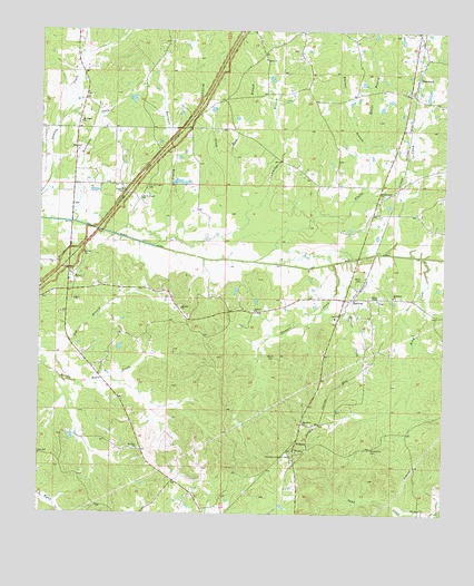
Reform, MS USGS Topographic Map
Click on map above to begin viewing in our Map Viewer.

This topographic map contains these locations and features:
Feature Name Type Latitude Longitude GNIS ID View Map
Antioch ChurchChurchN33.4276°W89.1845°666320View Map
Antiocho CemeteryCemeteryN33.4276°W89.1842°707487View Map
Baker School (historical)SchoolN33.3923°W89.1459°685830View Map
Bethany ChurchChurchN33.4282°W89.2067°666869View Map
Bethsalem Baptist ChurchChurchN33.4312°W89.1409°667033View Map
Bethsalem CemeteryCemeteryN33.4312°W89.1401°707492View Map
Blytha CreekStreamN33.4404°W89.1851°667347View Map
Blytha Creek ChurchChurchN33.4571°W89.1451°667348View Map
Blythe Creek CemeteryCemeteryN33.4576°W89.1431°707495View Map
Boatman BranchStreamN33.4451°W89.2140°667352View Map
Boatner BranchStreamN33.4715°W89.1509°667353View Map
Booth Lake DamDamN33.4818°W89.2201°682135View Map
Bowles CemeteryCemeteryN33.4421°W89.2367°667475View Map
Brooks Lake DamDamN33.4835°W89.1301°682137View Map
Burdine Lake DamDamN33.4668°W89.2067°682108View Map
BywyPopulated PlaceN33.4373°W89.2412°667894View Map
Bywy ChurchChurchN33.4304°W89.2392°667895View Map
Bywy Volunteer Fire DepartmentBuildingN33.4378°W89.2407°2665874View Map
Center Ridge School (historical)SchoolN33.4721°W89.1845°685840View Map
Choctaw Lookout TowerTowerN33.3898°W89.1720°711216View Map
Cummings BranchStreamN33.4471°W89.1951°669017View Map
E L Sherdan Pond DamDamN33.4701°W89.1251°682115View Map
Hebron School (historical)SchoolN33.4758°W89.2389°685854View Map
Hester BranchStreamN33.4590°W89.1495°671138View Map
Hurricane CreekStreamN33.4504°W89.2403°671612View Map
K T Barnett Lake DamDamN33.3951°W89.2384°682054View Map
King CreekStreamN33.4418°W89.1317°672153View Map
Macedonia CemeteryCemeteryN33.3915°W89.1470°672989View Map
Macedonia Primitive Baptist ChurchChurchN33.3987°W89.1681°673012View Map
Mount Nebo ChurchChurchN33.3918°W89.2192°674095View Map
Mount Pisgah Baptist ChurchChurchN33.4762°W89.2381°674202View Map
Mount Pisgah CemeteryCemeteryN33.4759°W89.2381°1805886View Map
Mud BranchStreamN33.4607°W89.1912°674427View Map
Nebo CemeteryCemeteryN33.3921°W89.2203°707519View Map
Old Mount Pisgah CemeteryCemeteryN33.4598°W89.2181°675211View Map
Old Mount Pisgah ChurchChurchN33.4565°W89.2195°675213View Map
Pensacola (historical)LocaleN33.3848°W89.2065°685864View Map
Phillips CreekStreamN33.4551°W89.1848°675690View Map
Pilgrims Rest ChurchChurchN33.4373°W89.2398°685866View Map
Pilgrims Rest School (historical)SchoolN33.4423°W89.2334°685867View Map
Pinto (historical)LocaleN33.4840°W89.1801°685870View Map
ReformPopulated PlaceN33.4307°W89.1548°676586View Map
Reform ChapelChurchN33.4304°W89.1459°676587View Map
Reform Consolidated School (historical)SchoolN33.4257°W89.1587°685874View Map
Reform Volunteer Fire DepartmentBuildingN33.4276°W89.1551°2665876View Map
Rhiner CreekStreamN33.4398°W89.1459°676613View Map
Robinson ChapelChurchN33.4590°W89.2253°676728View Map
Robinson Chapel School (historical)SchoolN33.4593°W89.2251°685875View Map
Robinsons Store (historical)LocaleN33.4398°W89.2487°685876View Map
SherwoodPopulated PlaceN33.4879°W89.1340°677658View Map
Stewart CreekStreamN33.4398°W89.1603°678284View Map
Supervisor District 2CivilN33.4699°W89.1928°711804View Map
WEXA-FM (Eupora)TowerN33.4718°W89.2267°680241View Map
WilliamsPopulated PlaceN33.3946°W89.1698°679700View Map
Wood CemeteryCemeteryN33.4357°W89.1512°679829View Map

Note: Coordinates in the location and feature list above are referenced to NAD83 datum.


Copyright (C) 2008-2024 Ryan Niemi / Sunset Dynamics ... All Rights Reserved