TopoQuest Logo
Do you find TopoQuest useful?
Help keep TopoQuest running and adding new maps/features by donating!
Bitcoin:  19c7KJd3qBynnjoSw5npx9KScwjBe4ifkT
Litecoin:  LXs6TkuXGGXo1vDsWCkWVdjQX94eUKd6ui
Home View Maps Find Maps Find Places Resources & Links


Sturgis, Mississippi Topographic Map

USGS Map Title: Sturgis, MS
USGS Map MRC: 33089C1
DRG (GeoTIFF) Download: o33089c1.tif


Neighboring USGS Topographic Map Quads:


  Reform, MS  
33089D2
 

  Double Springs, MS  
33089D1
 

  Longview, MS  
33088D8
 

  Ackerman, MS  
33089C2
 

  Sturgis, MS  
33089C1
 

  Bradley, MS  
33088C8
 

  Highpoint, MS  
33089B2
 

  Louisville North, MS  
33089B1
 

  Betheden, MS  
33088B8


Map MRC Location:

N34°
W90°
N34°
W89°
H8 H7 H6 H5 H4 H3 H2 H1
G8 G7 G6 G5 G4 G3 G2 G1
F8 F7 F6 F5 F4 F3 F2 F1
E8 E7 E6 E5 E4 E3 E2 E1
D8 D7 D6 D5 D4 D3 D2 D1
C8 C7 C6 C5 C4 C3 C2 C1
B8 B7 B6 B5 B4 B3 B2 B1
A8 A7 A6 A5 A4 A3 A2 A1
N33°
W90°
N33°
W89°

Sturgis, MS USGS 1:24K Topographic Map Preview:
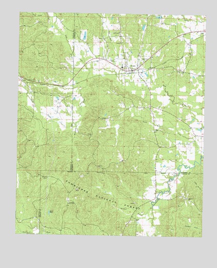
Sturgis, MS USGS Topographic Map
Click on map above to begin viewing in our Map Viewer.

This topographic map contains these locations and features:
Feature Name Type Latitude Longitude GNIS ID View Map
Bearfoot BranchStreamN33.2660°W89.0337°692496View Map
Beaver PondReservoirN33.2623°W89.1027°692513View Map
Berry Thomas School (historical)SchoolN33.3273°W89.0934°705143View Map
Bethel (historical)LocaleN33.2885°W89.0709°704469View Map
Bethel CemeteryCemeteryN33.2882°W89.0695°705746View Map
Bethel ChurchChurchN33.2890°W89.0703°692562View Map
Blackwood CemeteryCemeteryN33.2815°W89.1064°692634View Map
Bogue FallahStreamN33.3110°W89.0859°692664View Map
Boughenia CreekStreamN33.3437°W89.0776°692676View Map
BughPopulated PlaceN33.3662°W89.0017°692759View Map
Cannon (historical)LocaleN33.3348°W89.0903°685839View Map
Chestnut Grove Baptist ChurchChurchN33.2910°W89.0728°704471View Map
Choctaw State Wildlife Management AreaParkN33.2585°W89.1167°705531View Map
Church of GodChurchN33.3410°W89.0009°692909View Map
Colemans Lake DamDamN33.3185°W89.0651°695486View Map
Cork Colored School (historical)SchoolN33.3007°W89.1198°705147View Map
Elliotts Store (historical)LocaleN33.3404°W89.0862°704472View Map
FulcherPopulated PlaceN33.3382°W89.1231°693274View Map
Liberty Hill United Methodist ChurchChurchN33.3093°W89.0323°692681View Map
McKinnon Lake DamDamN33.3701°W89.0551°695491View Map
Mount Airy Baptist ChurchChurchN33.3435°W89.0173°694048View Map
Mount Zion Missionary Baptist ChurchChurchN33.3587°W89.0573°694116View Map
Old Sturgis CemeteryCemeteryN33.3493°W89.0428°694271View Map
Pleasant Hill ChurchChurchN33.2712°W89.0098°694435View Map
Pleasant Hill Number One CemeteryCemeteryN33.2718°W89.0103°710068View Map
Quinns Mill (historical)LocaleN33.3376°W89.0190°704476View Map
Red Bank CreekStreamN33.3393°W89.0576°694521View Map
Shaw Lake DamDamN33.3601°W89.0834°695490View Map
Spring Hill ChurchChurchN33.2854°W89.0673°694867View Map
SturgisPopulated PlaceN33.3446°W89.0453°694900View Map
Sturgis Attendance CenterSchoolN33.3448°W89.0556°705777View Map
Sturgis Baptist ChurchChurchN33.3421°W89.0526°704477View Map
Sturgis CemeteryCemeteryN33.3451°W89.0506°705778View Map
Sturgis Post OfficePost OfficeN33.3430°W89.0489°2768829View Map
Sturgis Presbyterian ChurchChurchN33.3448°W89.0501°704478View Map
Sturgis United Methodist ChurchChurchN33.3435°W89.0451°704479View Map
Sykes Mill (historical)LocaleN33.3723°W89.0126°704480View Map
Tombigbee Lookout TowerTowerN33.2685°W89.0898°711324View Map
Town of SturgisCivilN33.3452°W89.0458°2406676View Map
Wake Forest Baptist ChurchChurchN33.3643°W89.0578°695079View Map
Wake Forest CemeteryCemeteryN33.3654°W89.0570°705782View Map
Whitefield (historical)LocaleN33.3529°W89.0445°705784View Map

Note: Coordinates in the location and feature list above are referenced to NAD83 datum.


Copyright (C) 2008-2025 Ryan Niemi / Sunset Dynamics ... All Rights Reserved