TopoQuest Logo
Do you find TopoQuest useful?
Help keep TopoQuest running and adding new maps/features by donating!
Bitcoin:  19c7KJd3qBynnjoSw5npx9KScwjBe4ifkT
Litecoin:  LXs6TkuXGGXo1vDsWCkWVdjQX94eUKd6ui
Home View Maps Find Maps Find Places Resources & Links


Draketown, Georgia Topographic Map

USGS Map Title: Draketown, GA
USGS Map MRC: 33085G1
DRG (GeoTIFF) Download: o33085g1.tif


Neighboring USGS Topographic Map Quads:


  Felton, GA  
33085H2
 

  Rockmart South, GA  
33085H1
 

  Yorkville, GA  
33084H8
 

  Buchanan, GA  
33085G2
 

  Draketown, GA  
33085G1
 

  New Georgia, GA  
33084G8
 

  Bremen, GA  
33085F2
 

  Temple, GA  
33085F1
 

  Villa Rica, GA  
33084F8


Map MRC Location:

N34°
W86°
N34°
W85°
H8 H7 H6 H5 H4 H3 H2 H1
G8 G7 G6 G5 G4 G3 G2 G1
F8 F7 F6 F5 F4 F3 F2 F1
E8 E7 E6 E5 E4 E3 E2 E1
D8 D7 D6 D5 D4 D3 D2 D1
C8 C7 C6 C5 C4 C3 C2 C1
B8 B7 B6 B5 B4 B3 B2 B1
A8 A7 A6 A5 A4 A3 A2 A1
N33°
W86°
N33°
W85°

Draketown, GA USGS 1:24K Topographic Map Preview:
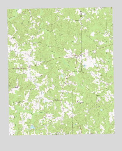
Draketown, GA USGS Topographic Map
Click on map above to begin viewing in our Map Viewer.

This topographic map contains these locations and features:
Feature Name Type Latitude Longitude GNIS ID View Map
Allgood ChurchChurchN33.8465°W85.0286°354287View Map
Asbury CemeteryCemeteryN33.7501°W85.0333°310639View Map
Ayresouth AirportAirportN33.7696°W85.0606°351927View Map
Baxter CreekStreamN33.7757°W85.1111°310870View Map
Brooks CreekStreamN33.8526°W85.0769°311832View Map
Corinth CemeteryCemeteryN33.8182°W85.1002°350623View Map
Corinth ChurchChurchN33.8184°W85.0994°355315View Map
District Line ChurchChurchN33.7843°W85.0683°313485View Map
DraketownPopulated PlaceN33.8262°W85.0441°331586View Map
Draketown Baptist ChurchChurchN33.8270°W85.0413°350624View Map
Draketown CemeteryCemeteryN33.8273°W85.0408°350625View Map
Draketown School (historical)SchoolN33.8282°W85.0388°350626View Map
Eaves Bridge (historical)BridgeN33.8665°W85.1169°350701View Map
Edgefield ChurchChurchN33.8282°W85.0208°355641View Map
Eulenfield LakeReservoirN33.7599°W85.0464°336055View Map
Fellowship ChurchChurchN33.8676°W85.0963°355788View Map
Foster LakeReservoirN33.8080°W85.0611°339936View Map
Foster Lake DamDamN33.8101°W85.0616°339935View Map
Friendship ChurchChurchN33.8465°W85.1194°314425View Map
Garrett LakeReservoirN33.7707°W85.0796°339120View Map
Golden CreekStreamN33.7707°W85.0966°356043View Map
Haney CemeteryCemeteryN33.8009°W85.0569°315084View Map
Haralson County Fire Department Station 14BuildingN33.8455°W85.0964°2604004View Map
Haralson County Fire Department Station 2BuildingN33.7824°W85.1029°2604443View Map
Hatfields LakeReservoirN33.7578°W85.0978°339118View Map
Lake VioletReservoirN33.8176°W85.0339°316569View Map
Lake Violet DamDamN33.8184°W85.0355°335884View Map
Liberty ChurchChurchN33.7501°W85.0683°316817View Map
Little River Structure Number Eight DamDamN33.7701°W85.0799°339119View Map
Little River Structure Number Seven DamDamN33.7601°W85.0983°339117View Map
Little Tallapoosa Watershed Dam Number OneDamN33.7601°W85.0449°336054View Map
McClendon CreekStreamN33.8468°W85.0122°317861View Map
Mill CreekStreamN33.8204°W85.0561°318205View Map
Mount Carmel CemeteryCemeteryN33.7901°W85.0230°349650View Map
Mount Carmel ChurchChurchN33.7873°W85.0205°318611View Map
Mud CreekStreamN33.8468°W85.0122°319111View Map
Oak Hill ChurchChurchN33.7812°W85.0391°319832View Map
Old Union Hill CemeteryCemeteryN33.7837°W85.1108°350657View Map
Panther CreekStreamN33.8282°W85.0661°326622View Map
Piney WoodsPopulated PlaceN33.8465°W85.0956°2508009View Map
Piney Woods CemeteryCemeteryN33.8404°W85.0958°350660View Map
Piney Woods ChurchChurchN33.8404°W85.0949°320737View Map
Pleasant Grove ChurchChurchN33.8620°W85.0388°320838View Map
Suburban EstatesPopulated PlaceN33.8265°W85.0222°349951View Map
Ton Wiggins DamDamN33.7918°W85.0166°336034View Map
Union Hill CemeteryCemeteryN33.7818°W85.1111°350682View Map
Union Hill ChurchChurchN33.7826°W85.1108°324572View Map
Ward CemeteryCemeteryN33.7670°W85.0822°324835View Map
Wiggins DamDamN33.7734°W85.0149°339357View Map
Wiggins LakeReservoirN33.7736°W85.0153°339358View Map

Note: Coordinates in the location and feature list above are referenced to NAD83 datum.


Copyright (C) 2008-2024 Ryan Niemi / Sunset Dynamics ... All Rights Reserved