TopoQuest Logo
Do you find TopoQuest useful?
Help keep TopoQuest running and adding new maps/features by donating!
Bitcoin:  19c7KJd3qBynnjoSw5npx9KScwjBe4ifkT
Litecoin:  LXs6TkuXGGXo1vDsWCkWVdjQX94eUKd6ui
Home View Maps Find Maps Find Places Resources & Links


Drexel, Missouri Topographic Map

USGS Map Title: Drexel, MO
USGS Map MRC: 38094D5
DRG (GeoTIFF) Download: o38094d5.tif


Neighboring USGS Topographic Map Quads:


  Louisburg, KS  
38094E6
 

  Freeman, MO  
38094E5
 

  Everett, MO  
38094E4
 

  New Lancaster, KS  
38094D6
 

  Drexel, MO  
38094D5
 

  Main City, MO  
38094D4
 

  Boicourt, KS  
38094C6
 

  Amoret, MO  
38094C5
 

  Virginia, MO  
38094C4


Map MRC Location:

N39°
W95°
N39°
W94°
H8 H7 H6 H5 H4 H3 H2 H1
G8 G7 G6 G5 G4 G3 G2 G1
F8 F7 F6 F5 F4 F3 F2 F1
E8 E7 E6 E5 E4 E3 E2 E1
D8 D7 D6 D5 D4 D3 D2 D1
C8 C7 C6 C5 C4 C3 C2 C1
B8 B7 B6 B5 B4 B3 B2 B1
A8 A7 A6 A5 A4 A3 A2 A1
N38°
W95°
N38°
W94°

Drexel, MO USGS 1:24K Topographic Map Preview:
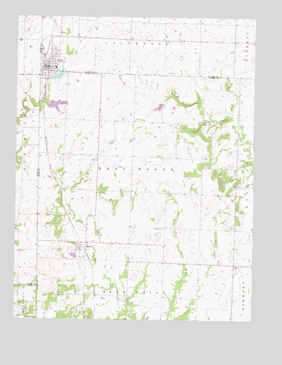
Drexel, MO USGS Topographic Map
Click on map above to begin viewing in our Map Viewer.

This topographic map contains these locations and features:
Feature Name Type Latitude Longitude GNIS ID View Map
Arvin Ranch Airport (historical)AirportN38.4403°W94.5933°758658View Map
Boone Lake DamDamN38.4650°W94.6102°763283View Map
DrexelPopulated PlaceN38.4795°W94.6086°729875View Map
Drexel City Reservoir SouthReservoirN38.4634°W94.6045°763115View Map
Drexel City Reservoir South DamDamN38.4633°W94.6086°763114View Map
Drexel Community Fire Protection AssociationBuildingN38.4787°W94.6096°2621048View Map
Drexel Elementary SchoolSchoolN38.4791°W94.6047°745938View Map
Drexel High SchoolSchoolN38.4795°W94.6044°2545084View Map
Drexel LakeReservoirN38.4754°W94.6030°762894View Map
Drexel Lake DamDamN38.4733°W94.6069°762893View Map
Drexel North Wastewater Treatment FacilityLocaleN38.4834°W94.6110°2477722View Map
Drexel Post OfficePost OfficeN38.4787°W94.6090°2779523View Map
Drexel South Wastewater Treatment FacilityLocaleN38.4738°W94.6095°2477723View Map
Edgewood CemeteryCemeteryN38.4124°W94.5468°755478View Map
Edgewood School (historical)SchoolN38.4131°W94.5366°745983View Map
Hodges Lake DamDamN38.4650°W94.5419°763112View Map
Maple Grove School (historical)SchoolN38.4575°W94.5808°745981View Map
May Airport (historical)AirportN38.4792°W94.5522°758659View Map
May LakeReservoirN38.4783°W94.5569°763275View Map
May Lake DamDamN38.4783°W94.5569°763274View Map
MerwinPopulated PlaceN38.4047°W94.5911°722244View Map
Rocking Chair Ranch Lake DamDamN38.4017°W94.5936°763113View Map
Shannon Circle S Ranch Lake DamDamN38.4000°W94.5769°763348View Map
Sharon CemeteryCemeteryN38.4775°W94.5466°726273View Map
South DrexelPopulated PlaceN38.4764°W94.6088°739483View Map
Township of West BooneCivilN38.4377°W94.5611°766311View Map
Village of MerwinCivilN38.4041°W94.5908°2399322View Map
West Point CemeteryCemeteryN38.3850°W94.5983°728608View Map
Woodland School (historical)SchoolN38.4567°W94.5361°745982View Map

Note: Coordinates in the location and feature list above are referenced to NAD83 datum.


Copyright (C) 2008-2024 Ryan Niemi / Sunset Dynamics ... All Rights Reserved