TopoQuest Logo
Do you find TopoQuest useful?
Help keep TopoQuest running and adding new maps/features by donating!
Bitcoin:  19c7KJd3qBynnjoSw5npx9KScwjBe4ifkT
Litecoin:  LXs6TkuXGGXo1vDsWCkWVdjQX94eUKd6ui
Home View Maps Find Maps Find Places Resources & Links


Main City, Missouri Topographic Map

USGS Map Title: Main City, MO
USGS Map MRC: 38094D4
DRG (GeoTIFF) Download: o38094d4.tif


Neighboring USGS Topographic Map Quads:


  Freeman, MO  
38094E5
 

  Everett, MO  
38094E4
 

  Austin, MO  
38094E3
 

  Drexel, MO  
38094D5
 

  Main City, MO  
38094D4
 

  Adrian, MO  
38094D3
 

  Amoret, MO  
38094C5
 

  Virginia, MO  
38094C4
 

  Butler, MO  
38094C3


Map MRC Location:

N39°
W95°
N39°
W94°
H8 H7 H6 H5 H4 H3 H2 H1
G8 G7 G6 G5 G4 G3 G2 G1
F8 F7 F6 F5 F4 F3 F2 F1
E8 E7 E6 E5 E4 E3 E2 E1
D8 D7 D6 D5 D4 D3 D2 D1
C8 C7 C6 C5 C4 C3 C2 C1
B8 B7 B6 B5 B4 B3 B2 B1
A8 A7 A6 A5 A4 A3 A2 A1
N38°
W95°
N38°
W94°

Main City, MO USGS 1:24K Topographic Map Preview:
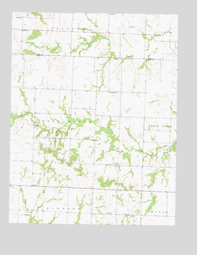
Main City, MO USGS Topographic Map
Click on map above to begin viewing in our Map Viewer.

This topographic map contains these locations and features:
Feature Name Type Latitude Longitude GNIS ID View Map
Buckhorn School (historical)SchoolN38.4111°W94.4283°745987View Map
BurdettPopulated PlaceN38.4336°W94.4827°715065View Map
Burdett CemeteryCemeteryN38.4403°W94.4833°715066View Map
Burdett School (historical)SchoolN38.4111°W94.4825°745989View Map
Dixie School (historical)SchoolN38.4114°W94.4825°745985View Map
Everett School (historical)SchoolN38.4996°W94.4268°717684View Map
Fairview ChurchChurchN38.3817°W94.4272°717786View Map
Fairview School (historical)SchoolN38.3817°W94.4263°745988View Map
Green Valley School (historical)SchoolN38.4533°W94.4263°718816View Map
LacyvillePopulated PlaceN38.3972°W94.4825°740999View Map
Main CityPopulated PlaceN38.4895°W94.4922°741037View Map
Main City School (historical)SchoolN38.4970°W94.4925°721761View Map
Mc Donnell AirportAirportN38.4887°W94.4124°758574View Map
McNeil School (historical)SchoolN38.4550°W94.4919°745984View Map
Millsap CreekStreamN38.4211°W94.3805°722409View Map
Silverdale School (historical)SchoolN38.3825°W94.4855°745986View Map
Township of East BooneCivilN38.4355°W94.4543°766292View Map

Note: Coordinates in the location and feature list above are referenced to NAD83 datum.


Copyright (C) 2008-2025 Ryan Niemi / Sunset Dynamics ... All Rights Reserved