TopoQuest Logo
Do you find TopoQuest useful?
Help keep TopoQuest running and adding new maps/features by donating!
Bitcoin:  19c7KJd3qBynnjoSw5npx9KScwjBe4ifkT
Litecoin:  LXs6TkuXGGXo1vDsWCkWVdjQX94eUKd6ui
Home View Maps Find Maps Find Places Resources & Links


Everett, Missouri Topographic Map

USGS Map Title: Everett, MO
USGS Map MRC: 38094E4
DRG (GeoTIFF) Download: o38094e4.tif


Neighboring USGS Topographic Map Quads:


  West Line, MO  
38094F5
 

  Peculiar, MO  
38094F4
 

  Harrisonville, MO  
38094F3
 

  Freeman, MO  
38094E5
 

  Everett, MO  
38094E4
 

  Austin, MO  
38094E3
 

  Drexel, MO  
38094D5
 

  Main City, MO  
38094D4
 

  Adrian, MO  
38094D3


Map MRC Location:

N39°
W95°
N39°
W94°
H8 H7 H6 H5 H4 H3 H2 H1
G8 G7 G6 G5 G4 G3 G2 G1
F8 F7 F6 F5 F4 F3 F2 F1
E8 E7 E6 E5 E4 E3 E2 E1
D8 D7 D6 D5 D4 D3 D2 D1
C8 C7 C6 C5 C4 C3 C2 C1
B8 B7 B6 B5 B4 B3 B2 B1
A8 A7 A6 A5 A4 A3 A2 A1
N38°
W95°
N38°
W94°

Everett, MO USGS 1:24K Topographic Map Preview:
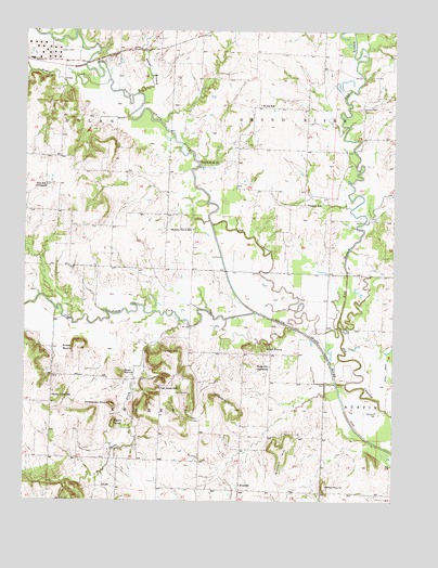
Everett, MO USGS Topographic Map
Click on map above to begin viewing in our Map Viewer.

This topographic map contains these locations and features:
Feature Name Type Latitude Longitude GNIS ID View Map
Adams BranchStreamN38.6083°W94.4625°713139View Map
Bieger MoundSummitN38.5406°W94.4827°714126View Map
Burford CemeteryCemeteryN38.6044°W94.3869°715067View Map
Bybee School (historical)SchoolN38.6053°W94.4208°715155View Map
Christiansen MoundSummitN38.5258°W94.4708°715822View Map
Dolan MoundSummitN38.5336°W94.4677°716966View Map
Dorsett HillSummitN38.5120°W94.4122°716993View Map
East Branch South Grand RiverStreamN38.5458°W94.3930°717259View Map
EverettPopulated PlaceN38.5045°W94.4272°717682View Map
Freeman Wastewater Treatment FacilityLocaleN38.6196°W94.4948°2477724View Map
Grand River ChurchChurchN38.5895°W94.4397°718674View Map
Hart Airport (historical)AirportN38.5495°W94.4766°758685View Map
Herrell HillSummitN38.5386°W94.4486°719404View Map
Hickory Grove School (historical)SchoolN38.5722°W94.4433°719472View Map
Hilltop MoundSummitN38.5045°W94.3983°719620View Map
Masters HillSummitN38.5245°W94.4286°721966View Map
Moudy CemeteryCemeteryN38.5286°W94.4444°722687View Map
Oak Grove School (historical)SchoolN38.5297°W94.4541°729938View Map
Oakland Farms LakeReservoirN38.5650°W94.4586°762600View Map
Oakland Farms Lake DamDamN38.5650°W94.4586°762599View Map
Osburn MoundSummitN38.5203°W94.4702°723866View Map
Owens CreekStreamN38.5483°W94.4480°723907View Map
Poney CreekStreamN38.6117°W94.4719°479422View Map
Prospect School (historical)SchoolN38.5792°W94.4052°724958View Map
Rocky Point School (historical)SchoolN38.5278°W94.4905°725525View Map
South Fork South Grand RiverStreamN38.5503°W94.4219°726755View Map
Steen MoundSummitN38.5411°W94.4186°727055View Map
Steen School (historical)SchoolN38.5358°W94.4169°727056View Map
Township of DolanCivilN38.6151°W94.4965°766436View Map
Township of EverettCivilN38.5180°W94.4543°766437View Map
Zion School (historical)SchoolN38.5839°W94.4930°729259View Map

Note: Coordinates in the location and feature list above are referenced to NAD83 datum.


Copyright (C) 2008-2024 Ryan Niemi / Sunset Dynamics ... All Rights Reserved