TopoQuest Logo
Do you find TopoQuest useful?
Help keep TopoQuest running and adding new maps/features by donating!
Bitcoin:  19c7KJd3qBynnjoSw5npx9KScwjBe4ifkT
Litecoin:  LXs6TkuXGGXo1vDsWCkWVdjQX94eUKd6ui
Home View Maps Find Maps Find Places Resources & Links


Dubre, Kentucky Topographic Map

USGS Map Title: Dubre, KY
USGS Map MRC: 36085G5
DRG (GeoTIFF) Download: o36085g5.tif


Neighboring USGS Topographic Map Quads:


  Summer Shade, KY  
36085H6
 

  Edmonton, KY  
36085H5
 

  Breeding, KY  
36085H4
 

  Sulphur Lick, KY  
36085G6
 

  Dubre, KY  
36085G5
 

  Waterview, KY  
36085G4
 

  Tompkinsville, KY  
36085F6
 

  Vernon, KY  
36085F5
 

  Blacks Ferry, KY  
36085F4


Map MRC Location:

N37°
W86°
N37°
W85°
H8 H7 H6 H5 H4 H3 H2 H1
G8 G7 G6 G5 G4 G3 G2 G1
F8 F7 F6 F5 F4 F3 F2 F1
E8 E7 E6 E5 E4 E3 E2 E1
D8 D7 D6 D5 D4 D3 D2 D1
C8 C7 C6 C5 C4 C3 C2 C1
B8 B7 B6 B5 B4 B3 B2 B1
A8 A7 A6 A5 A4 A3 A2 A1
N36°
W86°
N36°
W85°

Dubre, KY USGS 1:24K Topographic Map Preview:
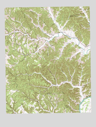
Dubre, KY USGS Topographic Map
Click on map above to begin viewing in our Map Viewer.

This topographic map contains these locations and features:
Feature Name Type Latitude Longitude GNIS ID View Map
Anderson HollowValleyN36.8447°W85.6188°485944View Map
Bacon BranchStreamN36.8181°W85.5961°486192View Map
Beck HollowValleyN36.8536°W85.5450°486642View Map
Big BranchStreamN36.8720°W85.5119°487130View Map
Black BranchStreamN36.7840°W85.5300°487352View Map
Bob HollowValleyN36.7784°W85.5272°2742608View Map
Broad BranchStreamN36.7523°W85.5175°487926View Map
Bryant BranchStreamN36.7826°W85.5502°488160View Map
Butler HollowValleyN36.8193°W85.5028°488515View Map
Casey Fork ChurchChurchN36.8698°W85.5091°489049View Map
Clark HollowValleyN36.8487°W85.5416°489541View Map
Clover Hill ChurchChurchN36.7564°W85.5836°489704View Map
Collins BranchStreamN36.7784°W85.5161°489857View Map
Creacy CemeteryCemeteryN36.8726°W85.5561°490314View Map
Davis HollowValleyN36.8460°W85.5274°490669View Map
DubrePopulated PlaceN36.8389°W85.5586°507879View Map
Ferris Fork CreekStreamN36.8448°W85.5422°492053View Map
Franklin CemeteryCemeteryN36.8256°W85.5144°492447View Map
Garmon BranchStreamN36.8470°W85.6089°492706View Map
Grey BranchStreamN36.7795°W85.5191°493371View Map
Harmon HollowValleyN36.8308°W85.5226°493756View Map
Hickory RidgeRidgeN36.7709°W85.5691°494145View Map
Hickory Ridge SchoolSchoolN36.7728°W85.5630°494152View Map
Hominy CreekStreamN36.8289°W85.5176°494468View Map
Humphrey HollowValleyN36.8296°W85.5597°494759View Map
Jody BranchStreamN36.7603°W85.5166°495290View Map
Kessler Ridge School (historical)SchoolN36.8306°W85.5980°495692View Map
Leamon HollowValleyN36.8423°W85.6206°496114View Map
Leatherwood CreekStreamN36.8356°W85.5641°496123View Map
Leatherwood SchoolSchoolN36.8295°W85.5572°496127View Map
Line SchoolSchoolN36.7520°W85.5291°496585View Map
MarrowbonePopulated PlaceN36.8278°W85.5066°497558View Map
Marrowbone Baptist ChurchChurchN36.8423°W85.5550°497559View Map
Marrowbone Census Designated PlaceCensusN36.8319°W85.5053°2629647View Map
Marrowbone West Cumberland Fire DepartmentBuildingN36.8309°W85.5112°2636636View Map
Mud CampLocaleN36.7859°W85.5405°498974View Map
Mud Camp BarFlatN36.7629°W85.5146°2742621View Map
Mud Camp CemeteryCemeteryN36.7817°W85.5222°498975View Map
Mud Camp Church of ChristChurchN36.7817°W85.5114°498976View Map
Mud Camp CreekStreamN36.7648°W85.5122°498977View Map
Murray BranchStreamN36.8231°W85.5772°499119View Map
Norris BranchStreamN36.8592°W85.5530°499527View Map
Oak Hill SchoolSchoolN36.8184°W85.6202°499709View Map
Palmore BranchStreamN36.7871°W85.5352°500141View Map
Pitman CreekStreamN36.8367°W85.5561°500775View Map
Pitman SchoolSchoolN36.8439°W85.5658°500779View Map
Rockhouse HollowValleyN36.7940°W85.6091°502209View Map
Shaw CreekStreamN36.8517°W85.5750°503276View Map
Simmons BranchStreamN36.8709°W85.5600°503520View Map
Slate CreekStreamN36.8426°W85.5925°503646View Map
Slick Rock SchoolSchoolN36.7609°W85.6027°503682View Map
Stillhouse HollowValleyN36.8424°W85.5966°504414View Map
Sulphur Spring HollowValleyN36.8458°W85.6099°504764View Map
Temple Hill Church (historical)ChurchN36.7651°W85.5991°505061View Map
Turner BranchStreamN36.8214°W85.5097°505646View Map
White HollowValleyN36.8329°W85.5122°506587View Map
Williams HollowValleyN36.8626°W85.5067°506826View Map
Willow ShadePopulated PlaceN36.8478°W85.6077°509378View Map
Wisdom CreekStreamN36.8570°W85.5002°506968View Map

Note: Coordinates in the location and feature list above are referenced to NAD83 datum.


Copyright (C) 2008-2024 Ryan Niemi / Sunset Dynamics ... All Rights Reserved