TopoQuest Logo
Do you find TopoQuest useful?
Help keep TopoQuest running and adding new maps/features by donating!
Bitcoin:  19c7KJd3qBynnjoSw5npx9KScwjBe4ifkT
Litecoin:  LXs6TkuXGGXo1vDsWCkWVdjQX94eUKd6ui
Home View Maps Find Maps Find Places Resources & Links


Dugdale, Minnesota Topographic Map

USGS Map Title: Dugdale, MN
USGS Map MRC: 47096F3
DRG (GeoTIFF) Download: o47096f3.tif


Neighboring USGS Topographic Map Quads:


  Gentilly, MN  
47096G4
 

  Marcoux Corners, MN  
47096G3
 

  Terrebonne, MN  
47096G2
 

  Harold, MN  
47096F4
 

  Dugdale, MN  
47096F3
 

  Mentor, MN  
47096F2
 

  Melvin, MN  
47096E4
 

  Fertile, MN  
47096E3
 

  Halverson Lake, MN  
47096E2


Map MRC Location:

N48°
W97°
N48°
W96°
H8 H7 H6 H5 H4 H3 H2 H1
G8 G7 G6 G5 G4 G3 G2 G1
F8 F7 F6 F5 F4 F3 F2 F1
E8 E7 E6 E5 E4 E3 E2 E1
D8 D7 D6 D5 D4 D3 D2 D1
C8 C7 C6 C5 C4 C3 C2 C1
B8 B7 B6 B5 B4 B3 B2 B1
A8 A7 A6 A5 A4 A3 A2 A1
N47°
W97°
N47°
W96°

Dugdale, MN USGS 1:24K Topographic Map Preview:
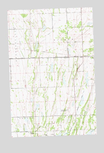
Dugdale, MN USGS Topographic Map
Click on map above to begin viewing in our Map Viewer.

This topographic map contains these locations and features:
Feature Name Type Latitude Longitude GNIS ID View Map
County Ditch Number One Hundred FortyCanalN47.6730°W96.3303°641686View Map
County Ditch Number One Hundred TwentynineCanalN47.6447°W96.3609°641644View Map
County Ditch Number SeventytwoCanalN47.6419°W96.2798°642294View Map
DugdaleLocaleN47.7017°W96.2661°2081422View Map
DugdalePopulated PlaceN47.7016°W96.2664°654680View Map
Dugdale Post Office (historical)Post OfficeN47.7017°W96.2661°2081423View Map
Glacial Ridge National Wildlife RefugeParkN47.7103°W96.2921°2765310View Map
Judicial Ditch Number SixtysixCanalN47.7430°W96.3092°1815115View Map
Leeston Post Office (historical)Post OfficeN47.6458°W96.2806°2081375View Map
Our Saviors CemeteryCemeteryN47.6263°W96.3131°649081View Map
Shypoke State Wildlife Management AreaParkN47.6483°W96.3048°652004View Map
Tilden JunctionPopulated PlaceN47.7022°W96.2889°654976View Map
Tilden Post Office (historical)Post OfficeN47.7028°W96.2917°2081345View Map
Township of GodfreyCivilN47.6296°W96.2593°664285View Map
Township of Tilden (historical)CivilN47.7094°W96.2881°665788View Map

Note: Coordinates in the location and feature list above are referenced to NAD83 datum.


Copyright (C) 2008-2025 Ryan Niemi / Sunset Dynamics ... All Rights Reserved