TopoQuest Logo
Do you find TopoQuest useful?
Help keep TopoQuest running and adding new maps/features by donating!
Bitcoin:  19c7KJd3qBynnjoSw5npx9KScwjBe4ifkT
Litecoin:  LXs6TkuXGGXo1vDsWCkWVdjQX94eUKd6ui
Home View Maps Find Maps Find Places Resources & Links


Dugout Valley, Alabama Topographic Map

USGS Map Title: Dugout Valley, AL
USGS Map MRC: 34085E6
DRG (GeoTIFF) Download: o34085e6.tif


Neighboring USGS Topographic Map Quads:


  Henagar, AL  
34085F7
 

  Ider, AL  
34085F6
 

  Sulphur Springs, AL  
34085F5
 

  Sylvania, AL  
34085E7
 

  Dugout Valley, AL  
34085E6
 

  Valley Head, AL  
34085E5
 

  Chavies, AL  
34085D7
 

  Fort Payne, AL  
34085D6
 

  Jamestown, AL  
34085D5


Map MRC Location:

N35°
W86°
N35°
W85°
H8 H7 H6 H5 H4 H3 H2 H1
G8 G7 G6 G5 G4 G3 G2 G1
F8 F7 F6 F5 F4 F3 F2 F1
E8 E7 E6 E5 E4 E3 E2 E1
D8 D7 D6 D5 D4 D3 D2 D1
C8 C7 C6 C5 C4 C3 C2 C1
B8 B7 B6 B5 B4 B3 B2 B1
A8 A7 A6 A5 A4 A3 A2 A1
N34°
W86°
N34°
W85°

Dugout Valley, AL USGS 1:24K Topographic Map Preview:
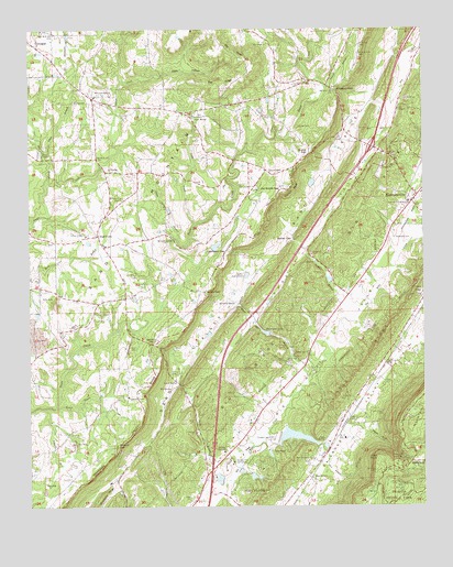
Dugout Valley, AL USGS Topographic Map
Click on map above to begin viewing in our Map Viewer.

This topographic map contains these locations and features:
Feature Name Type Latitude Longitude GNIS ID View Map
Allen BranchStreamN34.5193°W85.6747°150062View Map
Allen Memorial Baptist ChurchChurchN34.5126°W85.6600°158773View Map
Allen PointCapeN34.5129°W85.6391°150064View Map
Allen SpringSpringN34.5168°W85.6564°150065View Map
Allen SwitchLocaleN34.5081°W85.6602°150066View Map
Ashberry BranchStreamN34.5259°W85.7447°150075View Map
Barnard SpringSpringN34.5537°W85.6850°150081View Map
Bethel BranchStreamN34.5490°W85.6502°150089View Map
Bethel ChurchChurchN34.5643°W85.6597°150092View Map
Bethel GapGapN34.5698°W85.6664°150093View Map
Biddle GapGapN34.5923°W85.6622°150099View Map
Biddle Spring BranchStreamN34.5701°W85.7036°150100View Map
Big SpringSpringN34.5309°W85.7055°150109View Map
Blackburns Store (historical)LocaleN34.5959°W85.6522°1805302View Map
Chambers DamDamN34.5651°W85.6916°150636View Map
Chambers LakeReservoirN34.5651°W85.6916°150635View Map
Church of GodChurchN34.5634°W85.7072°157519View Map
Cordell (historical)Populated PlaceN34.5256°W85.6286°150670View Map
Cordell CemeteryCemeteryN34.5995°W85.6655°150168View Map
Council BluffCliffN34.5826°W85.6666°150170View Map
Council BluffPopulated PlaceN34.5868°W85.6733°156220View Map
Council Bluff School (historical)SchoolN34.5890°W85.6652°150672View Map
Cranes Store (historical)LocaleN34.5954°W85.6427°1805303View Map
Davenport CemeteryCemeteryN34.5704°W85.6341°150185View Map
Day BranchStreamN34.5854°W85.7444°150190View Map
Fort Payne City LakeReservoirN34.5183°W85.6665°150662View Map
Fort Payne DamDamN34.5181°W85.6708°150626View Map
Glade BranchStreamN34.5918°W85.7452°150258View Map
Green CemeteryCemeteryN34.5020°W85.6989°150264View Map
Hammond GapGapN34.5670°W85.6883°150275View Map
HammondvillePopulated PlaceN34.5818°W85.6266°150276View Map
Hammondville BranchStreamN34.5651°W85.6333°150277View Map
Hammondville Police DepartmentBuildingN34.5799°W85.6294°2751815View Map
Hammondville Volunteer Fire DepartmentBuildingN34.5794°W85.6283°2683172View Map
Hawkins ChapelChurchN34.5290°W85.7186°150282View Map
Hawkins Chapel School (historical)SchoolN34.5290°W85.7189°1805304View Map
Hawkins DamDamN34.5601°W85.6550°150634View Map
Hawkins LakeReservoirN34.5601°W85.6550°150633View Map
Henagar DivisionCivilN34.6124°W85.7216°165754View Map
High PointPopulated PlaceN34.5715°W85.7283°150290View Map
High Point Church of GodChurchN34.5837°W85.6797°150291View Map
High Point School (historical)SchoolN34.5687°W85.7266°150700View Map
House of Prayer ChurchChurchN34.5556°W85.6500°150702View Map
Interchange 231CrossingN34.5943°W85.6411°155701View Map
Johnson BranchStreamN34.6095°W85.6564°150307View Map
Keith BranchStreamN34.6123°W85.7130°1805305View Map
Keith HollowValleyN34.6113°W85.7204°150313View Map
Kings ChapelChurchN34.5509°W85.7291°150318View Map
LakewoodPopulated PlaceN34.5151°W85.6697°156576View Map
Lea ChapelChurchN34.6048°W85.6322°158854View Map
Lea Chapel School (historical)SchoolN34.6043°W85.6325°1805306View Map
Lyons SpringSpringN34.5329°W85.7033°150362View Map
Mays Gulf (historical)Populated PlaceN34.6043°W85.6791°150721View Map
McCurdy BridgeBridgeN34.5698°W85.7047°150375View Map
Mount Olive ChurchChurchN34.5809°W85.7202°150401View Map
Mount Olive Church (historical)ChurchN34.5679°W85.6866°157528View Map
New HomePopulated PlaceN34.6023°W85.6991°150422View Map
New Home School (historical)SchoolN34.6015°W85.6975°1805307View Map
Old Biddle GapGapN34.5831°W85.6705°150439View Map
Pea RidgeRidgeN34.6163°W85.6793°150449View Map
Pea Ridge ChurchChurchN34.6218°W85.6752°150450View Map
Pea Ridge School (historical)SchoolN34.6215°W85.6736°157534View Map
Pells Chapel (historical)ChurchN34.5084°W85.7361°157535View Map
Pine Grove ChurchChurchN34.5712°W85.7322°150457View Map
Prestwood DamDamN34.5450°W85.6739°150630View Map
Prestwood LakeReservoirN34.5455°W85.6751°150468View Map
Price CemeteryCemeteryN34.5287°W85.6475°150469View Map
Smith BranchStreamN34.5059°W85.6875°150515View Map
Smith CemeteryCemeteryN34.5345°W85.7052°150516View Map
Smith GapGapN34.5426°W85.7108°150519View Map
Snake CreekStreamN34.5737°W85.6980°150520View Map
Snake Creek (historical)Populated PlaceN34.6020°W85.7286°150744View Map
Snake GapGapN34.5562°W85.6947°150521View Map
StampPopulated PlaceN34.5879°W85.7261°150526View Map
Terrapin Hills Golf EstatesLocaleN34.5118°W85.6827°150548View Map
Thomas BranchStreamN34.5784°W85.6269°150551View Map
Town of HammondvilleCivilN34.5685°W85.6397°2406640View Map
Wade GapGapN34.5115°W85.6291°150570View Map
Wade GulfValleyN34.5209°W85.6486°150571View Map
Walker BranchStreamN34.5262°W85.7416°150572View Map
Welcome View ChurchChurchN34.6081°W85.7286°150580View Map
West Fork Bengis CreekStreamN34.5748°W85.7491°150584View Map
White Hall BranchStreamN34.5340°W85.6619°150588View Map
White Hall CemeteryCemeteryN34.5373°W85.6683°150589View Map
White Hall ChurchChurchN34.5406°W85.6616°150590View Map
Whiteoak GapGapN34.6087°W85.6527°150591View Map
Willow SpringSpringN34.5151°W85.6883°150596View Map
Wills LakeReservoirN34.5434°W85.6683°150629View Map
Wooten GapGapN34.5159°W85.7219°150602View Map

Note: Coordinates in the location and feature list above are referenced to NAD83 datum.


Copyright (C) 2008-2024 Ryan Niemi / Sunset Dynamics ... All Rights Reserved