TopoQuest Logo
Do you find TopoQuest useful?
Help keep TopoQuest running and adding new maps/features by donating!
Bitcoin:  19c7KJd3qBynnjoSw5npx9KScwjBe4ifkT
Litecoin:  LXs6TkuXGGXo1vDsWCkWVdjQX94eUKd6ui
Home View Maps Find Maps Find Places Resources & Links


Arapahoe, North Carolina Topographic Map

USGS Map Title: Arapahoe, NC
USGS Map MRC: 35076A7
DRG (GeoTIFF) Download: o35076a7.tif


Neighboring USGS Topographic Map Quads:


  Reelsboro, NC  
35076B8
 

  Bayboro, NC  
35076B7
 

  Vandemere, NC  
35076B6
 

  Upper Broad Creek, NC  
35076A8
 

  Arapahoe, NC  
35076A7
 

  Oriental, NC  
35076A6
 

  Havelock, NC  
34076H8
 

  Cherry Point, NC  
34076H7
 

  Merrimon, NC  
34076H6


Map MRC Location:

N36°
W77°
N36°
W76°
H8 H7 H6 H5 H4 H3 H2 H1
G8 G7 G6 G5 G4 G3 G2 G1
F8 F7 F6 F5 F4 F3 F2 F1
E8 E7 E6 E5 E4 E3 E2 E1
D8 D7 D6 D5 D4 D3 D2 D1
C8 C7 C6 C5 C4 C3 C2 C1
B8 B7 B6 B5 B4 B3 B2 B1
A8 A7 A6 A5 A4 A3 A2 A1
N35°
W77°
N35°
W76°

Arapahoe, NC USGS 1:24K Topographic Map Preview:
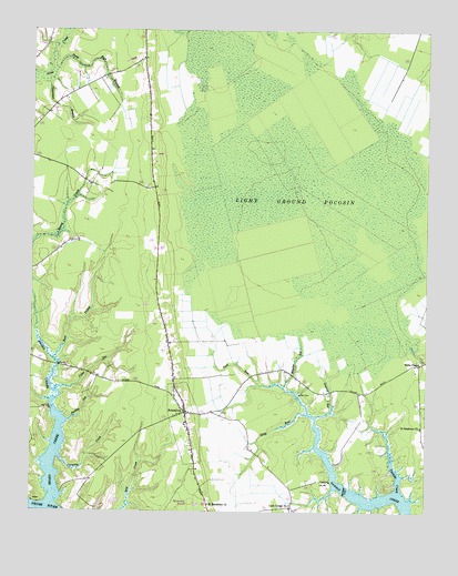
Arapahoe, NC USGS Topographic Map
Click on map above to begin viewing in our Map Viewer.

This topographic map contains these locations and features:
Feature Name Type Latitude Longitude GNIS ID View Map
ArapahoePopulated PlaceN35.0257°W76.8255°1018839View Map
Arapahoe Elementary SchoolSchoolN35.0224°W76.8258°1003164View Map
Arapahoe Free Will Baptist ChurchChurchN35.0275°W76.8265°2506083View Map
Arapahoe Post OfficePost OfficeN35.0260°W76.8248°2774206View Map
Arapahoe Volunteer Fire DepartmentBuildingN35.0249°W76.8253°2638639View Map
Beard CreekStreamN35.0571°W76.8747°980744View Map
Beards CreekLocaleN35.0368°W76.8647°1023382View Map
Bethany Christian ChurchChurchN35.0272°W76.8264°2506093View Map
Caraway CreekStreamN35.0143°W76.8652°982645View Map
Cash Corner Number 2Populated PlaceN35.0015°W76.7916°1023629View Map
Cedar GutStreamN35.0313°W76.8666°982860View Map
Deep RunStreamN35.0252°W76.7869°984094View Map
Deep Run BranchStreamN35.1149°W76.8677°984097View Map
East Prong Beard CreekStreamN35.0393°W76.8674°984521View Map
Fork RunStreamN35.0327°W76.8016°985304View Map
Granny GutStreamN35.0249°W76.7841°985924View Map
Holts ChapelChurchN35.0388°W76.7519°986984View Map
Light Ground PocosinSwampN35.0782°W76.7941°988471View Map
Purifoy GutStreamN35.0232°W76.8636°992919View Map
Saint Matthews ChurchChurchN35.0021°W76.8177°994054View Map
Saint Stephens ChurchChurchN35.0224°W76.7510°994134View Map
Simmons BranchStreamN35.1121°W76.8705°994834View Map
Tarkiln CreekStreamN35.0054°W76.7585°995868View Map
Town of ArapahoeCivilN35.0215°W76.8260°2405159View Map
Township 5CivilN35.0097°W76.8188°1027022View Map
Wheeler GutStreamN35.0324°W76.7944°997110View Map

Note: Coordinates in the location and feature list above are referenced to NAD83 datum.


Copyright (C) 2008-2024 Ryan Niemi / Sunset Dynamics ... All Rights Reserved